West Virginia - US Route 48
US Route 48
US Route 48 is a new road through relatively virgin terrain. This page heads east along the short section from WV Route 42 in Scherr to US Route 220 in Moorefield.

Picking up on the bridge seen in the last photo on the WV Route 42 page, looking east through Greenland Gap in New Creek Mountain.


Coming through Knobly Mountain at Middle Fork Patterson Creek, what else would be ahead but Patterson Creek Mountain? When every two miles is a mountain in your state, names get made up on the spot. Photos are a left/right pair.


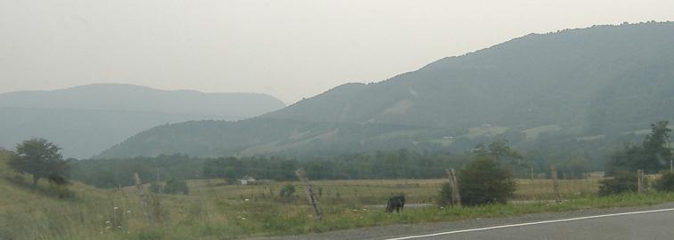
The north end of Patterson Creek Mountain, but then it continues and keeps going north. This isn't even the end of it, as you'll see later. It's very scraggly but also scrappy.


A triptych of the part of Patterson Creek Mountain I'm approaching at Squirrel Hollow Road.


As I ascend the mountain, the road curves south and my view down the west slope of Patterson Creek Mountain is, well, southwest. The second photo is Cave Mountain (left) and North Fork Mountain (behind/center), which then give way to Knobly Mountain and New Creek Mountain in the last photo (more westerly).


As I summit Patterson Creek Mountain, the view ahead is Mill Creek Mountain, featuring High Knob.


Panning from north to south, the first photo starts with a separated ridge that is actually the northern extent of Patterson Creek Mountain. Just a bit disconnected. Mill Creek Mountain takes us through the second photos, as South Branch Mountain picks up behind it to take us through the last. You'll see more than enough of that one below. Inadvertently, I've shown you all of the warnings and the runaway truck ramp itself.


From left to right, Mill Creek Mountain and the left and right sides of South Branch Mountain. The left foreground of the last photo is taken up by its offshoots, Potato Row and Sugarloaf Knob, while you can see Elkhorn Mountain start to rise to the right behind Timber Ridge. We still have to get through that cut in the middle.


Moving on to said cut, Timber Ridge first reveals the south end of South Branch Mountain, and then more is revealed to the left and right (Elkhorn Mountain) respectively.


The first photo is the entirety of Potato Row and Sugarloaf Knob, and now you can see the cut in the latter that US Route 48 uses to continue east. The second photo picks up from there and heads east across the remainder of South Branch Mountain.


Nearing Howard Sions Road, these photos pan from the north (still with a piece of Timber Ridge in the foreground) to the south (Elkhorn Mountain, seen larger from Victory Lane).


Getting tired of this yet? Maybe a little? Okay, these are the last two left-right panoramas. The first 3-photo panorama is all South Branch (with Potato and Sugarloaf, a solid meal). The 4th photo looks due north from the South Branch Potomac River crossing at the south butt end of Mill Creek Mountain, and the remaining photos pan south to Elkhorn Mountain.

A look back west at Patterson Creek Mountain. The twin peaks straight ahead if you follow the road are Round Knob and Turkey Mountain. The vantage is actually WV Route 55 westbound, which connects US Route 48 to US Route 220.

My favorite photo of the whole lot, Sugarloaf Knob dead ahead at the US Route 220 exit.
US Route 48 roads photos
Back to West Virginia Non-Roads
Back to Non-Roads main page