Tasmania - Pitt Water
Pitt Water


Some call it Pitt Water, some call it Pittwater. I call it heading east on the Tasman Highway (A3), toward the hills of Woodvine Nature Reserve and Mount Morrison.


Looking north from McGee's Causeway across Pitt Water, I see Mount Lord.


From there, Craigow Hill is to the northwest and Seven Mile Beach is to the southeast. It occurs to me that this is now an outdated Imperial unit of coastline measurement.


After a brief traverse of Midway Point, the Tasman Highway crosses Sorell Causeway, separating the main body of Pitt Water from Orielton Lagoon to the north. These photos look southeast toward Mount Elizabeth and northeast toward Mt. Morrison.


Looking west from Lewiston Scenic Drive (Highway C340), here are more views of Mt. Rumney (across Seven Mile Beach) and Mt. Lord (across Midway Point).

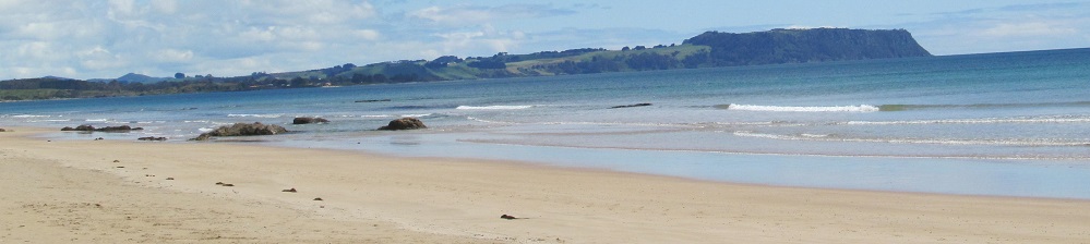
One last chance to see Mt. Rumney from the southern end of Pitt Water where it empties into Frederick Henry Bay.

To the north, here's one last look at Mt. Lord (left) behind Midway Point, and Weston Hill to the right.

Near the southern edge of Lewisham, there is a syzygy of Seven Mile Beach (south end), Spectacle Island (Spectacle Head pokes in from the left), and Cape Deslacs in the distance.
See more of Pitt Water along Arthur Highway
See more of Pitt Water from the air
Tasman Highway (A3) road photos
Back to Tasmania Non-Roads
Back to Non-Roads main page