Queensland - National Rte. 1
National Route 1
All photos but the first were taken heading east (in general) toward Cairns.

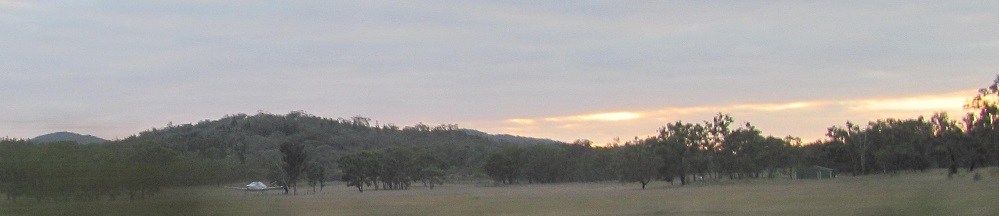
As I headed west from State Route 62 to the Undara Lava Tubes (ultimately to discover it would have taken hours I didn't plan for), I noticed that the southern half of the scenery was scorched brown, but the northern half was still green. And there was a tiny bit of smoke on the left. Okay, let's see what happens by the time I head back east.


Apparently, small fires in dry season end up becoming larger fires. I didn't take a photo of the actual fires that I passed because they were within centimetres of the roadway and I preferred not to combust, in the moment.


Northern Territory doesn't have a monopoly on Standing Stones, unless you would sooner call these rockbales.


The first photo is by Nettle Creek, and there's another Stone that's Standing around. The second photo is about 10 km farther along and shows Mt. Pandanus and Mt. Ronald on the right. Pandanus is taller but farther away.

Doubles as a barber, and probably a movie theatre, hotel, and senior centre as well!


Photos start 20 minutes north of the 1950s and Ravenshoe. The 5th (of 8) faces south instead of generally ahead (northeast) or to my left.


A whole lot of mountains going on. North of Atherton, I spy the Lamb Range with Mounts Tiptree, Haig, and Edith, among others. After a right/left pair of photos, I get another right/left pair with what I believe to be Mt. Tiptree to the left and Mt. Haig to the right in the first of those two.

Looking east along the Barron River in Kuranda.


I've come off the Great Dividing Range now and my "eastward" journey has taken a pronounced southward component to head into Cairns. These photos look to my west; the first photo has North Peak in front of Mt. Williams to the right, and the last photo looks back behind me at the MacAlister Range (featuring Red Peak) where National Route 1 just spent a lot of time winding down through the rainforest.


Turned southward now, we have the Grey Peaks on the left, featuring Mt. Yarrabah, and Lumley Hill (left) and Mt. Whitfield (right) on the right.


Because that's what it takes to come down off the Great Dividing Range, I'm crossing the Barron River a second time in these photos. Mt. Williams (left) and North Peak (right) have become distinct from this vantage, while Red Peak (left) is fading into the MacAlister Range.
Big Millstream Falls
Atherton
Big Captain Cook and other Big Things
Continue east onto Bruce Highway (A1)
See more of the Great Dividing Range
National Route 1 road photos
Back to Queensland Non-Roads
Back to Non-Roads main page