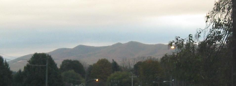
Virginia Roads - US 11 - S. of Salem/Roanoke
US 11 south of Salem and Roanoke
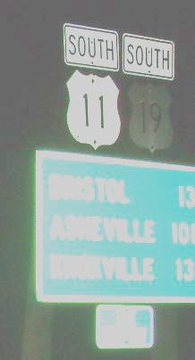
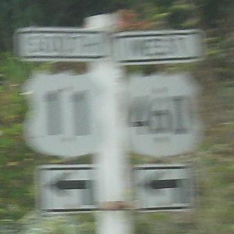
SB in VA (first destination) to NC (second, via US 19) or TN (last, via US 11), courtesy Lou Corsaro.
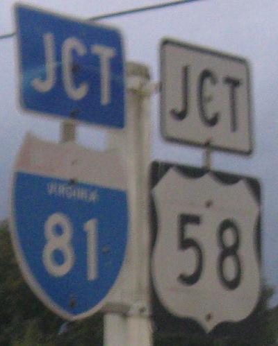
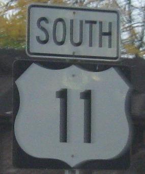
NB from there to I-81 Exit 19. US 58 is too wimpy to stick with US 11 all the way to Bristol, opting for the smooth comfort of the sterile Interstate.
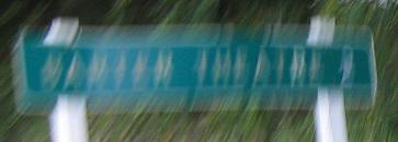
For the negligible time they now spend together, US 11 and 58 barely manage to have one interesting photo - an old SB/WB distance sign to Barter Theatre that doesn't come out in the gloaming.
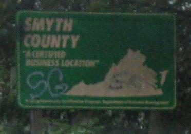
NB to interesting times in Marion and VA 16, not US 16. The interesting bits between the second and third photos are on the 16 page, linked at bottom. The graffiti is okay, because the "SC" just reinforces the message.

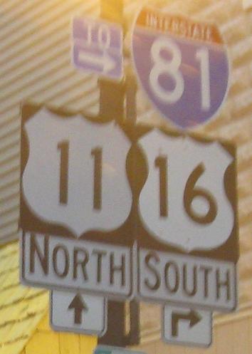
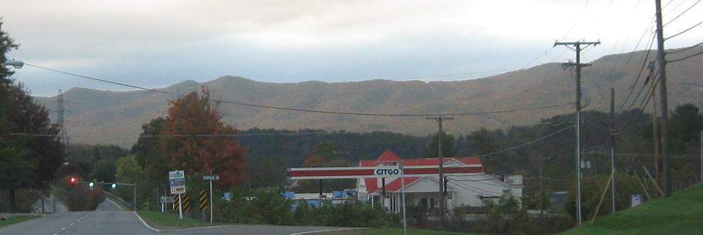
Before I-81, this may well have been a hub, but now NB travelers on US 11 have to do a double-take when they see this sign, and if they're me, U-turn a couple of times to get a good photo of it. I'm sure it was a hub when this sign was last painted.
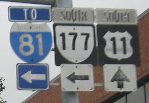
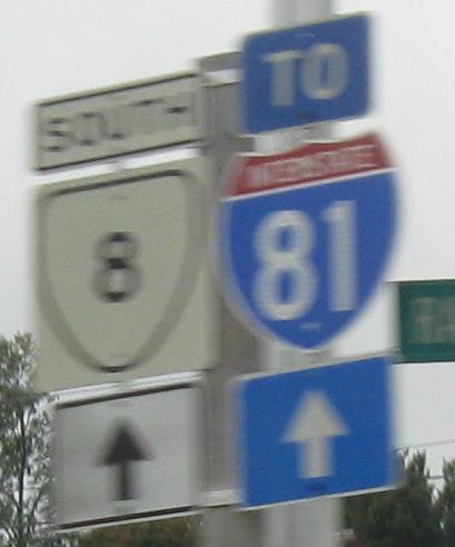
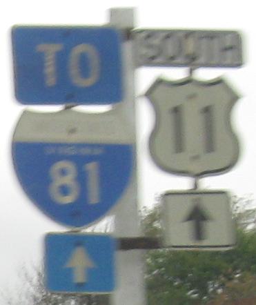
SB in Wytheville. You could fit 1111 in there.
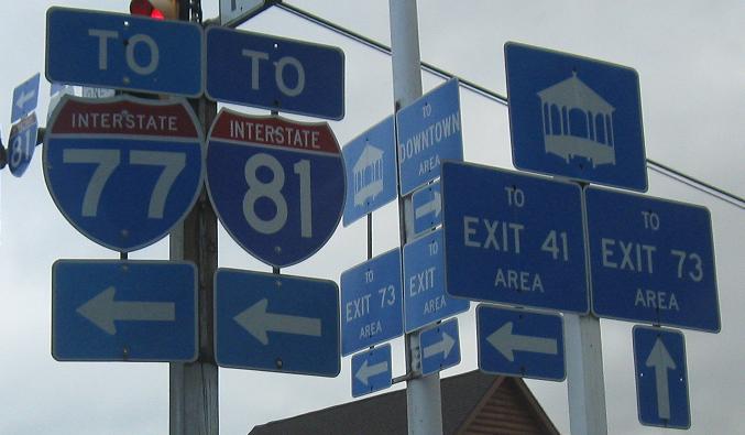
Past US 21 through "downtown" Wytheville. I'm being a little cruel, because there still is some life in this city. A lot of that life, though, has moved to the outskirts as seen in the second photo. To the left at 11th St., Peppers Ferry Rd. leads to I-77 Exit 41. Straight ahead leads to I-81 Exit 73. Which begs the question, why is I-81 signed to the left?
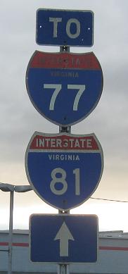
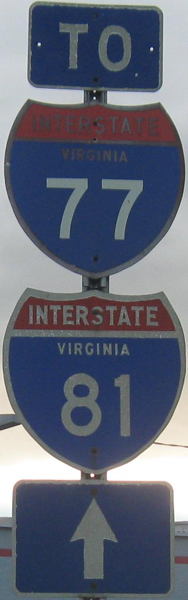
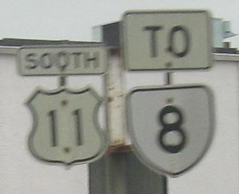
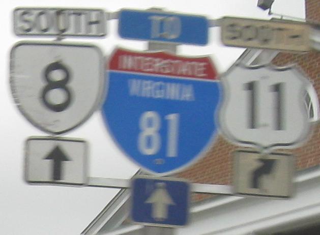
It does not get better than this, so savor it on its own, and click to see it as large as it gets. The bottom shield and auxiliary signs have definitely been around since the 1960's, while the top shield is a more interesting case. The shield itself appears to date to the early 1970's, but the numbers look quite new. Either they were patched very neatly over the old 77, or more plausibly (based on patching attempts I've witnessed), it was a shield blank previously used in other contexts or just stored somewhere with some exposure to the elements, and pressed into service here within the last few years. Head NB out of Wytheville toward "Exit 73 Area" to see this before it's gone.
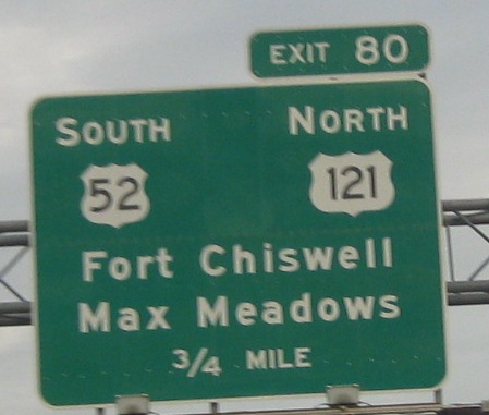
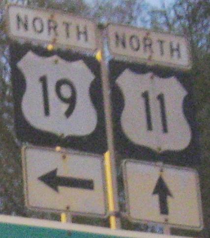
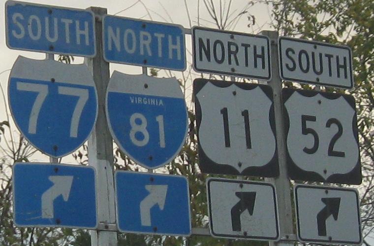
It does not get worse - yes, yes, it can get worse, please bear with my parallel structure - than this, since there is no US 121. It's also pretty bad to have US 11 NB on a ride with US 52 SB, along with I-81 NB and I-77 SB in a wrong-way pair of multiplexes all at once.

Not even the natural beauty of the Appalachians can compete with old Interstate and US shields. But after Wytheville, you'll have less of those, unfortunately.
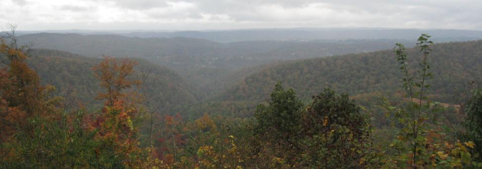
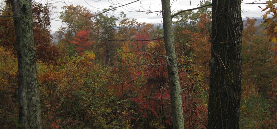
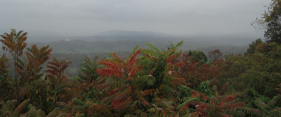
High above the valley, US 11 threads a pass to Pulaski, and you get these impeccable views to the east at the summit.
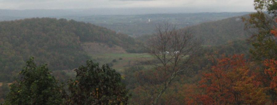
A little exploration uncovered an old homestead, inn, or similar building just north of the parking lot, and a different range of scenery facing west from the SB side.
One interesting sign in Radford, but boy, is it a doozy. I assume Radford put this up themselves, because only the I-81 shield is remotely close to specifications.
Varieties of old shields in Christiansburg, along with one new state-name Interstate shield that may just ruin the concept forever for me. Luckily, the last photo restores my faith in the state name and all that is awesome.
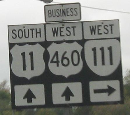
SB in Christiansburg with Business (former) US 460. I'd rather have one-piece assemblies than BGS cutouts (newer with no black outline) strewn about, but I'd rather have old cutouts above any of those.
Continue north on US 11
Onto US 421, US 11E/421, and US 11W/421
Onto VA 16 and US 11/VA 16
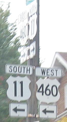
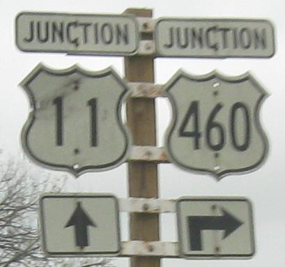
Onto US 460 and US 11/460
Back to US 11 main page
Into Tennessee on US 11W
Into Tennessee on US 11E
Onto US 19
Onto I-81
Onto US 58
Onto VA 16
Onto I-77
Onto US 52
Back to Virginia Roads
Back to Roads