Tennessee Roads - TN 109
TN 109
All photos are from the 2014 Middle Tennessee Regional Road Meet's visit to the 1954 Martha Gallatin Bridge in its death throes.


TN 109 SB to the Cumberland River. All traffic had been shifted to the future NB side (now 2 lanes) to permit construction of the approaches to the SB side over the former bridge approaches. Enough of the old road was left on either side to serve driveways.

The driveway frontage on the south side of the river.


Walking south in the future SB lanes instead of on the sidewalk, because I can.


Views back north from there.

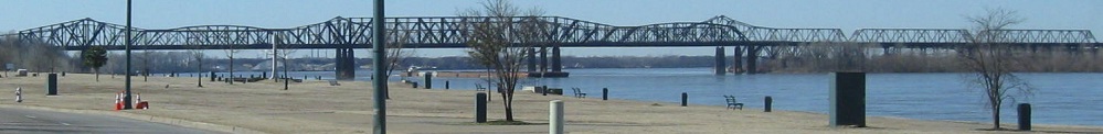
The Cumberland River to the west.


Starting my walk south on the old bridge. Punching holes in the asphalt makes it easier to tear apart later and discourages people from driving onto the bridge. They also ripped out some of the railing. X marks the intentional damage.


Completing my walk across the span to the also-damaged southern approach.


You may have noticed some incuse lettering. This is what it spells out. But Tennessee already has a Gateway Bridge.

I was gonna make a joke, but you don't know where the piers are when you're on the bridge deck.


The walk back north to the pockmarked pavement has one wrinkle not observed SB: Mile 0 at the Wilson/Sumner County line.
Back to the Middle Tennessee Road Meet page
Back to Tennessee Roads
Back to Roads