| NEW | CURRENT (directions given S-N and W-E) |
| RI 2 | RI 114 west of RI 121 |
| RI 3 | RI 78 |
| RI 5 | Watch Hill Rd., RI 1A, US 1, Grove Ave., RI 3, RI 102, RI 94 |
| RI 7 | RI 100 |
| RI 8 | RI 107 |
| RI 9 | RI 96 |
| RI 10 | US 44, RI 102, RI 146A, RI 146, Sayles Hill Rd., RI 126, Main St./Manville Hill Rd., RI 122, RI 120 |
| RI 11 | RI 102 north of RI 94, RI 98 |
| RI 12 | I-295 east of RI 146 |
| RI 13 | RI 3 between RI 102 and 118 |
| RI 14 | RI 116 east of RI 104 |
| RI 15 | Hopkins Hill Rd., RI 3, RI 33, RI 116, RI 5, RI 104, Providence St., Main St., Truman Dr., RI 126 |
| RI 16 | RI 123 |
| RI 17 | RI 216 south of northern RI 91 junction |
| RI 18 | Anan Wade Rd., Snake Hill Rd., W. Greenville Rd. |
| RI 19 | RI 112 north of RI 2 |
| RI 20 | US 44 east of RI 102, RI 15, Main St./Church St., Park Pl., RI 114, RI 15 |
| RI 21 | RI 33 north of RI 117, RI 115, RI 51 |
| RI 22 | US 44 between RI 15 and eastern US 1 junction |
| RI 23 | RI 33 north of RI 115 |
| RI 24 | RI 101 |
| RI 25 | RI 2, RI 5 south of RI 116 |
| RI 26 | I-195 east of Exits 4-5 |
| RI 27 | RI 110 |
| RI 28 | US 6 east of I-295 (RI 10, I-95, I-195), US 44 west of Broadway |
| RI 29 | RI 108 north of RI 1A |
| RI 30 | US 6, US 6A, Broadway, US 1, Memorial Blvd., Waterman St./Angell St., Henderson Bridge, Broadway, US 44 |
| RI 31 | RI 4 |
| RI 32 | RI 14 east of RI 102, Westminster St., US 1 south of Broadway |
| RI 33 | Branch Pike, RI 5, RI 146A |
| RI 34 | RI 103, Warren Ave., US 6 |
| RI 35 | I-95, I-295, RI 146, RI 99 |
| RI 36 | RI 12 west of Old Plainfield Pike |
| RI 37 | RI 128, US 44, RI 104 south of RI 5 |
| RI 38 | Natick Ave. south of RI 51, RI 37 |
| RI 39 | RI 10 south of US 6 |
| RI 40 | RI 14, Old Plainfield Pike, RI 12 |
| RI 41 | RI 5, RI 2 |
| RI 42 | Airport Connector |
| RI 43 | RI 108, US 1 south of RI 1A |
| RI 45 | Ocean Rd. (Point Judith), RI 1A, US 1, Weybosset St./Westminster St., College St. |
| RI 46 | RI 113 |
| RI 47 | RI 7, Douglas Pike to MA |
| RI 48 | RI 115 |
| RI 49 | I-95 between I-295 and I-195 |
| RI 50 | RI 117 west of Warwick Neck Ave. |
| RI 51 | US 1A, Post Rd., Broad St. south of US 1 |
| RI 52 | RI 103 east of RI 114 |
| RI 53 | RI 117A |
| RI 54 | RI 118, RI 3, Cowesett Rd. |
| RI 55 | Warwick Neck Ave., RI 117, US 1A, US 44, US 1, RI 246 to Admiral St., RI 146 |
| RI 56 | RI 401 |
| RI 57 | RI 146 south of Admiral St. |
| RI 59 | RI 246 north of Admiral St. |
| RI 60 | RI 177 |
| RI 61 | US 1A/US 44, India St., Gano St. south of Angell St. |
| RI 62 | Bates Trail, Frenchtown Rd., RI 402 |
| RI 63 | RI 126 south of Social St./Clinton St. |
| RI 64 | RI 403 |
| RI 65 | US 1 north of RI 246, RI 122, Cumberland St., RI 126, Railroad St., RI 122 |
| RI 67 | US 1 north of RI 122, George St., Park Pl., RI 15, RI 114, RI 121 |
| RI 68 | RI 179, Adamsville Rd. to MA |
| RI 69 | Veterans Memorial Pkwy. |
| RI 70 | RI 165, RI 3, RI 102 to east |
| RI 71 | Broadway (East Providence), RI 152 |
| RI 72 | RI 138 between RI 114 and RI 138A |
| RI 73 | RI 103A |
| RI 74 | RI 138 between US 1 and RI 238 |
| RI 75 | RI 138A west of Thames St., RI 238, RI 138, RI 114, RI 103 (Barrington), RI 114, US 1 |
| RI 76 | Bridgetown Rd. (from RI 138 to RI 1A) |
| RI 77 | I-95 north of US 6 |
| RI 78 | RI 238 west of RI 138A (Goat Island) |
| RI 79 | US 1A north of RI 114 |
| RI 80 | RI 138 west of US 1 |
| RI 81 | RI 114 north of RI 103 (Barrington), East Shore Expwy. |
| RI 82 | RI 216, RI 91 to east |
| RI 83 | RI 214 |
| RI 84 | RI 91 west of RI 216 (as signed) |
| RI 85 | RI 138A east of Thames St., RI 138, Boyds Lane, RI 114, RI 136 |
| RI 86 | RI 1A, South Kingston section west of Beach St. |
| RI 88 | RI 1A, section near RI 110 |
| RI 89 | RI 114A (both) |
| RI 90 | US 1 west of RI 108 |
| RI 92 | RI 1A, Rum Pond section |
| RI 93 | RI 24 |
| RI 94 | RI 1A, Charlestown section |
| RI 96 | RI 1A, Ninigret Park section |
| RI 97 | RI 77, RI 138 |
| RI 98 | RI 1A, Westerly section east of Watch Hill Rd. |
| RI 99 | RI 81 |
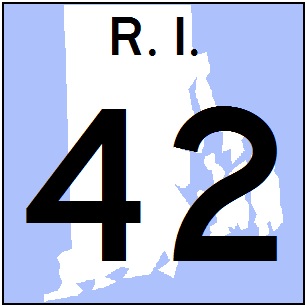 My proposed state route shield in the colors of the Ocean State.