Pennsylvania Roads - US 1 - Roosevelt Expwy. and S.
US 1, Roosevelt Expressway and south
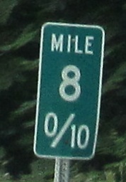
From the Oxford Bypass, the freeway from the Maryland Line north to Kennett Square, which has both original concrete and milemarkers that don't know how many tenths are good for them.
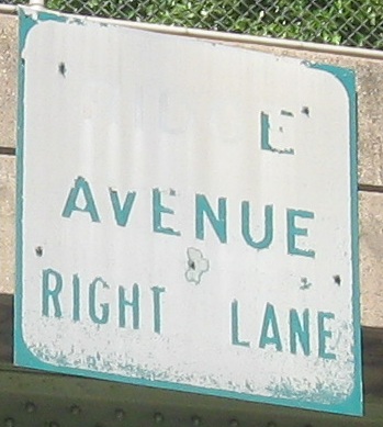
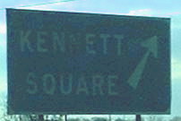 A now-replaced '50's-style LGS (check out the arrow) on US 1 SB near Delaware (Kennett Square, PA) and the beginning of the Oxford Bypass.
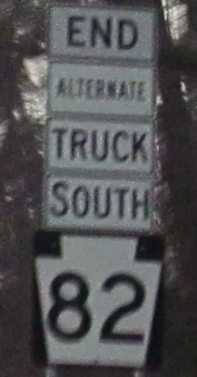
Sign salad? More of a deli sandwich, piled high on the NB exit ramp to PA 82. "Alternate" is unnecessary.
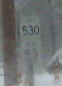
Well, this is new - first time I've seen these little white markers together on a concurrency. This is where PA 52 SB splits from US 1 NB (really heading east, so it's okay), and the snow-obscured arrow tells you which route goes where. This is also the first time I've seen an arrow on one of these LWS.
 NB.
NB.
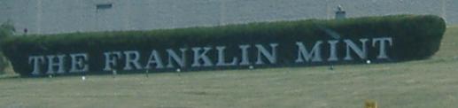
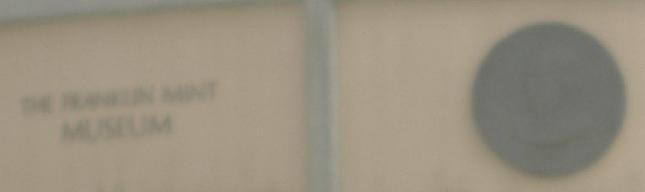
The Franklin Mint died in 2003, and Wawa HQ has begun to take over the old buildings from across the street, but unwary tourists (such as my family and I) may still think it's here. Then again, weeds growing as tall as trees might be a clue to the demise of the Mint, as might empty, crumbling parking lots.
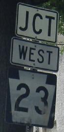
Rare state-name sighting on the NB ramp. It's also a rare interchange, known as a "volleyball", where the ramps from both freeways meet and cross each other on a single level (at traffic signals). US 1 would never get away with that if it were an Interstate.
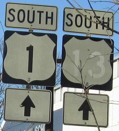
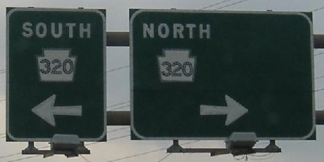
SB. US 13 is not multiplexed with US 1 here, and there are no further signs to direct you where to go. That's because this is the last remnant of when US 13 did come this way with US 1 on one of its many routings. The second photo is on the SB exit for PA 320, and rumor has it that the extra space was left for "TO I-476" to make a planned connection from US 1 SB to I-476 NB. PA 320 never got that connection, clearly.
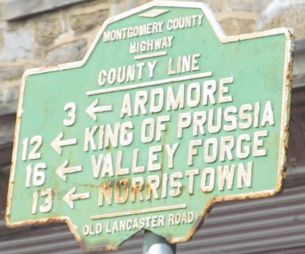
This 1920's cast iron guide sign is at, yes, Old Lancaster Rd., right at the Philly city line. To the left is all Montgomery Co. To the right is 54th St. in the city. Thanks to Scott Sullivan for submitting the original photo that alerted me to this.
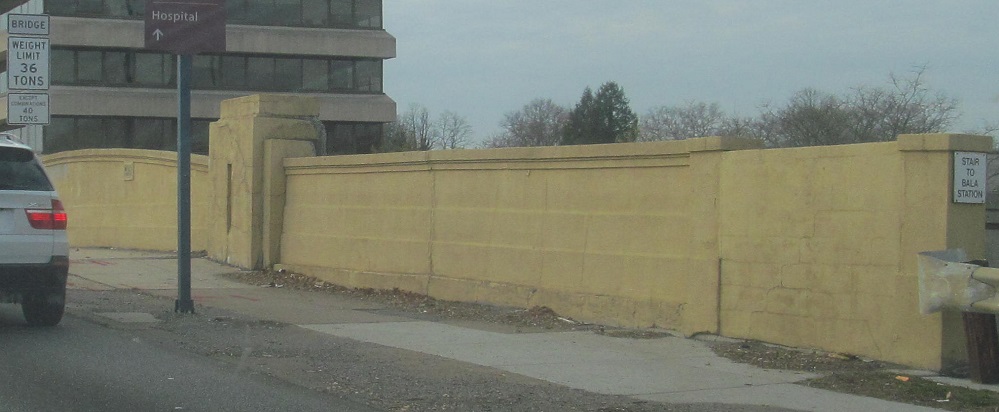
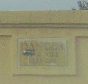
Just north of there, US 1 SB crosses the tracks at Bala Station. By the time you see the weight limit, it's too late.
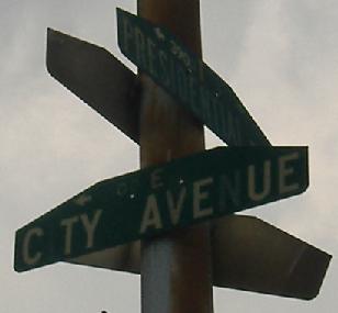
Older street signs and then a newer one that acts like a guide sign.
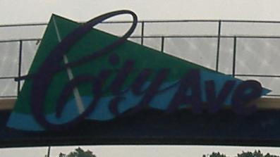
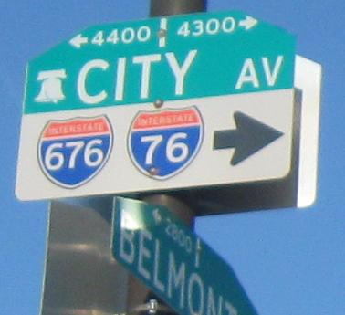
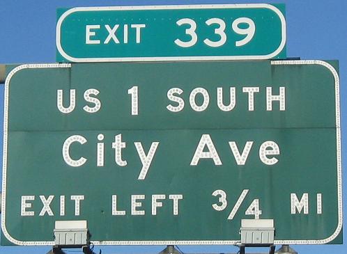
SB heading away from I-76. City Ave. looks nice but doesn't seem like a particular attraction.
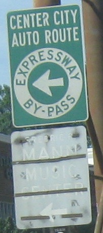
Two SB photos just south of I-76, including an expressway by-pass I don't quite understand (isn't the expressway supposed to be the by-pass?).
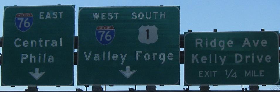
NB, same area.
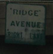
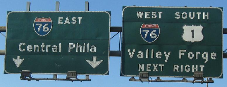
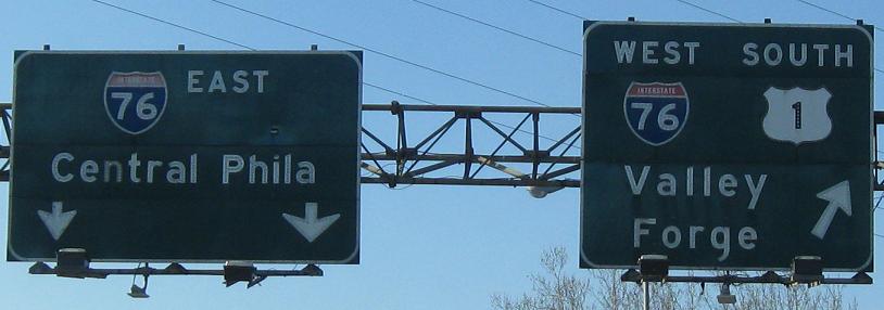
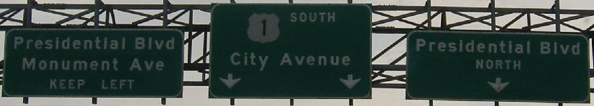
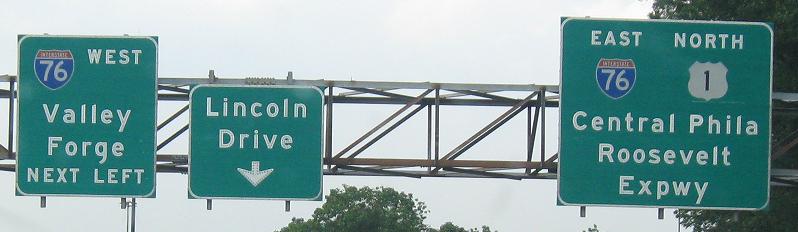
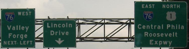
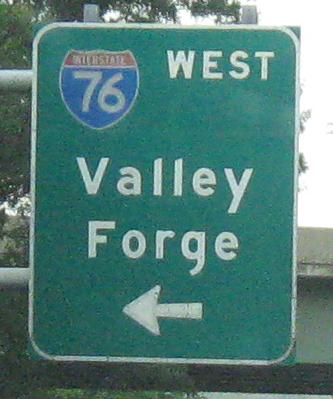
East of I-76, US 1 becomes the Roosevelt Expressway briefly. These photos are SB approaching I-76. Click on the old Ridge Ave. LGS to see how it's deteriorated from 2005 to 2010. The last photo is on the ramp taking US 1 SB down onto I-76 EB.
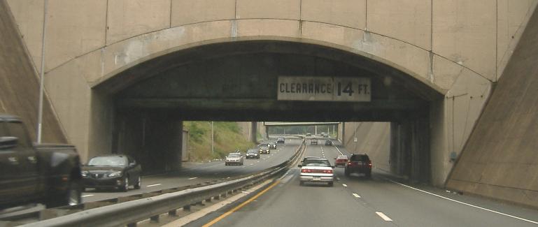
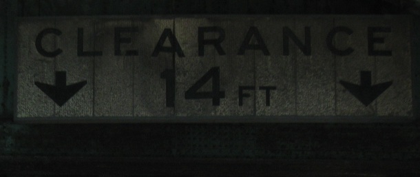
The Expressway heads into a big dip at PA 611, where the Broad Street subway passes over US 1. Click for closeup of the old clearance sign.
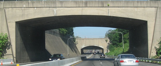
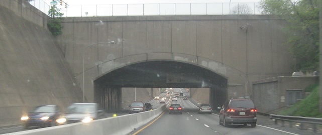
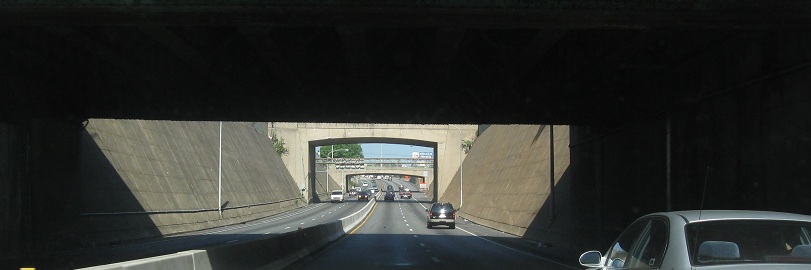
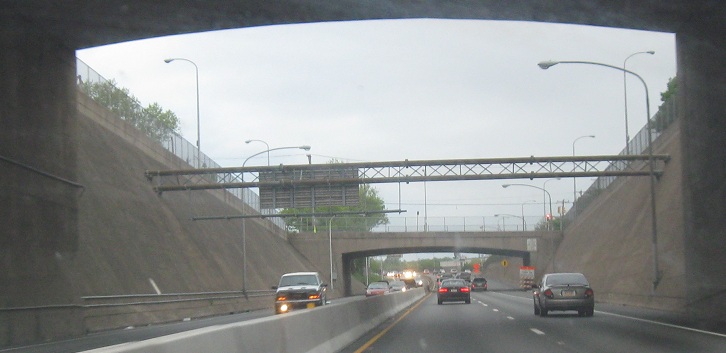
EB in the depressed four-lane Expressway with another old clearance sign on old bridges.
North to Roosevelt Boulevard
Old US 1, Baltimore Pike
Back to US 1 main page
Enter Maryland on US 1
Onto PA 82
Onto PA 52
Onto PA 23
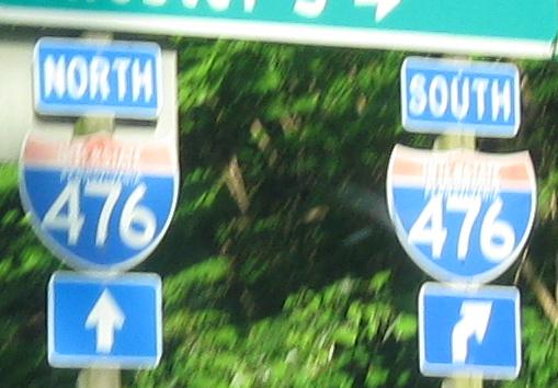
Onto I-476
To US 13
Onto I-76
Toward Lincoln Drive and the Gustine Lake interchange
Into Philadelphia
The Oxford Bypass on Steve Anderson's phillyroads.com
Back to Pennsylvania Roads
Back to Roads