Pennsylvania Roads - I-78/US 22/PA 309 WB/NB
I-78 WB (US 22 WB, PA 309 NB)
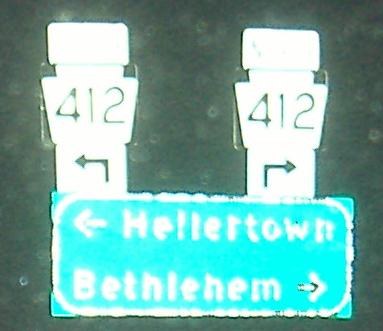
Last photo is down the Exit 67 ramp.
Aww, schnookums cutie-wutie milepost shieldy-wieldy! *barf*
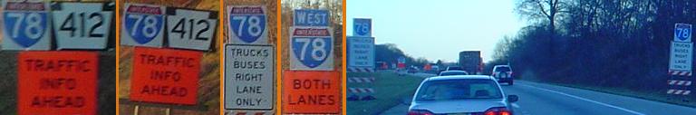
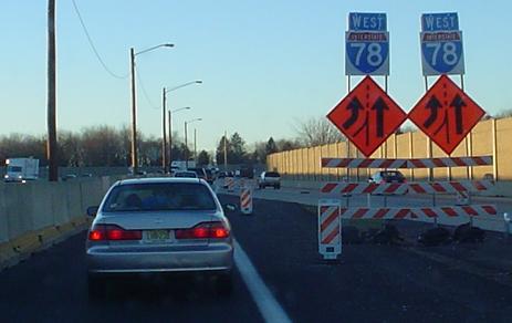
The montage is a series of signs leading up to Exit 67, where there's apparently some construction going on. That leads to the "cattle chute" in the last photo, where one lane of westbound traffic runs on eastbound side, away from the rest. All courtesy Lou Corsaro.
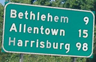
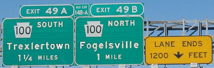
The first and fourth signs in this run are courtesy Lou Corsaro, and the last two are on the left and right of the same gantry.
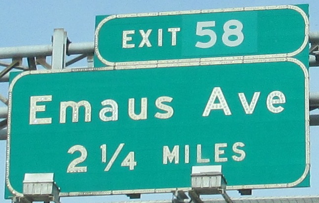
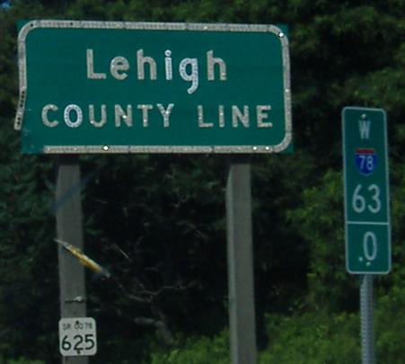
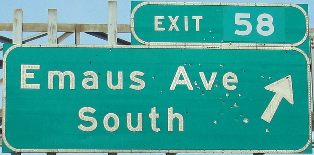
Emaus Avenue, but Emmaus, PA? Emaus was the name of Maguntsche/Macungie (which is now a different town) between 1830 and 1938. It was Emmaus on either side of that time period, but the road was built while it was Emaus and that name never changed when the town reverted (thanks to Charles Meitzler for all this information). In Pennsylvania, like many northern states but especially so, following a road with a town name will take you to that town. The second photo is courtesy Mike Byrnes, and the third and fourth photos are the left and right of the same gantry.
The first two photos and last two photos are each on the left and right of their respective gantries.
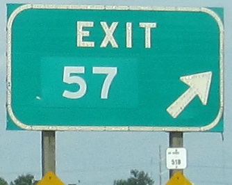
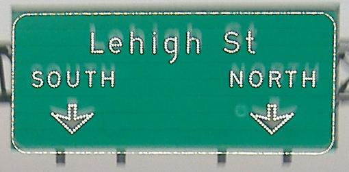
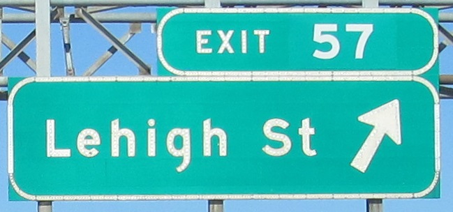
On down the Exit 57 ramp.
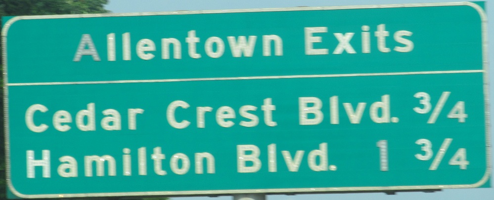
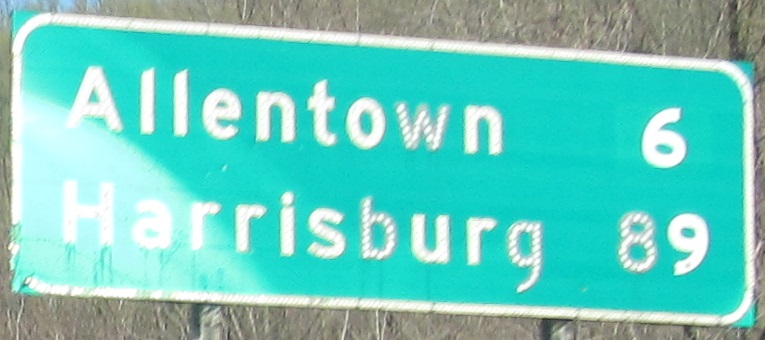
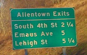
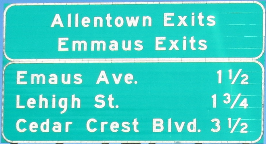
The first Allentown sign lied! And how about that Emmaus/Allentown sign?! This is a case where "Allentown - Next N Exits" works better than "Allentown Exits"... "Allentown Exits"...
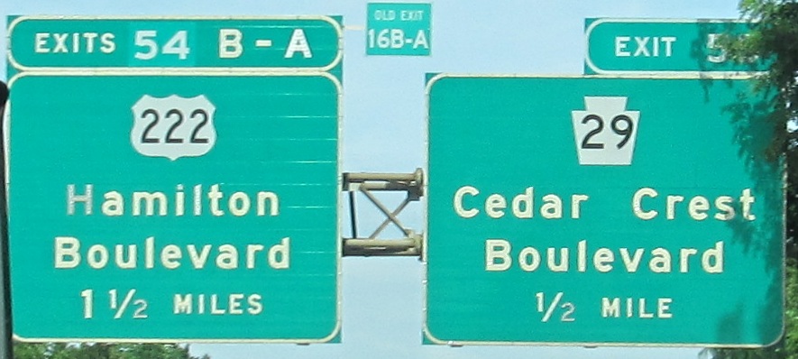
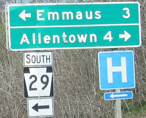
The second and third photos are on the left and right sides of the same gantry, and the photo run ends on the exit ramp. PA 29 used to continue north into Allentown from here.

Guess what? The last two photos are on the left and right sides of the same gantry. But you may not have guessed the 4th and 5th photos are as well.
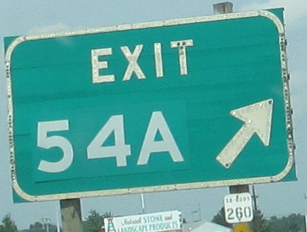
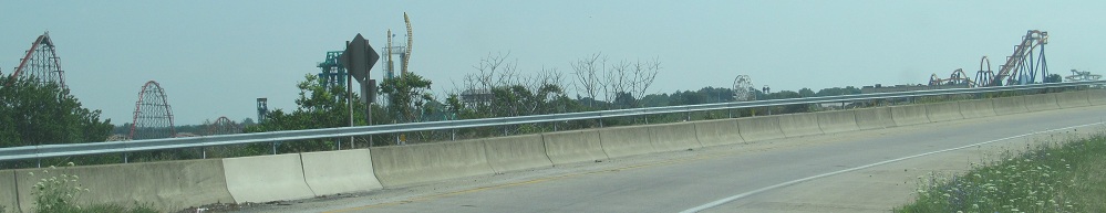
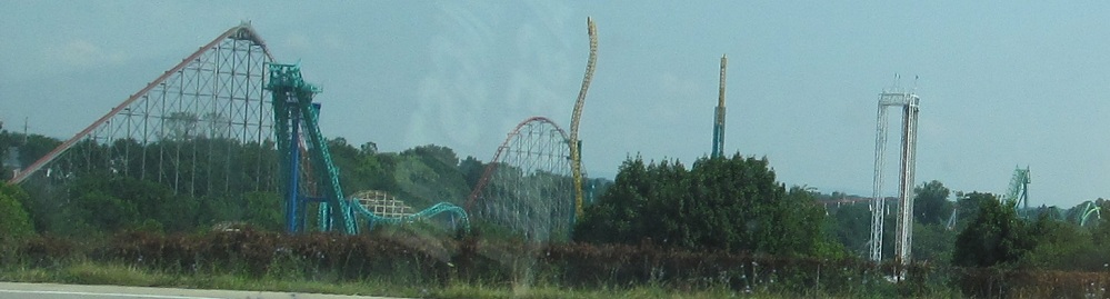
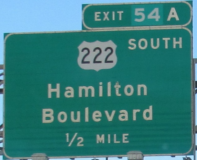
The Exit 54A ramp has some nice views of Dorney Park, just to the north.
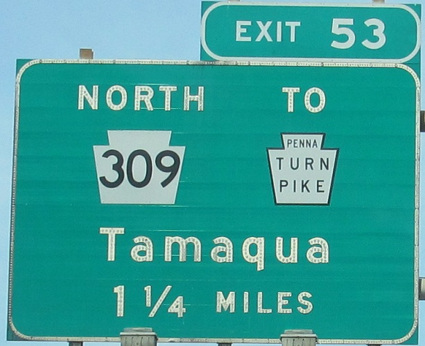
The black-on-white Turnpike shields can only ever be found on BGS's, and even then I don't recall looking quite like this elsewhere.
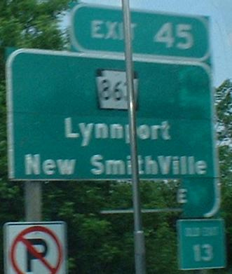
Three things wrong with this WB picture:
• Only NJ uses a black square background for its shields, and now even NJDOT is starting to shy away from that practice.
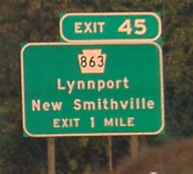
• That should be Smithville, not SmithVille.
• There should be a bit more sign there.
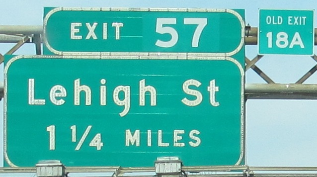
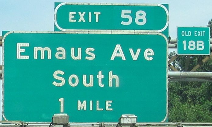
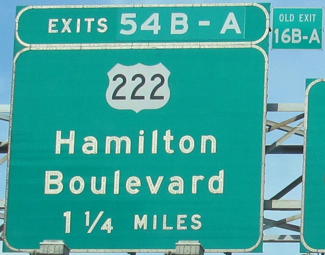
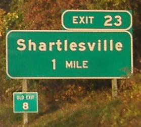
On the plus side, it shows off PA's "OLD EXIT" signage very well. In 2001, PA renumbered all its freeways from sequential exits to mileage-based (there are more pictures of this in the I-76, I-81, and I-83 folders). Ohio's method is to use dual signage, "Exit XX/Mile YYY" (also tested along I-295 in Rhode Island), and NJ used yellow signs when I-287 was renumbered to account for I-95 not being built between its southeastern end and Trenton.
A look at the original US 22 freeway, now shared by I-78 and US 22, courtesy Lou Corsaro.
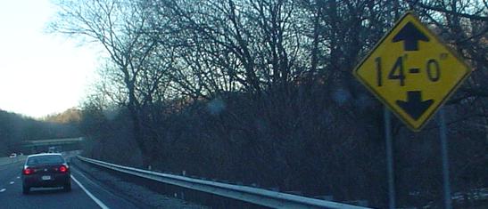
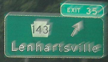
The third photo, of the off-kilter height sign, is courtesy Lou Corsaro. The last one is on the Exit 35 exit ramp.
Another offramp sign, at Exit 19.
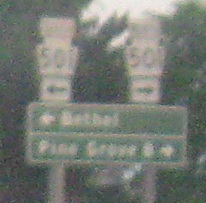
On down the Exit 13 ramp, second photo courtesy Lou Corsaro.
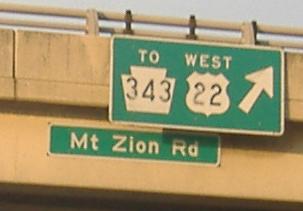
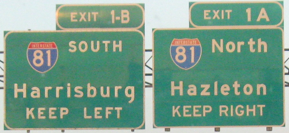
Past a decidedly non-Interstate standard exit sign (it's Exit 8 for US 22 West to PA 343), to a contrast of old and new. When the old exit tab was tacked on (likely to a previously unnumbered exit, since it's the end of the highwy), PennDOT inserted a hyphen in Exit 1B. The new sign is incorrect in not capitalizing all of NORTH.
Switch to the EB side
Roads intersecting I-78
Onto US 22 alone
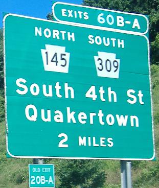
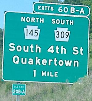
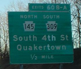
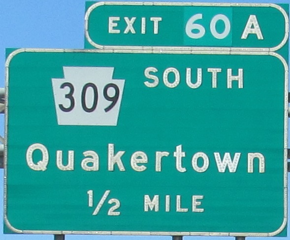
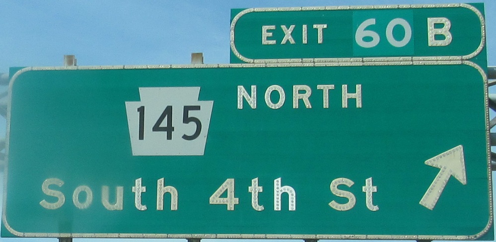
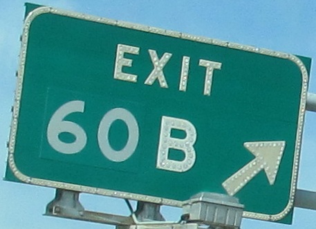
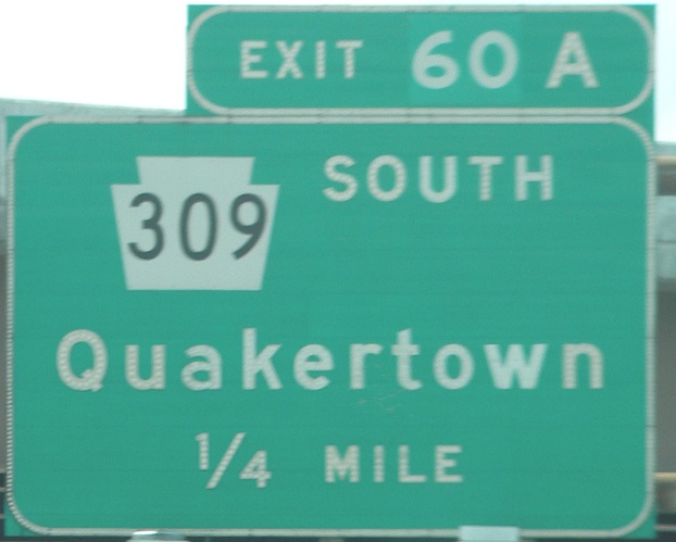
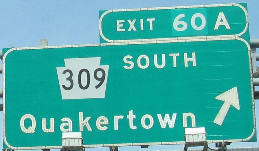
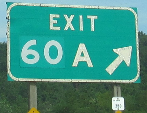
Exit 60 or 53 to PA 309 alone
Back to I-78 main page
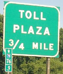
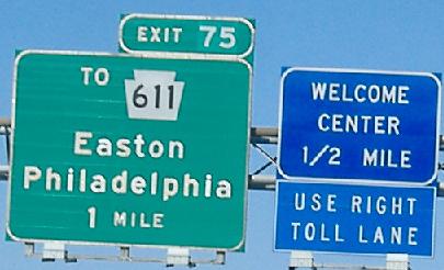
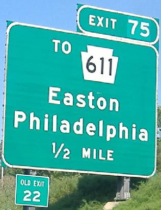
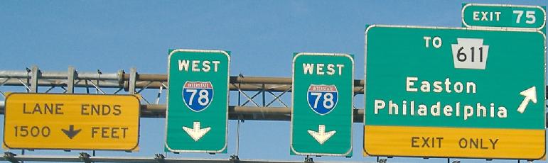
Exit 75 to PA 611
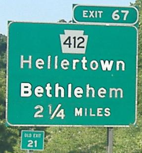
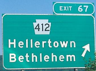
Exit 67 to PA 412
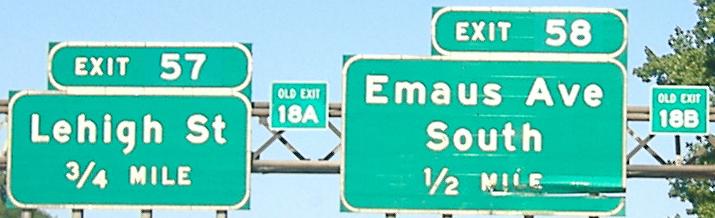
Exits 57-55 to Allentown
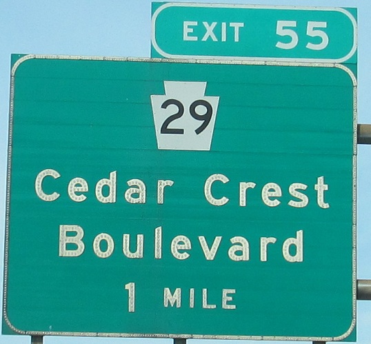
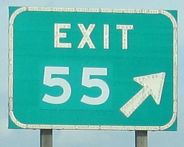
Exit 55 to PA 29
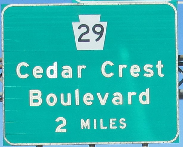
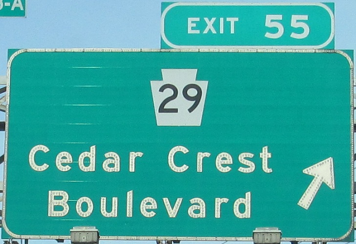
Exit 55 to Cedar Crest Blvd.
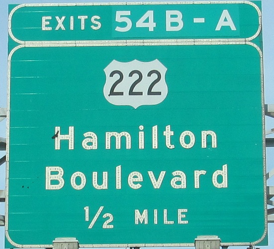
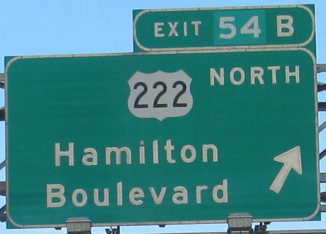
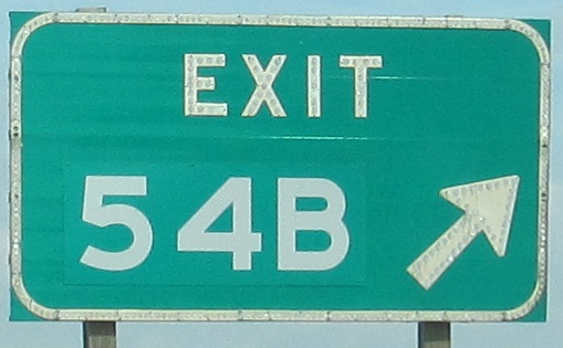
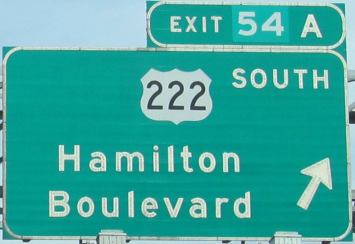
Exit 54 to US 222
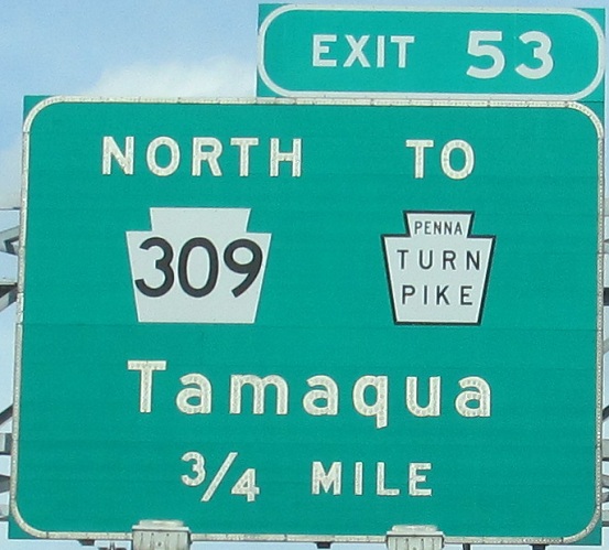
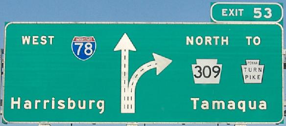
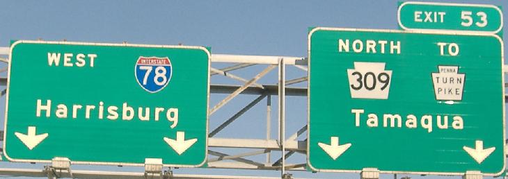
Follow Exit 53 to the Turnpike (NE Extension), I-476
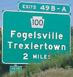
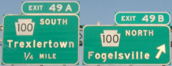
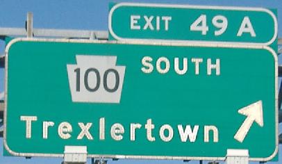
Exit 49 to PA 100
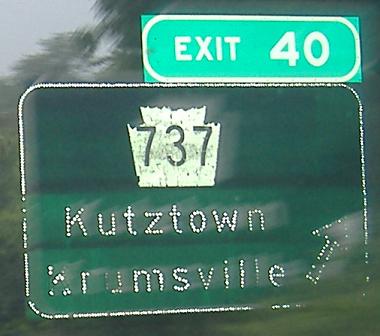
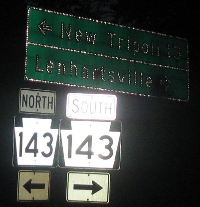
Exit 35 to PA 143
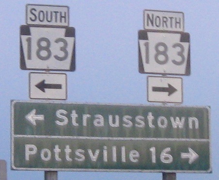
Exit 19 to PA 183
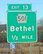
Exit 13 to PA 501
Exit 1 to I-81
Back to Pennsylvania Roads
Back to Roads