New York Roads - Queens
Queens

36th Ave. at Bell Blvd. in Queens was once Lamartine Ave. at Bell Ave. After NYC incorporated the former county, they applied a numerical grid over the former named streets. (Since the streets don't follow a grid, there are some interesting concessions, like skipping dozens of streets at a time or out-of-place numbers continued from a different neighborhood.) Some of the major through streets (like Bell) kept their names, though many were changed to Boulevards. Some of the minor side streets still are named at the bottom of modern street signs in small, afterthought text. In this case, the only reminder of the past name is a stone monument on the corner. Now there are Avenues, Roads, Drives, and Terraces running "east-west" (for whatever definition that neighborhood uses for east-west) and Streets, Lanes, and Places running "north-south." Get in the right corner of the borough and you can get 7 or more identically numbered roads next to each other, since dead-ends and short connectors can also exist as Courts or similar.


LaGuardia Airport opened as New York Municipal Airport in 1939, and that's probably how old this alarm pullbox is, along Central Terminal Dr. at Lot P3. I wonder if it's still functional. Try it and let me know.

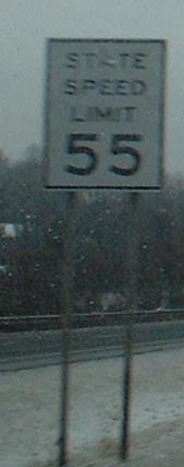
If it's legible enough to remain in service, I don't need to caption this for you.

49th Ave. WB under a freight railroad at 25th St. in Long Island City.


31st St. south from Ditmars Blvd. and under its eponymous N/W station. Gotta go slowly because of the piers, but don't gotta obey this typewritten sign.


The two-head signal faces the outer road of Greenpoint Ave. at Review Ave. on the north side of Greenpoint Bridge. For most traffic, this functions as a normal signal: green to Greenpoint, green to Review. For outer road traffic, you have a choice of red. Solid red means wait while Review Ave. is going, flashing red means stop and proceed if no one is turning off of Greenpoint on their green.

The five-head signal faces Brewer Blvd. SB and the other side faces JFK's North Boundary Rd., but until very recently it faced each direction of Rockaway Blvd. and functioned.


From a sign perspective, the best finds just might be in Mt. Hebron Cemetery.
21st Street
Astoria Boulevard
Borden Avenue
Hell Gate Bridge
JFK Airport
LaGuardia Airport
Union Turnpike
Woodhaven Blvd., Cross Bay Blvd. and Bridge
Marine Parkway Bridge
The Rockaways
~ Beach Channel Drive
~ Rockaway Freeway
NY 24
NY 25 (Queensboro Bridge, Queens Blvd., Hillside Ave.)
NY 25A (Northern Blvd.)
NY 25B (Hillside Ave.)
NY 27 (Conduit Ave.)
Belt Parkway
Cross Island Parkway
Grand Central Parkway
I-278 (Kosciuszko and Triboro Bridges, Brooklyn-Queens Expwys.)
~ I-278 Spur, BQE East Leg
I-295 (Throgs Neck Bridge, Clearview Expwy.)
I-495 (Queens-Midtown Tunnel, Horace Harding and Long Island Expwys.)
I-678 (Whitestone Bridge, Van Wyck and Whitestone Expwys.)
I-/NY 878 (Nassau Expwy.)
Shea Stadium
Queens Non-Roads
Back to New York Roads
Back to Roads