Northwest Territories Roads - NWT 1
Mackenzie Highway, NWT 1
Photos are EB (becomes SB) unless otherwise stated.

Heading east from Liard Highway, NWT 1 is 75% a road, and the missing 25% is the asphalt. Actually, this says the road can only handle 75% of the maximum statutory axle loads.

WB in the same spot. In NWT, the natives count by symbols, so these two moose symbolise the number '7'. That's a lie. This symbol is for "Liard Trail", which basically just follows the Liard Highway to the BC border, so why even designate it?


Across the Jean Marie River just east of NWT 7, and looking east (left).

Did the lake move? More likely, the road gets rebuilt every few years as permafrost moves around, but I really don't know why this sign just past Sambaa Deh Falls has changed, or who patched it. Not quite official, eh?


Construction in NWT is basically "we're here, go around us." When you can drive for hours and not pass any other vehicles, that works. This wooden bridge will see many more moons of service.


In the random nowhere about 30 km west of Yellowknife Highway (NWT 3), the gravel surface gradually gives way to pavement. It's really strange to see random patches of pavement in a sea of gravel before it finally takes full hold.

After 400 km of unpaved roadway, here's what my car looks like. Good time to take a toll road! If only the nearest one weren't thousands of kilometres away.
 I can guarantee you this is not an exit.


Both ends of an old alignment a little west of Enterprise, where a former sharp curve was significantly flattened. The nice thing about NWT is that you're never disturbing private property when building a new road.


The speed limits through Enterprise seem to use a strange combination of fonts where the '5' is bolder than the '0'. Maybe it draws your attention to the important digit?

The southern end of the Hay River Highway. Compare these blue shields to the green one at top. Also, NWT 1 is now apparently north-south instead of east-west. What's correct? Who's to say?


For that matter, here's a third type of route marker. I believe that NWT progressed from the blue on white pentagon to the white on green bear, and has since settled on the white on blue bear. I'm basing this solely on the apparent ages of signs I've seen. For example, these date to when lower case was stylish, so probably 1990s.

Another case of changing distances. One waystation opening or closing has a big effect on this distance.

A sample of kilometre posting along NWT highways. Is it just me, or is the '8' also bold?

Leaving Alexandria Falls, this once directed you to Louise Falls and Escarpment Creek with a "waterfalls route" logo.
 Do not attempt trivia contest with shoulder.

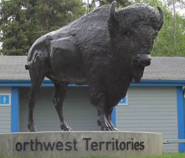
Because I went up Liard Highway, I didn't hit up the touristy spot until the end of my NWT visit. This is the only paved entrance to the territory and therefore has the most stuff, including a visitor centre (see main page).
Onto Liard Hwy. (NWT 7)
Onto NWT 3
Into Alberta on Mackenzie Hwy., AB 35
Mackenzie Highway Non-Roads
Back to NWT Roads
Back to Roads