New Jersey Roads - US 46 - Wayne to Clifton
 , Wayne to Clifton
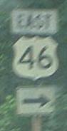
Old white county-crossing sign on US 46 EB, just after a 1920's-vintage bridge that carried the original two-lane highway from Fairfield Rd. to the NJ 23 circle (when such a thing existed).
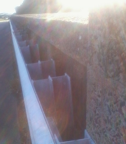
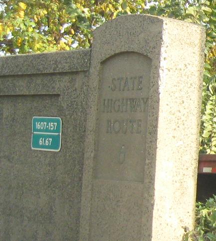
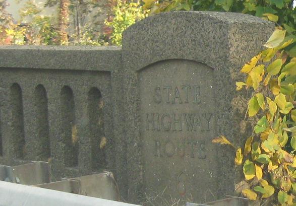
Oh, hey, a 1920's-vintage EB bridge across the Passaic River. That must be the one. In 1927, US 46 was still SHR 12 (as noted above), but was mere weeks away from becoming NJ 6.
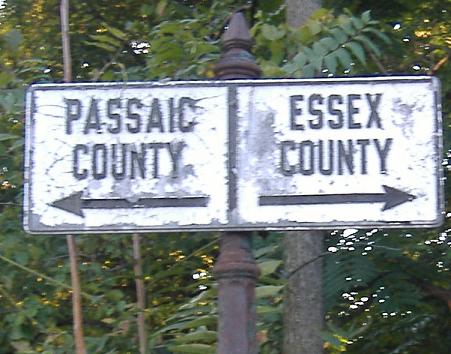
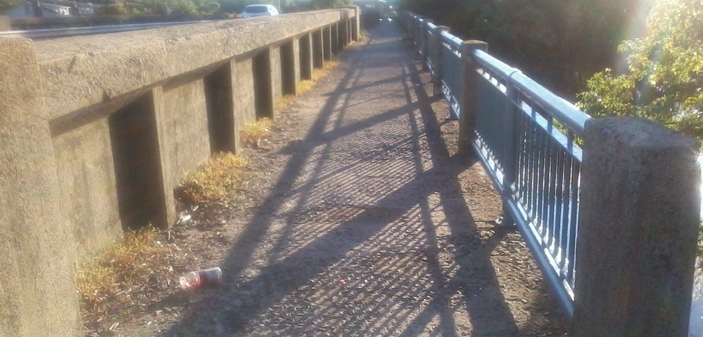
Not the Fairfield Road in Fairfield, this is the one along the Passaic River that leads to Mountain View in Wayne. This SB sign may die with the cosntruction in the area, which has created a new roadway between 46, the Wayne Plaza office park, and Fairfield Road, and reconstructed the interchange with the Willowbrook Mall "West Belt" overpass. (More on those quotation marks in the next caption.) This end of Fairfield Rd. will become SB-only, and all NB traffic will have to use the new roadway, and that's the best chance to swap out this sign. Hopefully, the state didn't notice it when drawing up the plans, and it will live on.
The former stub of the ramp that connects US 46 WB and the Willowbrook Mall, just west of NJ 23. This ramp was originally supposed to flow into West Belt Parkway, which runs across NJ 23 and dead-ends to the west - the ROW is still visible for it. Now, the overpass has been reconstructed (like everything else in the area), so the stub is disappearing. The upside is that there will be a direct connection from Wayne Plaza I and II (two short office towers) to Fairfield Ave., thus for the first time allowing traffic to get straight in there from the Mall instead of heading around to NJ 23 NB to US 46 WB with a tightly-curved still-dangerous left inside ramp. Incidentally, even though West Belt Parkway has recently been converted to serve office parks, there still is no SB 23-WB Parkway movement.
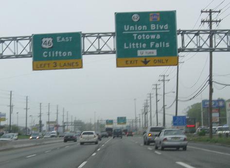
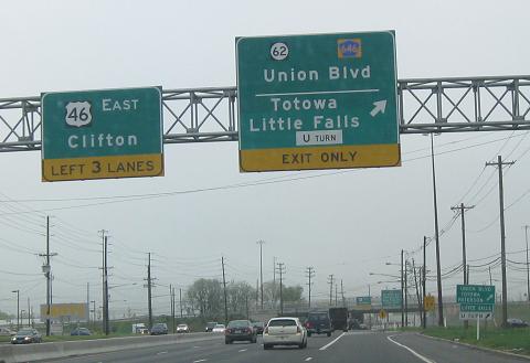
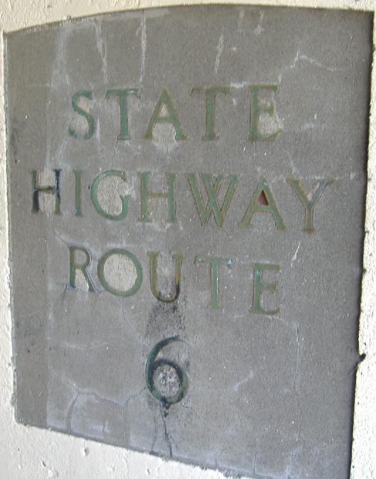
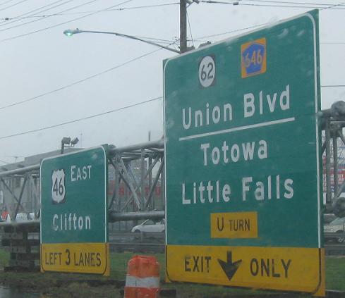
Pictures from 46 EB at the Union Boulevard bridge - if not for ground signage, you wouldn't know what it was, because the signage dating from the construction of US 46 doesn't tell you much. Note that there are two arrows over one lane, and that the second loop of the cloverleaf gets a straight right arrow. The third picture tells you how old the signage, the overpass, and US 46 are - older than 1953, because that's when SHR 6 became NJSR 46 (US 46 and NJ 6 co-existed until then, when it was decided that US routes should have the same NJ State Route number). These green-painted ceramic letters were engraved in all old overpasses built by NJDOT. Union Blvd. is NJ 62 between here and I-80 to the north. This has been under some debate in the past, as the 2000 NJ straight line diagrams dropped 62, but the 2001 SLD's resurrected it. In the past, NJ 62, previously NJ S-6 (a spur off of NJ 6, which underlaid US 46), was a longer, more important route through the heart of Totowa, but now it's only a tiny connector route, until recently completely unsigned...
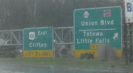
The contractor responsible for redoing the US 46/Union Blvd. interchange has let the cat run completely out of the bag and harass neighboring field mice. These signs with mini-shields are now up EB and there is another example WB. Click on the first two photos to see what the gantries look like mounted overhead. The last sign is at the end of the new ramp.
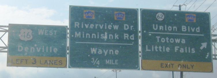
Here's a WB example already up on its support and showing off its tiny shields. I think the exit sign would look a lot better with all lines centered to each other. (Or without the county route shields - you're not supposed to mix street names and route numbers.)
Recognize that route number? Scroll up. This is supposed to be CR 639.
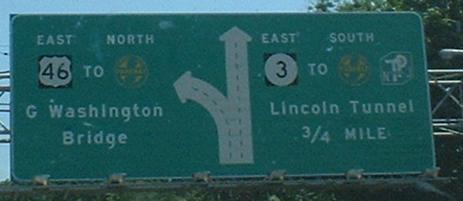
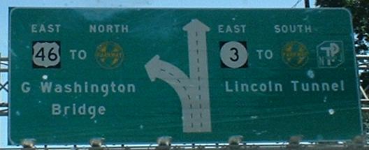
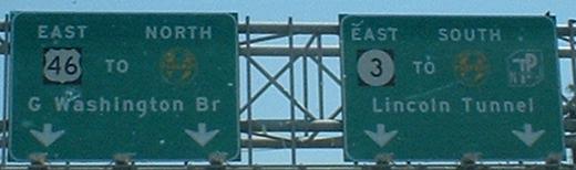
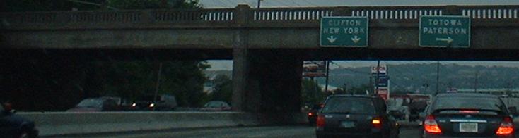
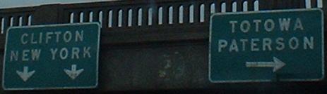
Three pictures of the diagrammatic beginning of NJ 3, which runs eastward as a Jersey and then full freeway to I-95 and the Lincoln Tunnel route NJ 495, ending at US 1-9.
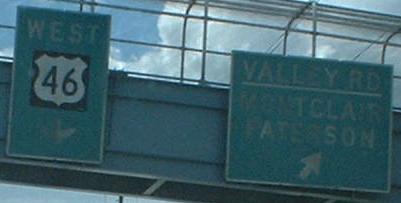
Not button-copy, but non-reflective, like older surface-mounted LGS's. Notice that US 46 only uses a single arrow, a common feature of older signage (two arrows for one lane is also common - see the Union Blvd. signs above). Valley Road is the only way for WB US 46 traffic to get to EB NJ 3, but this is not signed anywhere. Also, if you take this Valley Road exit, you end up dropping down to WB 3 just before it merges with 46, and then taking another ramp down to NB Valley. If you wait until the NJ 3 merge, you get another chance to exit to Valley Road, on what must be the only on/off ramp with a Volkswagen dealership on it. That ramp allows you to turn either SB or NB on Valley; in fact, if you took the first one and wanted to take Valley SB, you'd make a left, come a small way up the second one, and then curve to the left in a channelized movement, stop for the second ramp's turn to Valley NB (which has a stop sign of its own a short distance later), and finally merge with the second ramp's movement to Valley SB. Easy, huh?
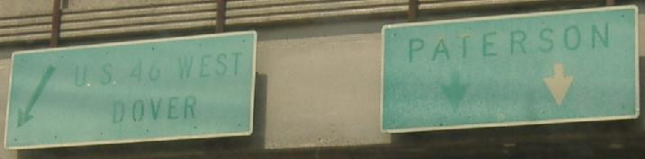
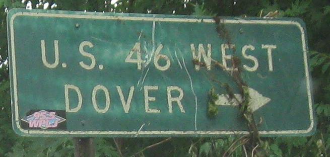
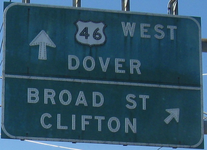
NB on Valley Road in Clifton, passing underneath US 46, which really is just one lane toward Paterson. It's much simpler from the ground, just one WB ramp (46) and one EB (46 and 3). The WB ramp to U S 46 WEST DOVER splits off with old Notch Road continuing a little distance before petering out at the side of the mountain. Notch Road followed a piece of the end of NJ 3, and went through the gap sthat US 46 took over when it was constructed way back in the 1950's.
The revamped EB Grove St. ramps take shape in late 2007. They've been closed so long, traffic has already adjusted to not having them there. Well, as best it can, since delays at Grove St./Van Houten Ave. are still around 5 minutes during the day. I don't know what's getting fixed, but I doubt it's worth the wait - why couldn't the exit have been kept open during construction?
EB after NJ 3, shortly before the Piaget Ave. section of US 46, which is short but is only a four-lane divided surface road with parking. After that section, US 46 turns to the north between NJ 21 and NJ 20, crossing the GSP again - this could be the only place where a NB ramp turns 90 degrees left to access an EB roadway, but that's what Exit 156 off the GSP does. Then, after both highways cross the Passaic River, 46 and the GSP meet one last time before finally going on their separate ways.
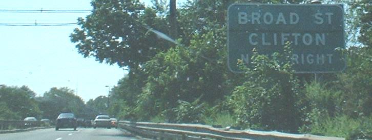
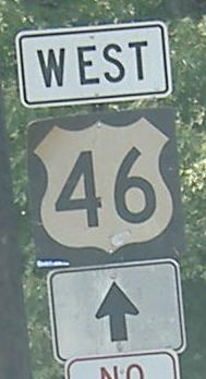
These WB signs give my heart flutters. The first sign, with its oversize all-caps lettering, has to be as old as US 46 through here, which is to say, at least 50 years old, maybe 60. Then you see the next sign. Not only does the smaller-than-normal 46 shield have no black square behind it, it has button-copy numerals AND a button-copy outline, and to top it all off, it's a different shape than the US shields of today. Also note the ridiculously small arrow for Broad Street. Believe it or not, the best is et to come.
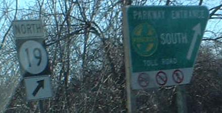
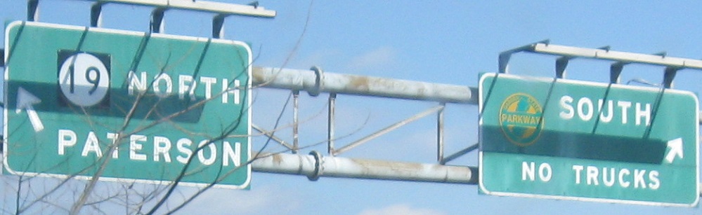
Just before the Broad Street exit is the combination NJ 19/GSP exit, and while signage for that is ordinary, there's still some nice button copy on the ramp (including a reverse-color GSP shield - for some reason, that mistake stopped being made years ago). NJ 19 turns into Broad Street to the south, in case you care, so it's part of the same interchange as the Broad St. ramp. I know you care.
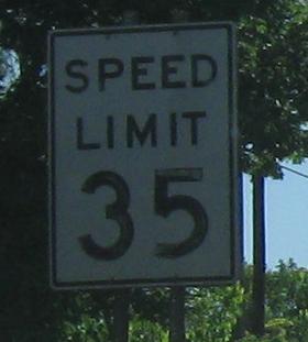
One of the rare old signs made in what would now be considered freeway size - Clifton really wants you to slow down before the Piaget Ave. traffic lights.
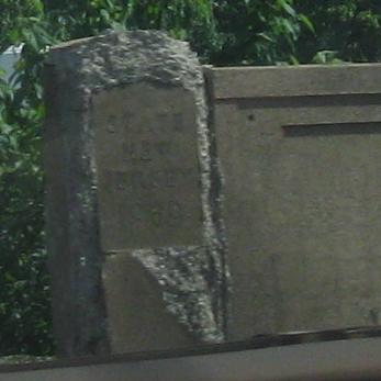
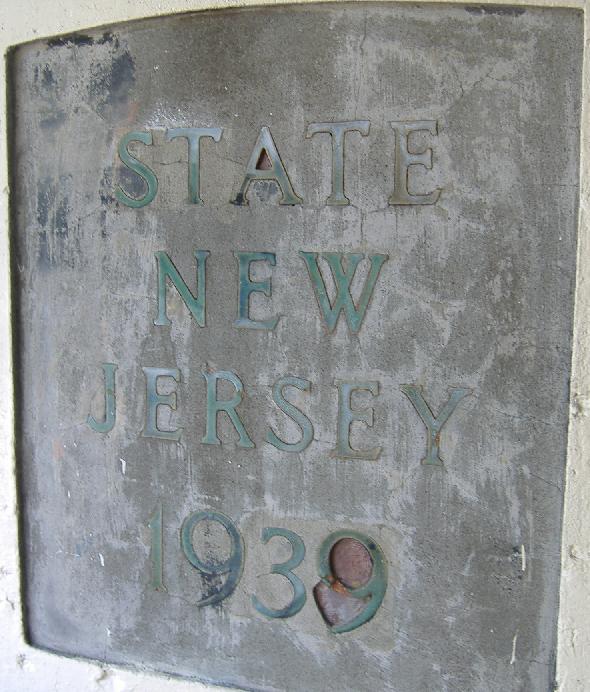
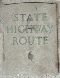
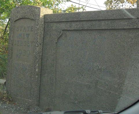
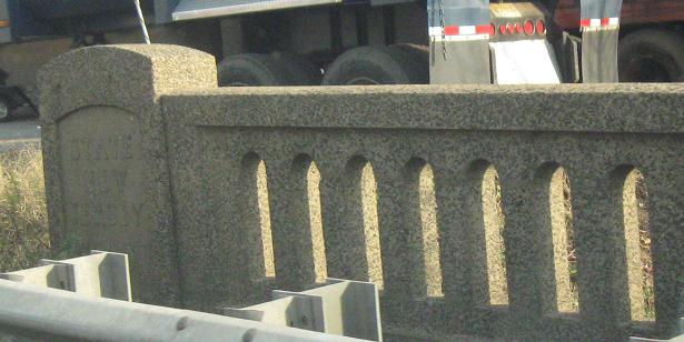
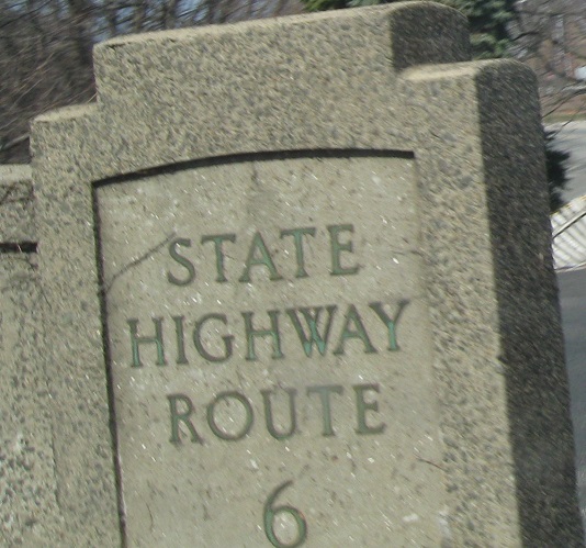
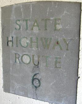
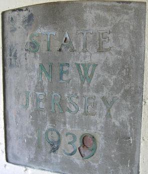
The date (1939) and State Highway Route number (6) on the westbound side of the railroad overpass just before Hazel St./Paulison Ave., seen from the EB side.
Now traveling westbound in 2008, notice how meticulous the repair job was!
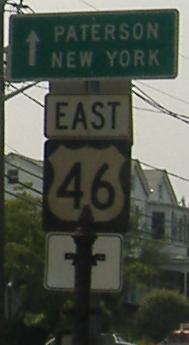
The EB side of the bridge, with a distance sign that once read to New York.
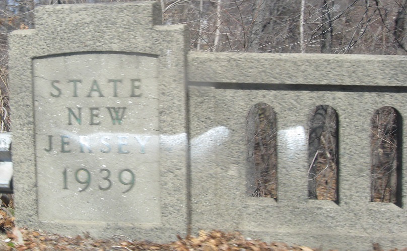
Of course, the Paulison Ave. bridge dates to the same year. These are WB.
Yet another remnant of the 1950's, this one actually on Piaget Avenue. Piaget soon exits, and US 46 becomes a semi-depressed freeway eastward across the Passaic River. Which leads you to:
Still more signage dating from the construction of its particular segment of US 46, these EB and WB signs feature black cast lettering on white enamel. Well, once it was white.
And when was that segment constructed? Ah. This underpass proved to me that these numbers are green tile, not rusted copper. Click on either for closeup.
Piaget Ave. WB. Piaget has a neat underpass to get to US 46 WB, which then becomes Piaget westward to the Garden State Parkway. The old pole in the first photo would have had an original white enamel direction sign; there is another on the WB US 46 ramp to Piaget Ave. EB (i.e. the opposite side from the second photo), and both poles probably date from 1939.
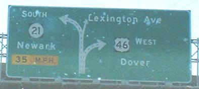
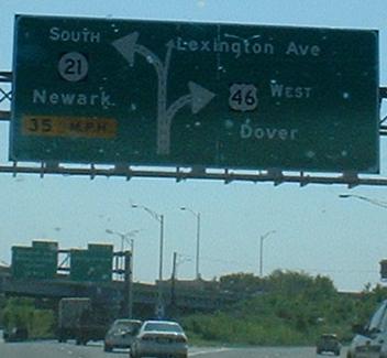
The new beginning of NJ 21. For a long time, 21 ended in an octopus of ramps in the middle of Passaic, and one needed to follow surface roads to US 46. Finally, the freeway found funding and was pushed through, replacing the tangled Lexington Avenue interchange with 46 in a neat double merge - Lexington and 21 both only tie into US 46 to the east.
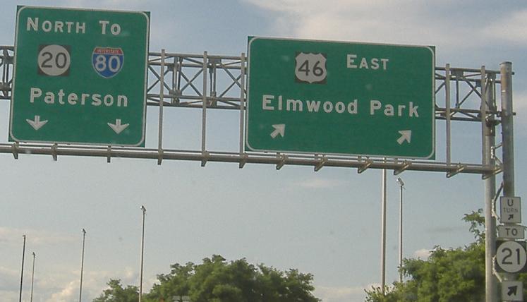
With the completion of NJ 21, 20 and 21 are now just a few hundred feet away from each other, and are similar quality roads (20 is an expressway, McLean Boulevard). It would make sense to turn NJ 20 into a real route again (it once was planned to include both NJ 120 and NJ 19 - if it only included the latter as a loop around Paterson, both ends would be at US 46). However, since two of the three original pieces of 20 have different names, I think it would be poetic justice to kill the last remaining piece... and then resurrect it as a superhighway! Or not.
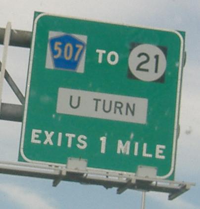
Notice that little assembly in the corner of the second sign. It used to only say "U", and I made fun of it, and then NJDOT read this and removed it, and that saddens me, because I only make fun of the signs I love. To expand on my U-turn text, you can't access US 46 WB from NJ 21 NB, and neither can you access 21 SB from 46 EB, so traffic desiring either movement needs to take CR 507 from 46 EB. The first picture is taken just before the Lexington Avenue onramp that was reconfigured to make room for NJ 21. Note the county route shield with a white background, as opposed to standard yellow, versus the new-style ugly wide shields that contrast the proper first shield.
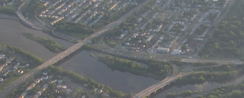
Looking west at US 46's NJ 21 (top left), Garden State Parkway Exit 156, and NJ 20 (center right) interchanges along the Passaic River.
Westward on US 46
Into the NJ 23/US 46/I-80 interchange
Eastward on US 46
Back to US 46 main page
To I-80
Onto Minnisink Rd., CR 642
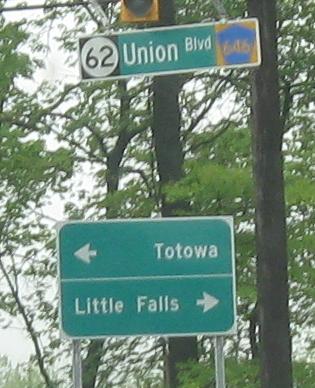
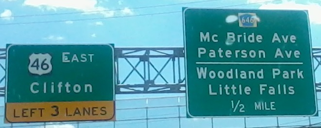
Onto Union Boulevard, NJ 62/CR 646
Onto NJ 3
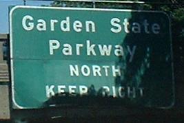
Onto the Garden State Parkway
Onto Broad St., CR 509
Onto NJ 19
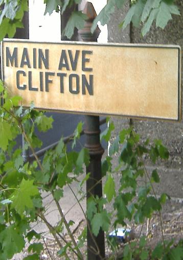
Onto Main Avenue
Onto NJ 21
Onto NJ 20
Onto CR 507
Back to New Jersey Roads
Back to Roads