Ground-level views of the first cloverleaf interchange in the U.S. (Europe had us beat), in Woodbridge, NJ. It's very close to replacement, dating from 1929, but Cloverleaf Park in the southwest quadrant will hopefully remain. You can see in the second photo that cars entering NJ 35 have a 90-degree right-hand turn rather than a merge; only the striping on US 1-9 saves traffic up there. Underneath the overpass, 35 has an extra half-lane on the right, which isn't quite enough to really travel in, but makes merging more of a New Jersey-style proposition - making two lanes out of one. Follow the US 1-9 link below to see a couple more photos of the old interchange.
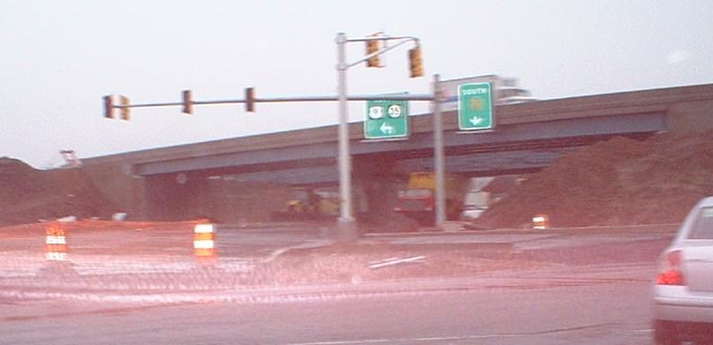
Click to drive across the Victory Bridge, then land in the Victory Circle in the winter 2004-5 photo, where construction is underway at US 9 to turn it into a Victory Interchange. US 9 is being reconstructed with some new overpasses, and then the old ones (turned into temporary openings underneath 9) will be removed and the roadways straightened out. Straight isn't only the Garden State Parkway, but also Main St. Extension in Sayreville.
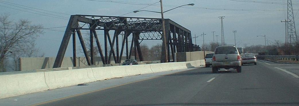
The SB half (right side, since we're traveling SB) is the old SHR 35 bridge from 1946, while the NB half was once a railroad trestle for a streetcar line (as early as 1904). There are traces of old two-lane 35 in and east of Sayreville (this bridge is at the eastern end of that town). Thanks to SPUI for information on this.
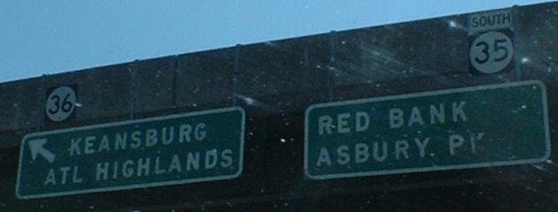
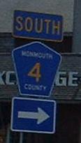
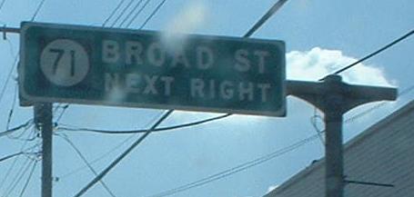
A couple of old button-copy signs, sandwiched around CR 4. Monmouth and Bergen are the only two counties to have non-6xx/7xx county routes, but Bergen tends to use the old white squares for theirs (see the County Routes Page). I don't know what was on the rest of the NJ 71 overhead - it very well may be nothing, extending to the right just to complete a T-junction. NJ 71 multiplexes with NJ 35 for another block or two to the south, and then goes off again, before ending once more at 35 further south, making the only NJ routes that intersect each other three times (other than freeway/surface route pairs and US 46/Garden State Parkway). NJ 36 begins here, thus intersecting NJ 35 twice.
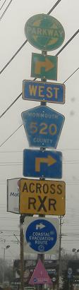
CR 520 WB/NJ 35 SB along their very short Red Bank duplex.
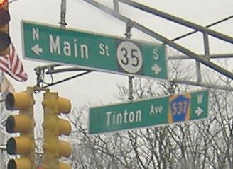
No, bad NJDOT, but at least they realized that CR 537 doesn't head left (east) into Fort Monmouth, but multiplexes down NJ 35 SB to the south of the army base.
NJ 36 continues eastward to end at NJ 18, and then the roadway follows the secret spur NJ 444S onto the Garden State Parkway. The second sign doesn't have a directional, and while it doesn't really need one since the WB 36 ramp just left, an EAST would be nice here (the route eventually turns NORTH, and once even turned WEST again but no longer).
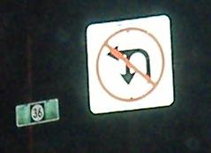
Combo no-turn sign on NJ 35 SB at the same converted circle.
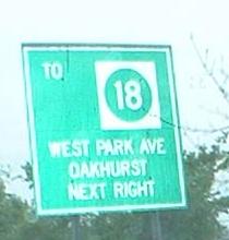
Kings Highway SB by West Park Road, a brief section of old alignment of what is now NJ 35. Due to its proximity to the West Park/35 intersection, traffic at the end of it is forced onto West Park Rd. WB, so you're supposed to turn here onto Cindy Lane and then left to get back to 35 or go east. Of course, there's no West Park Road EAST mentioned, merely Oakhurst (and how many people know where that is), and NJ 18 is in fact west, not east. So, really, it should say "ALL TURNS" or something similar, or else NJ 18 and West Park Road WEST should be pointed straight ahead. All of this is me griping because I had to pull a U-ey in traffic since these signs were unclear, but why they're here is because of the cool shieldless 18's.
Deal Rd. EB.
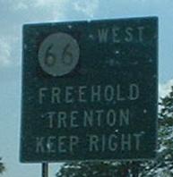
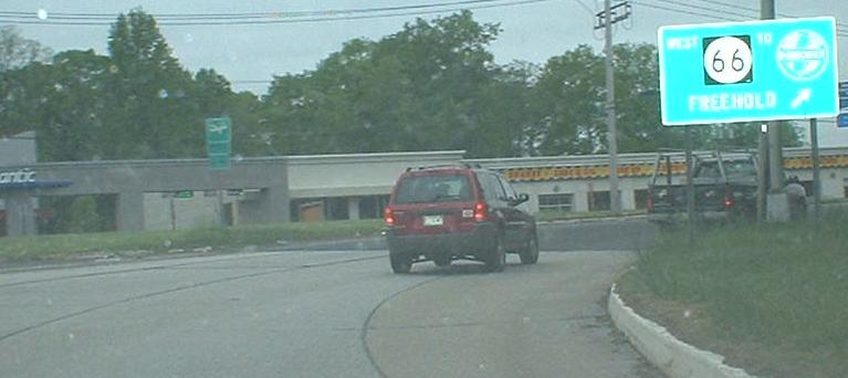
SB, the beginning of NJ 66 is a faded LGS and old concrete in a traffic circle with extra U-turns and a lot of accidents.
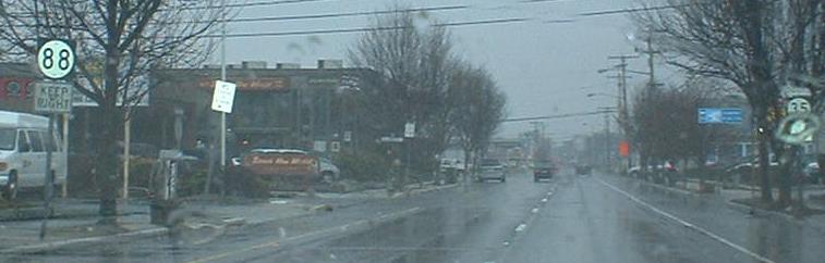
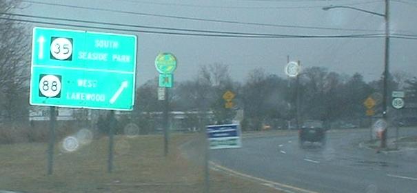
NJ 88 ends here at a traffic circle, though EB-NB traffic gets to cut through the middle at a traffic light. If you're savvy, you can head south on NJ 35 from 88 and hit the third sign, which takes you around the bottom of the circle and avoids all signals.
Some original concrete on the two-lane south of NJ 88. You'll see from the four trees on the left that I managed to take these photos in exactly the same spot (and same direction) a couple of years apart.
On the corner of Bridge St., CR 632 (which leads to NJ 13). The NB page has some nice old houses at this corner, but the SB page counters that with the house painted on the sign. I call it a draw.
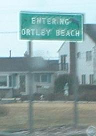
Ortley Beach mimics NJDOT here, since it's just a small piece of a township, and adds a dolphin to the green background! The only non-mammalian giveaway is the slightly wrong font.
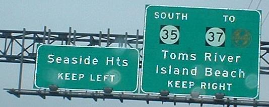
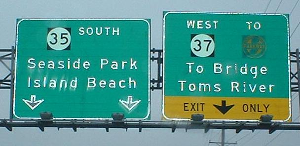
The crossover point where old NJ 35 (Central Ave.) crosses current NJ 35 NB (Dewey Dr.) just north of NJ 37.
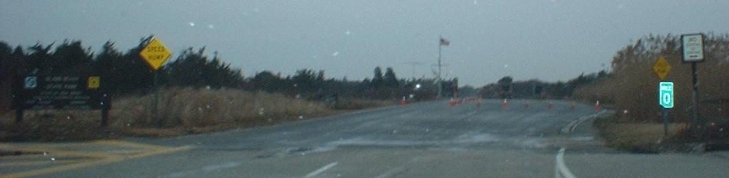
Heading through Seaside Park to the end of NJ 35. Many of its southern miles are spent as a one-way pair, and only at the very end of 35 do the two sides come back together one last time. The brown sign is at the end of the final one-way pair, just south of NJ 37. Note that SPEED HUMP is replacing SPEED BUMP in New Jersey; I like the connotations.
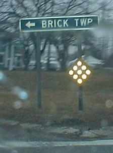
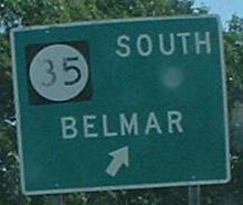
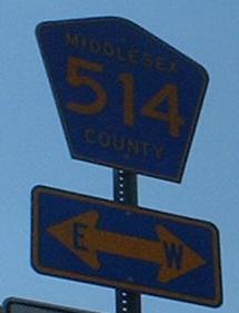 Directions in arrows are becoming more common.


 Deal Rd. EB.