New Jersey Roads - NJ 18/CR 527 NB
NJ 18 and NJ 18/CR 527 NB
Wait a minute... if NJ 18 begins here at NJ 138, why is there a northbound exit to 138? It's the only extra ramp opened to traffic in the interchange, and I don't know why the corresponding WB-SB-NB ramp isn't also open. I also don't see any reason to U-turn here, as there's nothing between here and the next opportunity to the east.
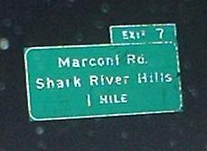
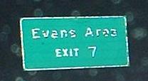
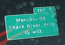
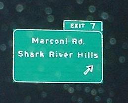
The last photo is from Brighton Ave. EB at Exit 7 (Marconi Rd. is to the right).
Heading NB on the NJ 18 freeway, just south of the Garden State Parkway and about to leave the alignment that would have been part of the aborted NJ 35 freeway for what was always intended to be NJ 18.
The way things were constructed, it's a pain to go most ways between NJ 18 and the Garden State Parkway (even intuitive paths like SB on the GSP to SB on 18), and signage isn't that informative in some directions.
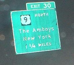
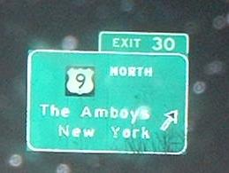
I'm given to believe that the NJ 18 freeway once ended a little south of US 9, and was upgraded to there from divided arterial by closing some median crossings; signage at US 9 clearly has the EXIT 30 tacked on at a later date.
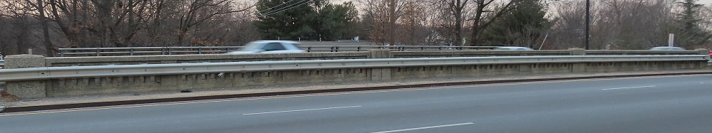
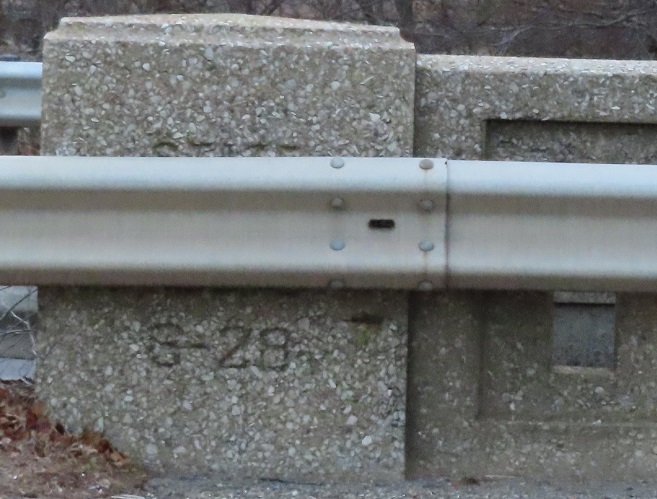
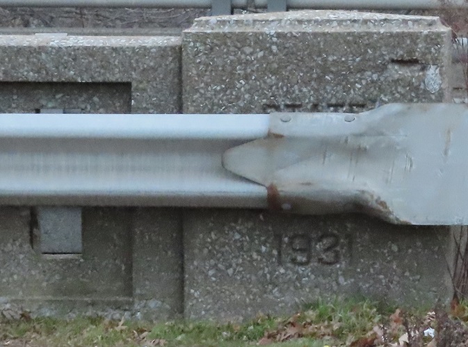
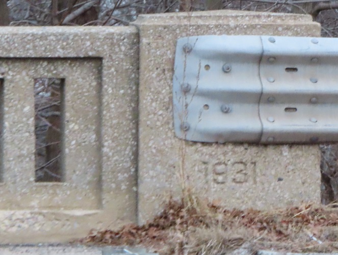
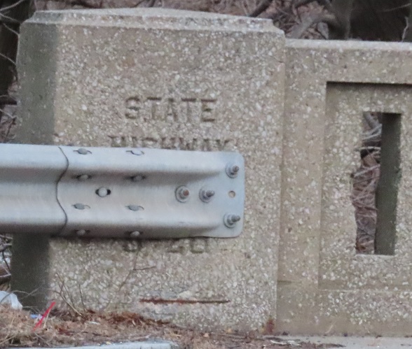
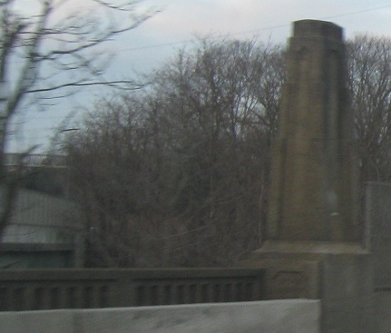
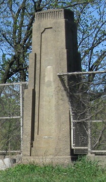
Where NJ 18 crosses an old railroad spur in East Brunswick, the NB side does so on the original NJSHR S-28 bridge, which you can see dates to 1931. The SB side has a significantly newer bridge, but here's the thing: because this was a 4-lane (undivided) road once, the NB side gets to have 4 lanes across the railroad, perfect for merging from Milltown Rd., while the SB side is stuck with just 3 lanes.
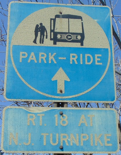
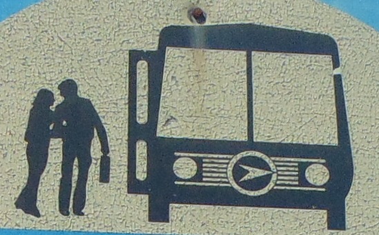
This sign was mounted at the NJ Tpk. overpass. NJ uses these Park & Ride signs all over, but have you ever really looked at them? How old is that bus? Is that the NJDOT logo on the front?
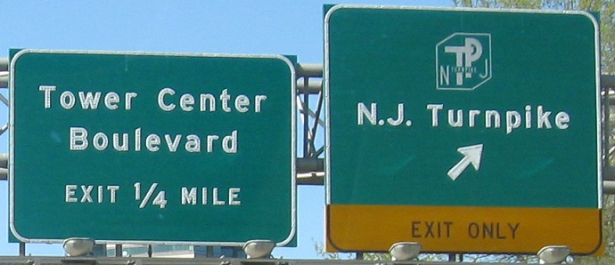
The Tower Center exit crosses the Turnpike onramp.
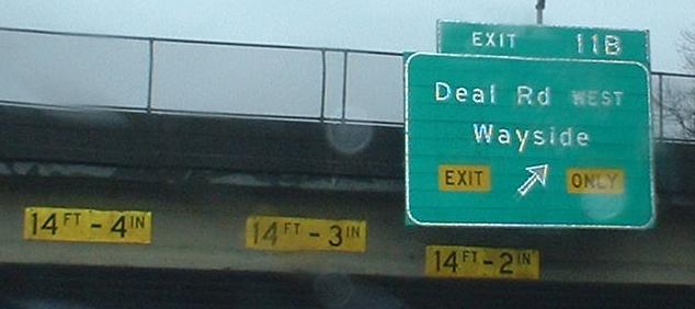
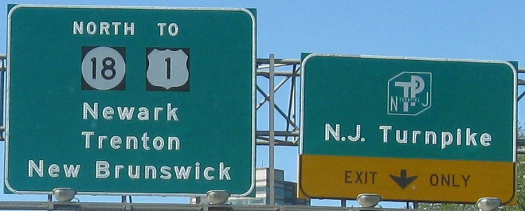
This 2013 assembly looks like it took the left sign from the first gantry and the right sign from the second, but not before pulling off the "Exit Only" tab.
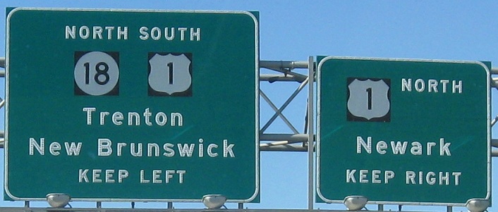
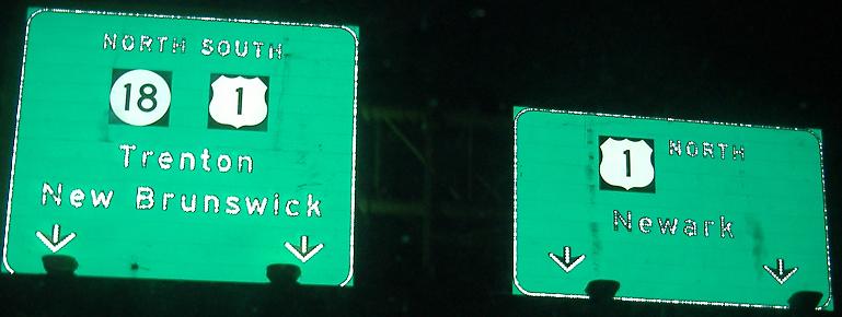
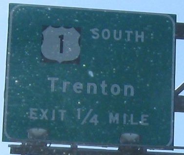
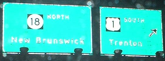
Sure, if NJDOT wanted to do it right, they could separate US 1 SOUTH and NJ 18 NORTH into two BGS's, those being two separate routes and all. Or at least add a "TO." Two of the four corners (SW and NE) of the original Westons Mill Pond bridge are sandwiched between the signs. If this still carried both sides of NJ 18, there would still be a SB sidewalk that would let me walk up and see what's stamped into the SW column.
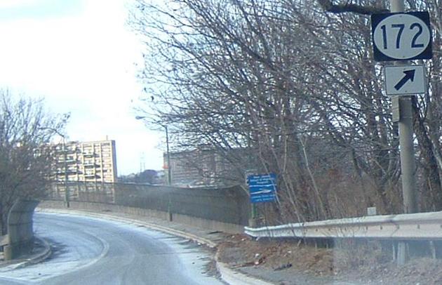
The old (pre-reconstruction) beginning of NJ 172, courtesy Scott Colbert, in a place where there was once a much older NJ 172 shield, I believe in the gore. NJ 172 is old NJ 18 in New Brunswick, though it ends at Commercial Blvd. A few blocks to the west, NJ 171 comes in and carries the old 18 to its former end at NJ 27, though the old end was a circle.
Same sign, two times of day. The advance sign (first photo) is probably original to the construction of NJ 18 along the river to NJ 27 (when the old alignment became NJ 172 along George Street).
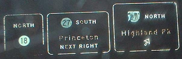
The old end of NJ 18, which just ramped down into 27. The NB 27-SB 18 surface street ramp still has traces of the original alignment.
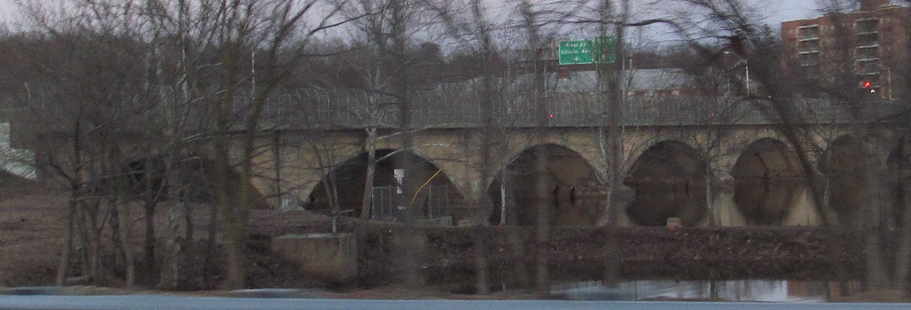
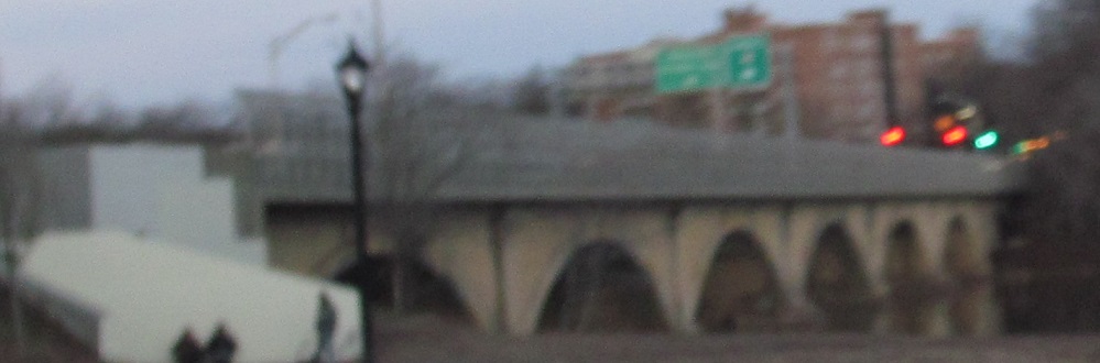
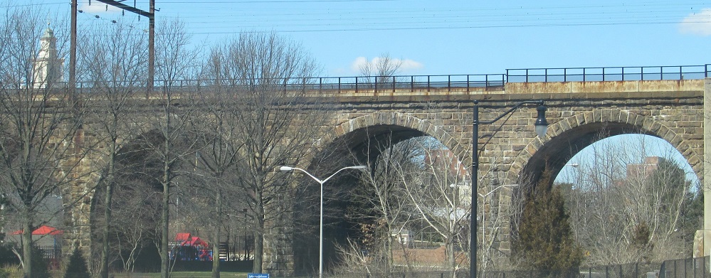
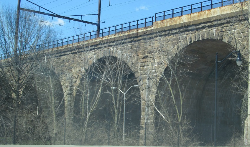
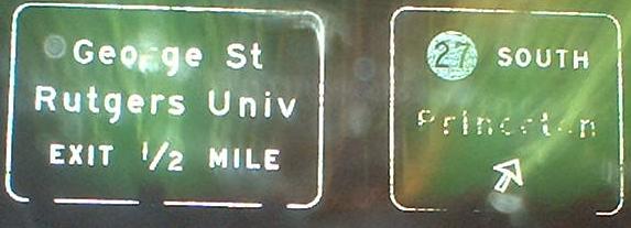
The first two photos are NJ 27 over the Raritan River. The last two are the Northeast Corridor over NJ 18.
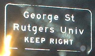
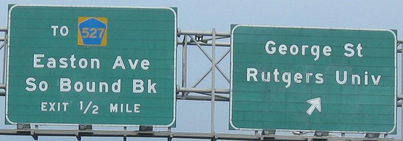
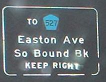
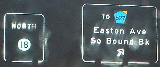
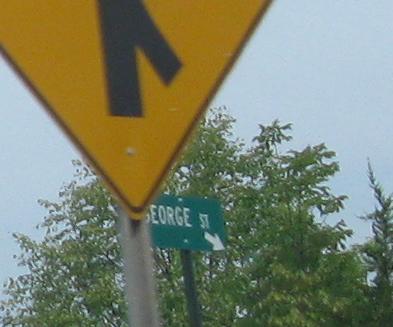
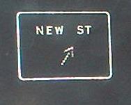
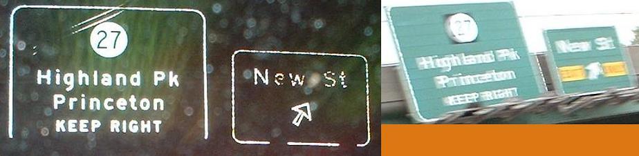
This is really the second George Street exit, the first being for NJ 172 (and also having but two LGS's to tell you what it is). Actually, as you can see in the very last photo, the "TO CR 527" is the third George St. exit - that sign is for George St. WB traffic splitting between staying on George and joining NJ 18 NB. Click on the second photo for a closeup of the left sign; the right one was replaced.
Over to the SB lanes
North to new NJ 18
Along NJ 18 (non-directional)
New Brunswick construction
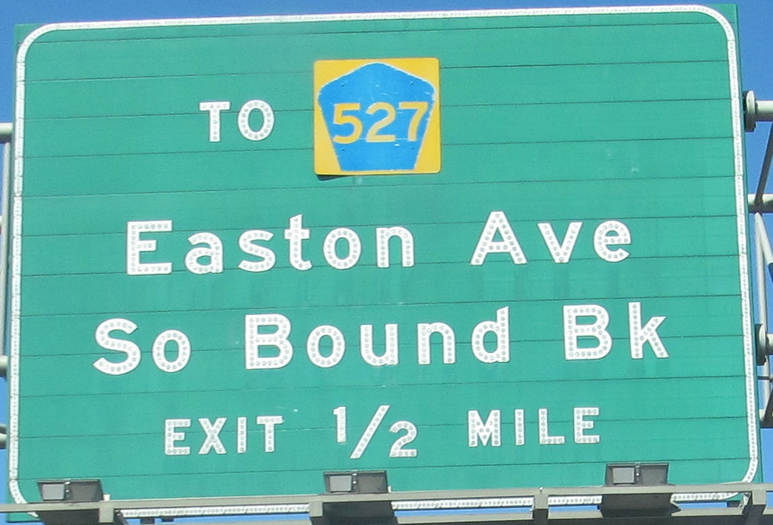
To CR 527 alone
NJ 172/CR 527 and interchange construction
Back to NJ 18 main page
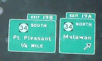
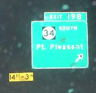
Into Monmouth Co.
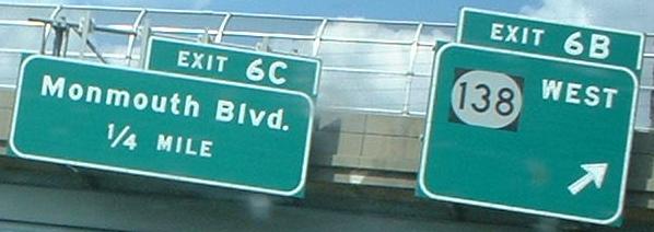
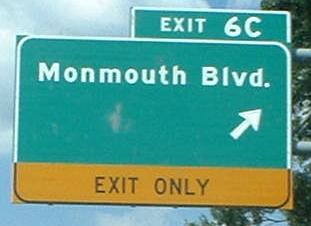
Exit 6 to NJ 138
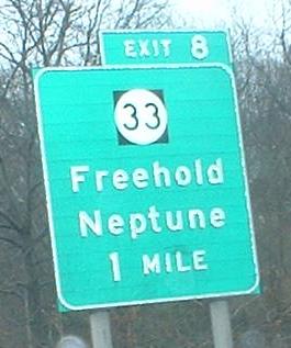
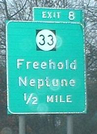
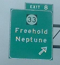
Exit 8 to NJ 33
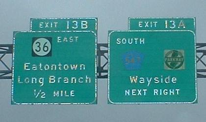
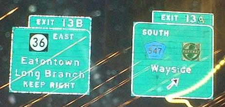
Exit 13A to the Garden State Parkway
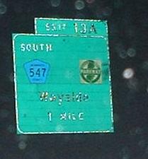
Exit 13A to CR 547
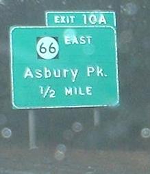
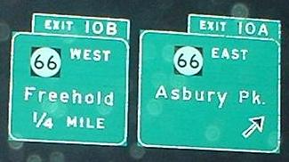
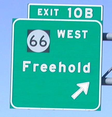
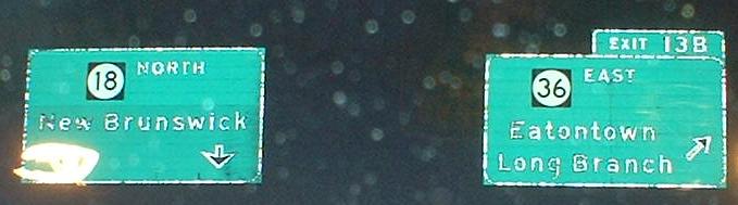
Exit 13B to NJ 36
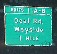
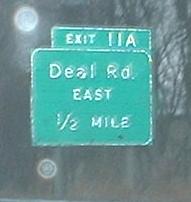
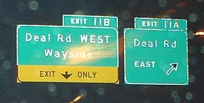
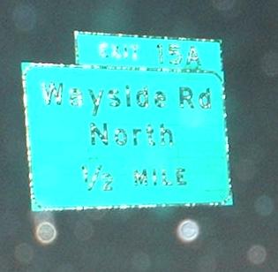
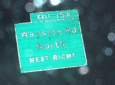
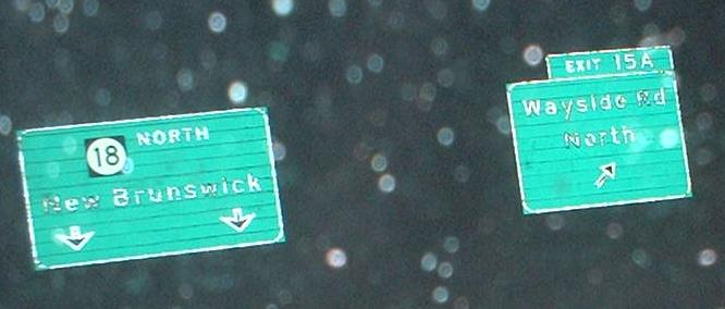
Exit 15 to Monmouth CR 38, Wayside Rd.
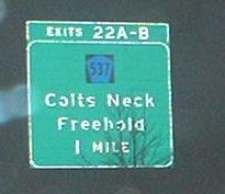
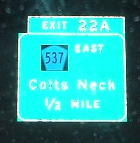
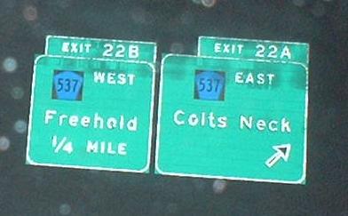
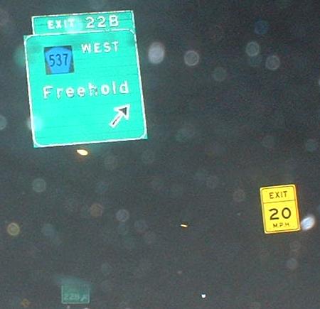
Exit 22 to CR 537
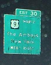
Exit 30 to US 9
Onto I-95, the N.J. Turnpike
Onto US 1
Onto NJ 27
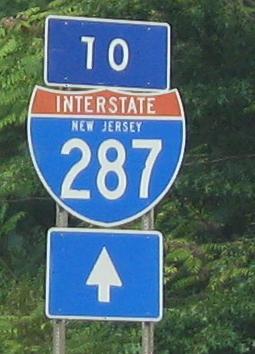
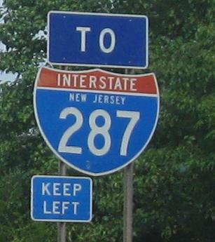
To I-287
Back to NJ Roads
Back to Roads