New Jersey Roads - NJ 171
NJ 171


NJ 171 ends and begins, respectively, sharing a terminus with US 130. This makes sense, because 171 is the remnant of when 130 ended inside New Brunswick at the Lincoln Highway (now NJ 27). Technically, until the US 1 ramps (to/from the north) merge, NJ 171 still exists, crossing US 1 on the overpass signed as US 130.

Either the original signs were replaced at well under 10 years old, which doesn't make sense, or they were swapped, which doesn't make sense. The best explanation I have is that someone hit the assembly and forced it to be reposted. Opposite order, still wrong with the banners underneath.
SB; NJ seems to like these.

I have only seen decimal mileposts on county roads before, but NJ 171 is ridiculously well-signed for about a mile north of US 130/US 1. It's a four-lane road before narrowing down to three with a center turn lane, and then down to two in New Brunswick. Georges Road ends, and after a zig 171 ends up on Commercial Avenue, from which it turns again onto Suydam St. However, the official NJDOT state map has NJ 171 following Commercial Avenue to the end of NJ 172 (George Street) - which is only a block away from NJ 18 - and then turning left onto the rest of George. At Livingston Avenue, these two accounts merge, and NJ 171 follows George to NJ 27, aka Albany Street. It seems like NJDOT, however confused on the routing, agrees that NJ 171 gets to NJ 27, but this isn't the whole story. Because the rest of 171 is town-maintained, it isn't signed as 171, which raises the issue - if a state highway is neither signed nor state maintained, is it really the route? Personally, I'd like 171 to follow the map routing down Commerical Avenue and then end at NJ 18, because that makes the most sense, but then again I'd also like NJ 26 to follow Livingston Avenue to the end, and I don't really want NJ 91 to exist at all. I do know that back in the day, 26 did do what I say it should (and before the 1953 Great Renumbering, US 1 was 26 south of New Brunswick, so it wasn't just a tiny spur route), but I have no data on how 171 went back that long ago. It had been US 130 for awhile, before being truncated when the NJSHR 25/US 1 bypass of New Brunswick opened, along whatever routing it may have taken.

I bet this isn't what you expected to see on this page. It is on Livingston Ave. in New Brunswick, just past Suydam Street. Yes, this was once NJ 26, but it's been awhile since 26 passed the New Brunswick border on Livingston (it now terminates right at the border, which is silly - should keep going into town). In fact, NJ 171, though town maintained, turns here from Suydam and heads north into the center of town and George St., meaning this shield isn't just old, but now entirely incorrect. According to the stickers on the lower left and right hand corners of the 26 shield, it dates from September of 1965, when NJDOT was known as the NJ State Highway Department.

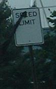
A Livingston Ave. speed limit sign that used to stand just past that NJ 26 shield, but has been replaced (why fix that and leave the 26 shield?). Courtesy Lou Corsaro.

From the multiplex pages I inherited from SPUI, I inherited this 1937 colorized photograph from Old New Brunswick. The perspective is NJ 171 SB on George St. approaching Livingston Ave., but as you saw above, it was part of NJ 26 back then. CR 527 continues straight with former NJ 18 (then NJSHR S-28).
South onto US 130
Onto US 1
Onto actual NJ 26
Back to New Jersey Roads
Back to Roads