New Jersey Roads - NJ State Highways - 31-40

NJ State Highways: 31-40

31   31A   S31   32   33   33A   Bus. 33   Bypass 33   33 and 35 Link   34   35   36   S36   37   38   39   S39   US 40   40   S40


31

31 runs north from Trenton. Before the GR, it was
30, and at the GR, it became 69. This was renumbered on 5/15/1967; too many signs were being stolen because of the newly attributed sexual connotation to the number "69." The only alignment change has been around Ringoes. Before the US 202 bypass was built in 1965, 31 went through town, partly on 179 (old US 202). A freeway was proposed for the 31 corridor, which is heavily used by trucks trying to follow the cancelled Somerset Freeway (I-95), but only now is NJDOT so much as four-laning the highway. State boring logs show that at some point, a northward extension from Buttzville toward I-80 was studied, on either side of Jenny Jump State Forest to a cloverleaf interchange. Of greater interest, 31 would have ended at I-80, but the freeway would have continued north for approximately 35 miles as the Foothills Expressway (or Freeway) to I-84 in New York near current Exit 1 (north end of 23. First proposed in 1966, that project was tied to the controversial Tocks Island Dam that would have resulted in greater development of western NJ forests. It was included as a proposed I-184 in an NJDOT letter to FHWA requesting additional Interstate mileage, which made no headway.
Before the GR, 31 went from Princeton to the New York state line near New Milford, NY. The section from Princeton to US 202 in Far Hills was pre-1927 16. From Princeton to Newton, 31 became US 206 in the GR (it was already multiplexed), and 94 from North Church to New York. The section from Newton to North Church was never built. East of Newton, 31 included one of the last sections of unpaved state highway in New Jersey.

ROUTE NO. 31. Princeton to Unionville, New York, by way of Somerville, Bedminster, Netcong, Newton, Sussex to a point in the State boundary line between New York and New Jersey in the vicinity of Unionville. Original bill.
ROUTE No. 31. PRINCETON TO MILFORD, NEW YORK. Beginning in Princeton and running by way of Somerville, Bedminster, Netcong, Newton, Lafayette, Hamburg, Vernon to a point in the New York state boundary line in the vicinity of New Milford, New York. L. 1927, c. 319.

Photos
End photos
History (Steve Anderson)

ends at N Broad St/Brunswick Ave/N Warren St/Princeton Ave (US 206/Bus. US 1)
TrentonPennington Rd
EwingPennington Rd
HopewellPennington Rd, Route 31
PenningtonRoute 31
HopewellRoute 31
PenningtonRoute 31
HopewellRoute 31
PenningtonRoute 31
HopewellRoute 31
East AmwellRoute 31, Route 202
RaritanRoute 202
FlemingtonRoute 202, Route 31
RaritanRoute 31
ReadingtonRoute 31
Clinton TwpRoute 31
Clinton BoroughRoute 31
Clinton TwpRoute 31
LebanonRoute 31
Glen GardnerRoute 31
HamptonRoute 31
Washington TwpRoute 31
Washington BoroughRoute 31
Washington TwpRoute 31
MansfieldRoute 31
OxfordRoute 31
WhiteRoute 31
ends at Route 46 (US 46)


31A

31A became
64 in the GR. It was planned for extensions in both directions, and probably was never signed. 133 is around where the eastern part of 31A would have been.

ROUTE NO. 31A. Beginning in State highway route No. 31 in or near Princeton, and thence to a point at or near Hightstown and connecting there with State highway route No. 33 eastwardly of Hightstown. L.1938, c. 345, p. 872, s. 1. Amended by L.1941, c. 105, p. 237, s. 1.

S31

S31 was multiplexed with
US 206 north of Newton pre-GR. ROUTE NO. S-31. Spur from Augusta to the Delaware river opposite the town of Milford, Pennsylvania. Original bill.
ROUTE NO. S-31. Spur from Route No. 31 near Newton to the Delaware river, via Branchville, to a point opposite the town of Milford, Pennsylvania. L. 1927, c. 319.

End photos

32

32 is a short connector at NJTP (
I-95) Exit 8A. It was formed in 1966, when the exit opened, though perhaps not exactly on the described alignment in the law below. There was a proposal to extend 32 west toward Princeton as 92 - visit that page for more. The road to the east is CR 612, and there was once a proposal to continue 32 around Jamesburg (south side, so not as described below) to US 9. Before the GR, 32 ran from south of Bedminster to Mountain View (23) with US 202, following pre-1927 13 (which ended in downtown Morristown).

ROUTE NO. 32. Bedminster, Mountain View, by way of Bernardsville, Morristown, Morris Plains, Littleton, Boonton to Mountain View, terminating on Route No. 23. L. 1927, c. 319.
ROUTE NO. . Beginning in the township of South Brunswick, in the county of Middlesex, at a point on Route 130 and extending in a general northeasterly direction to a point in the township of Monroe in the county aforesaid, near the intersection of Middlesex County Routes 522 and 535. L.1964, c. 121, s. 1.

Photos
End photos

ends at Route 130 (US 130)
South BrunswickForsgate Dr
ends at New Jersey Turnpike (I-95)


33

33 runs from Trenton east through Freehold to Neptune. The section west of
US 130 was pre-1927 1. Before the Trenton Freeway (US 1) was built in 1951, 33 ended at US 206 (S Broad St) on Greenwood Ave. The Freehold bypass was built in 1975 west of US 9/79. From there east to Halls Mill Rd it opened on 10/24/1988, but it wasn't until 7/1/1990 that it was signed as 33; before that it was Bypass 33, and 33 used Bus. 33 through downtown Freehold. At that point, 33 was temporarily signed (possibly as 33 TEMP) along Halls Mill Rd (CR 55) to Bus. 33 east of Freehold. The final section from Halls Mill Rd back to the old alignment opened as a two-lane freeway around 12/2002, with room left to widen each carriageway to two lanes per direction. It was the only part of the contract built as 33F; the others had been built as Bypass 33.

ROUTE NO. 33. TRENTON TO ASBURY PARK, by way of Robbinsville, Hightstown, Freehold and Asbury Park. L. 1927, c. 319.
33: From intersection of Broad and Market Streets in Trenton, via former Route 33 junction with Route U. S. 130 (former Route 25) at Robbinsville coincident with Route U. S. 130 to junction with Route U. S. 130 (former Route 25) west of Hightstown, via former Route 33 to junction with Route 34 in Howell Township, coincident with Route 34 to a junction with Route 34 in Shrewsbury Township, via Route 33 to junction with Route 71 (former Route 4-N) in Ocean Grove. 1953 renumbering.

Photos
End photos
History (Steve Anderson)

ends at Trenton Fwy/Route 129 (US 1/129)
TrentonMarket St, Greenwood Ave
HamiltonGreenwood Ave, Nottingham Way, Route 33
WashingtonRoute 33, Route 130
East WindsorRoute 130, Route 33
HightstownMercer St, S Main St, N Main St, Franklin St
East WindsorRoute 33
MonroeRoute 33
MillstoneRoute 33
ManalapanRoute 33
Freehold TwpRoute 33
HowellRoute 33
WallRoute 33
Tinton FallsRoute 33
Neptune TwpRoute 33, Corlies Ave
ends at Main St (71)


33A

33A is the pre-GR number for
66. Bids for the "Asbury Avenue cutoff" were received under the name 33 and 35 Link, but as early as 1946 and consistently thereafter (Daily Record, 6/10/46, 5/17/48; Asbury Park Press 8/25/52), the highway was known as 33A. The likelihood is that while the Link designation was originally written into law, the state decided it would be easier to sign the highway as 33A.

Business 33

Business 33 is old
33 through Freehold, since 7/1/1990. It is the only remaining bannered state route, and could easily become 186, the next available 1xx number in the sequence.

Photos
End photos

ends at Route 33 (33)
ManalapanBusiness Route 33
Freehold TwpBusiness Route 33
Freehold BoroughPark Ave
Freehold TwpBusiness Route 33
ends at Halls Mill Rd/Kozloski Rd/Route 33 (33)


Bypass 33

Bypass 33 was the number for the
33 bypass of Freehold as it was completed, up to west of Halls Mill Rd, until 7/1/1990.

ROUTE NO. . Beginning at a point in State Highway Route 33 (1953) west of Freehold and thence proceeding southeastwardly to another point in the said Route 33 (1953) east of Freehold. L.1965, c. 210, s. 2.

End photos

33 and 35 Link

33 and 35 Link (or "Connecting Link") was built in the 1940s to connect
33 to the newly built Asbury Ave double circle at 35. I do not know if the circle was built in anticipation of the state highway connection, or if it was needed for Asbury Park traffic anyway. The road is cited as "Route 33-35 connecting link" in the 6/14/41 Vineland Daily Journal and 6/26/41 Keyport Enterprise, but this later became known as 33A. It became 66 in the GR.

34

34 runs north-south east of Freehold. It was built as a new alignment of
US 9, taking it off of 35. In the GR it was extended north from 79 in Matawan over old 4A (older 4). It was truncated at the south end in the GR; it used to run along 70 southwest to 35 (now 88) in Laurelton.

ROUTE NO. 34. Freneau to Burnsville. Beginning at a joint in Route No. 4 at Freneau, thence in an easterly direction to the Valley drive, along Valley drive through Holmdel, Vanderburgh, Colts Neck to a point near Shark River station of the Central Railroad of New Jersey, thence to Allenwood, thence to Route No. 35 at Burnsville. Original bill.

ROUTE NO. 34. MATAWAN TO LAURELTON; beginning at the intersection of Main street and Valley drive in Matawan, thence along Valley drive through Holmdel, Vanderburgh, Colts Neck to a point near Shark River station of Central Railroad of New Jersey, thence to Allenwood, thence to Route No. 35 at Laurelton. L. 1927, c. 319.

34: From junction of Route 35 and Route 70 (former Route 34) in Brielle, via former Route 34 to a junction with Route 33, then coincident with Route 33 to a junction with Route 33 in Howell Township, via Route 34 to a junction with Route 79 (former Route 4 Alternate) at Matawan, via former Route 4 Alternate to a junction with Route U. S. 9 (former Route 4) near Cheesequake. 1953 renumbering.

Photos
End photos

ends at Route 35/Route 70 (35/70)
WallRoute 34, Route 33
HowellRoute 33, Route 34
Colts NeckRoute 34
HolmdelRoute 34
MarlboroRoute 34
AberdeenRoute 34
MatawanRoute 34
Old BridgeRoute 34
ends at Route 9 (US 9)


35

35 runs north-south along the shore from near Toms River north to Rahway. 4 was defined in 1916 to include a section from Lakewood east to Point Pleasant and north along the shore to South Amboy. In the 1927 renumbering, most of 4 stayed
4, but this section became 35. Even then, 35 bypassed the part of 4 from Eatontown to Belmar, which became 4N. In the 1929 amendment to the route, 35 also bypassed the part of pre-1927 4 from Belmar to Brielle, and so 4N was extended south. Here is a table of when each section of original 4 was built or taken over by NJDOT:

sectionlocationdate
15/takeoverUS 9 to Metedeconk River5/1/1920
21/takeoverMetedeconk River to Bay Head5/1/1920
13/takeoverBay Head to Manasquan River5/1/1920
20Manasquan River to Manasquan Turnpike5/1/1920
19Manasquan Turnpike to 8th Ave, Belmar5/1/1920
11Belmar to Roseld Ave, Deal5/1/1920
10Roseld Ave, Deal to Cedar Ave, West Long Branch5/1/1920
6Cedar Ave, West Long Branch to Main St, Eatontown9/1/1919
5Main St, Eatontown to Navesink River9/1/1919
1Navesink River to Middletown7/20/1918
2Middletown to Keyport6/1/1919
25Keyport to South Amboy9/1/1919

In 1923, two realignments were made. 4 had originally used River Ave to get between River Rd and F St in Belmar; it now used 8th Ave. And, in Red Bank, 4 originally used Broad St directly to Front St; it was rerouted to Maple Ave (part of which was probably newly built). The Keyport bypass opened in 1926. Traffic that had been forced through downtown on Main St, Broad St, and Front St could now bypass downtown on a new road. Next came the bypass from Belmar to Eatontown, namely newly-defined 35:

sectionlocationdatewhat it was previously
35A8th Ave, Belmar to Memorial Dr, Neptune1927
(4/35) 1Memorial Dr, Neptune to 661928
(35) 266 to Eatontown1928Kings Hwy from Deal Rd to Eatontown Circle

In 1928, a new bridge opened over Cheesequake Creek. The old road used Old Spye Rd on the north side and what's now a short access road on the south side. Middletown was bypassed in 1929. The old road had used Kings Hwy, Old Country Rd, and a no-longer-existent road going north from the curve in Cherry Tree Ln. Next came the rest of 35, bypassing 4N from Brielle to Belmar:

sectionlocationdatewhat it was previously
(35) 871 to Belmar Blvd, Wall1932
(35) 9Belmar Blvd, Wall to 711935Belmar Blvd

The bypass of South Amboy opened in 1937. The old route had entered from the south via Pine St, and then turned northeast on Bordentown Ave and northwest on Stevens Ave to end at 4 at Main St. 35 still ended at 4 at Main St, just now where the bypass crossed Main St. Next was a northern extension of 35. 35 was extended along the rest of the South Amboy bypass, multiplexed with 4. At the north end of the bypass, 35 split onto a new alignment to a new bridge over the Raritan River. From there it continued north, west of 4, ending at a merge with 25 at Iselin.

sectionlocationdatewhat it was previously
(35) 14South Amboy to Smith St1940
(35) 12Smith St to 5141939Old Post Road from 184 to 514
(35) 13514 to US 11938

The bridge over the Manasquan River was replaced and relocated in 1950. The old north approach became part of a complicated interchange with 4N and local roads.
In the 1953 renumbering, most of 35 remained 35. However, the east-west part from Lakewood to Point Pleasant became 88, and 35 was extended south along former 37 to end at what remained of 37 in Seaside Heights. North of South Amboy, 35 became part of US 9, while 4 (which was also US 9) to Rahway became 35. Histories of the sections that had been 4 and 37 are in their respective entries.
A bypass of downtown Seaside Heights was built in 1958. This caused 35 to be extended to the south border of Seaside Heights and 37 to be truncated at the new bypass west of downtown. I don't know when the new southbound roadway was built from South Mantoloking Beach south to Seaside Heights, but it was probably after the Seaside Heights bypass was built; this caused the old road to become northbound-only. I also have no idea when the short southbound route in Red Bank was taken over by the state. 18 south of Eatontown was originally planned as a 35 freeway; a 1969 USGS topo shows 35 on the freeway south of 66. It is unclear if this was ever actually signed. The northbound alignment along Cincinnati Ave in Point Pleasant was taken over and rebuilt by NJDOT in 1969; the old alignment became southbound-only. On 4/16/1980, NJDOT took over the road south from Seaside Heights to Island Beach State Park from Ocean County and extended 35 along it. In exchange, the county took over 180 as CR 50.

ROUTE NO. 35. South Amboy bridge plaza to Lakewood, by way of Keyport, West Long Branch, Oakhurst, Interlaken, West Asbury Park, Belmar, Manasquan, Point Pleasant, Burnsville to Lakewood. Original bill.
ROUTE No. 35. SOUTH AMBOY BRIDGE PLAZA TO LAKEWOOD, via Keyport, Eatontown, Belmar, Manasquan, Point Pleasant, Laurelton to Lakewood. L. 1927, c. 319.
ROUTE NO. 35. South Amboy Bridge plaza to Lakewood by way of Keyport, Eatontown, Belmar, Manasquan, Point Pleasant, Laurelton to Lakewood. L. 1928, c. 19, p. 33, s. 1.
ROUTE NO. 35. South Amboy bridge plaza to Lakewood, by way of Keyport, Eatontown, Belmar, Point Pleasant, Laurelton to Lakewood. L. 1929, c. 126, p. 215, s. 12.
ROUTE NO. . Beginning at the intersection of Route 25 and of the route described in chapter one hundred seventeen, laws of one thousand nine hundred and forty-six, thence continuing in a general southeasterly direction and terminating at a point on Route 35 northerly of the Raritan river, all in Woodbridge township, Middlesex county. L.1947, c. 328, p. 1051, s. 1.
35: From junction with Route 37 at Seaside Heights, via former Route 37 to junction with Route 88 (former Route 35) in Point Pleasant, via former Route 35, junction of Route U. S. 9 to junction of former Route 4, via former Route 4 over Victory Bridge to junction of Route 27 in Rahway. 1953 renumbering.
ROUTE NO. 35. FREEWAY EXTENSION. Beginning at the northerly terminus of the Route 35 Freeway in the vicinity of Eatontown, Monmouth county, and thence in a northwesterly direction to an appropriate connection with the Route 74 Freeway in Madison township, Middlesex county. L.1971, c. 61, s. 1, eff. March 25, 1971.

Photos
End photos
History (Steve Anderson)

ends at Island Beach State Park
BerkeleyCentral Ave
Seaside ParkS Central Ave, N Central Ave, [N Central Ave, Porter Ave](Decatur Ave, N Bayview Ave), Route 35
Seaside HeightsRoute 35
BerkeleyRoute 35
Seaside HeightsRoute 35
Toms RiverRoute 35, [Marlin Dr, Route 35 N](Pennsylvania Ave)
Lavallette[Grand Central Ave](Central Ave)
Toms River[Grand Central Ave](Central Ave)
Brick[Route 35 N](Route 35 S)
MantolokingOcean Ave
Bay HeadMain Ave
Point Pleasant BeachRoute 35, Sea Ave, [Cincinatti Ave, Hawthorne Ave](Sea Ave, Richmond Ave), Route 35
BrielleRoute 35
WallRoute 35
BelmarRiver Rd, H St
NeptuneRoute 35
Ocean TwpRoute 35
EatontownRoute 35, Main St
ShrewsburyBroad St
Red BankBroad St, Maple Ave, [Maple Ave, W Front St](Water St, Pearl St), Riverside Ave, Coopers Br
MiddletownCoopers Br, Route 35
HolmdelRoute 35
HazletRoute 35
KeyportRoute 35
AberdeenRoute 35
Old BridgeRoute 35
SayrevilleRoute 35
South AmboyRoute 35, Route 9
SayrevilleRoute 9, Route 35, Victory Bridge
Perth AmboyVictory Bridge, Convery Blvd
WoodbridgeConvery Blvd, Amboy Ave, St Georges Ave
RahwaySt Georges Ave
ends at Lincoln Ave (27)


36

36 is a backward C shape along the coast in Monmouth County. The section south/west of CR 57 (Ocean Blvd) is signed east-west, and north of there is signed north-south. Until around 2000, the section west of Sandy Hook was signed east-west, and a couple of those signs still remain. 36, in the Extension described in the laws below, was not signed in the GR because it was not yet complete at that point. It is the southern east-west part of 36, the one that is still signed as such.

ROUTE NO. 36. KEYPORT TO ATLANTIC HIGHLANDS. Beginning at Broad and Front Streets, Keyport, to First Street, to Second Street Bridge, Stone Road to Keansburg, thence via Church Street to Shore Road and draw bridge at Belford, thence to Center Avenue, Ocean View, thence to First Avenue, Atlantic Highlands, thence over Ocean Boulevard to Navesink Avenue, Highlands and the draw bridge. L. 1927, c. 319.
ROUTE NO. 36. Keyport to Highland Beach by way of Keansburg, Belford, Atlantic Highlands and Highlands to Highland Beach. L. 1929, c. 13, p. 31, s. 1.
ROUTE NO. 36, Extension. Beginning at the present eastern terminus of Route No. 36 in Highland Beach and from thence by way of Long Branch to Route No. 35 south of Eatontown. L.1940, c. 95, p. 226, s. 1.
36: From junction of Route 35 in Keyport, via former Route 36 to Highland Beach. [unsigned] From Route 35 east. 1953 renumbering.

Photos
End photos

ends at Hope Rd/Garden State Pkwy Exit 105 (444S)
EatontownRoute 36
West Long BranchRoute 36
Long BranchRoute 36, Rivington Ave, Joline Ave, N Ocean Blvd
Monmouth BeachOcean Ave
Sea BrightOcean Ave, Navesink Ave
HighlandsNavesink Ave
MiddletownRoute 36
Atlantic HighlandsMemorial Pkwy
MiddletownRoute 36
HazletRoute 36
KeyportRoute 36
ends at Route 35/Garden State Pkwy Exit 117 (35/former 444R)


S36

S36 was proposed as a state takeover of the Oceanic Bridge in Rumson to facilitate its repair or replacement in 1937. It was presented to the state by Assemblyman Joseph C. Irwin (of Red Bank) for legislation. It would seem this bill failed, as there is no evidence S36 ever came to be.

37

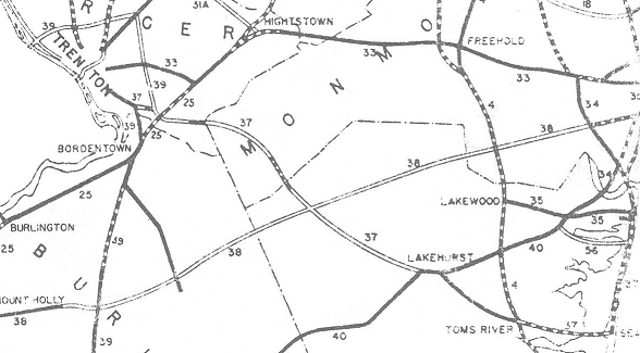
37 runs from Lakehurst to Seaside Heights via Toms River. Pre-GR, it extended north on
35 from the east end to 88. Also pre-GR, 37 ran along US 206 from the CR 524/CR 533 intersection (where 39 ended) to downtown Trenton at 30 (now 31) and 27 (also US 1/US 206). This western segment was part of pre-1927 13. Here's when the pieces of current 37 were built or taken over by the state:

sectionlocationdatewhat it was previously
5/8in Lakehurst1938
3Lakehurst to 5271929
4527 to 351930new west of Washington St
16Central Ave to Boulevard (Seaside Heights bypass)1958new
2Seaside Heights to Faber Ln, Brick1929
1Faber Ln, Brick to 35/881929

Even after the GR, until about 1990, several disjoint sections of 37 existed between Yardville and Lakehurst as shown in the 1942 NJDOT map clipping to the right, in preparation for a proposed extension that turned into a freeway. It was never built, and I-195 partly filled the gap as a compromise between the proposed 37 and 38 freeways. One piece of 37, legislated along CR 524 west of Yardville, existed where I-195 was planned to cross 524. NJDOT maintains that part of 524 mostly as part of the I-195 interchange, but between approximate MP 0.8 and 0.89 on 524, the contract number given is "N.J. 37 SEC." Therefore, a piece of what was built to be part of 37 remains under state maintenance. It is likely that the western of the two 70 circles in Lakehurst would have been the western end of a concurrency with 37.

ROUTE NO. 37. Trenton to Toms River by way of Allentown, Lakehurst and Toms River. Original bill.
ROUTE NO. 37. TRENTON TO POINT PLEASANT by way of Allentown, Lakehurst, Toms River, Seaside Heights, and Point Pleasant. L. 1927, c. 319.
ROUTE NO. . Beginning at Robbinsville in the county of Mercer and the State of New Jersey and from thence in a general southeasterly direction to a point in the vicinity of "The Thomas A. Mathis Bridge" across Barnegat bay in Ocean county from Seaside Heights to Dover township. L.1953, c. 111, p. 1297, s. 1.
37: From junction of Route 70 (former Route 40) at Lakehurst, via former Route 37 to Seaside Heights. [unsigned] Bridge and approaches at Gropps' Lake near Yardville in Hamilton Township. Section of road crossing the Mercer-Monmouth County line, west of Allentown. (Part of Monmouth County Road 539, formerly County Road 27). Beginning at a point about 0.5 miles east of the Ocean-Monmouth County line on County Road 539 (formerly Ocean County Road 33), in Plumstead Township, via former Route 37, to a point on County Road 539, just northwest of Monmouth County Road 27 near Cream Ridge. 1953 renumbering.

Photos
End photos
History (Steve Anderson)

ends at Route 70 (70)
LakehurstRoute 37
ManchesterRoute 37
Toms RiverLakehurst Rd, Route 37, Locust St, Route 37
BerkeleyRoute 37
ends at Route 35 (35)


38

38 runs east from Camden. Until 6/12/1986, the east end of the western section (now the only section) was in Mt Holly where the divided roadway ends;
CR 530 began there instead. Until 7/29/1988, 138 was part of 38; I-195 served as a replacement for the unbuilt section (which at that point was proposed as a freeway).

ROUTE NO. 38. CAMDEN TO EAST HAMPTON, via Merchantville, Moorestown, Mount Holly and East Hampton ending at Route No. 39. L. 1927, c. 319.
ROUTE NO. 38. Camden to East Hampton, by way of Moorestown, Mount Holly and East Hampton, ending in Route No. 39. L. 1929, c. 126, p. 215, s. 13.
ROUTE NO. 38, Extension. Beginning at the eastern terminus of Route No. 38 in the vicinity of Mount Holly and from thence to Route No. 4N in Wall township, passing in the vicinity of Camp Dix. L.1938, c. 51, p. 145, s. 1.
38: From junction Route U. S. 130 (former Routes 25 and 45) Pennsauken Township, via former Route 38 and Burlington County Road 10 to Route U. S. 206 (former Route 39), east of Mt. Holly. Beginning at Route 34, in Wall Township, via former Route 38 to Route 35 in Wall Township, south of Belmar. 1953 renumbering.

Photos
End photos
History (Steve Anderson)

ends at Crescent Blvd/Admiral Wilson Blvd (US 30/US 130)
PennsaukenKaighns Ave
Cherry HillKaighns Ave
Maple ShadeKaighns Ave, Route 38
MoorestownRoute 38
Mount LaurelRoute 38
HainesportRoute 38
LumbertonRoute 38
Mount HollyRoute 38, Pemberton Rd
LumbertonPemberton Rd
SouthamptonPemberton Rd
ends at Route 206 (US 206)


39

Before the GR, 39 followed pre-1927 13 along
US 206 south of the CR 524/CR 533 intersection (where 37 temporarily ended). It was proposed north as a half beltway around Trenton; this is now I-295 and I-95 (soon to be only I-295).

ROUTE NO. 39. Yardley Bridge by-passing Trenton through Bordentown to Da Costa. Beginning at Yardley Bridge thence in a semi-circular path around Trenton, through vicinity of Trenton Junction, Ewingville, Bakersville, Mercerville to Bordentown, Columbus, Vincentown, Red Lion, Indian Mills, Atsion and Da Costa. L. 1927, c. 319.
ROUTE NO. 39. Yardley Bridge by passing Trenton through Bordentown to Da Costa. Beginning at a point at or near the Yardley bridge across the Delaware River and running thence through the vicinity of Trenton Junction, Ewingville, Mercerville to Bordentown, Columbus, Vincentown, Red Lion, Indian Mills, Atsion and Da Costa. L. 1929, c. 126, p. 215, s. 14.
ROUTE NO. 39. Center of the Delaware river in the vicinity of the present Yardley bridge by passing Trenton through Bordentown to DaCosta. Beginning at a point in the center of the Delaware river on a new bridge to be constructed in the vicinity of the present Yardley bridge, thence to the New Jersey shore of the Delaware river, and running thence in a semicircular path around the city of Trenton, passing through the vicinity of Trenton Junction, Ewingville, Bakersville, Mercerville to Bordentown, Columbus, Vincentown, Red Lion, Indian Mills, Atsion and DaCosta.

End photos

S39

S39 became
68 in the GR. It was once proposed to continue further southeast as a freeway, roughly along the 72 corridor.

ROUTE NO. S-39. Beginning on Route No. 39 at Mansfield Square and from thence to Fort Dix. L.1941, c. 13, p. 25, s. 1, effective Feb. 24, 1941.

US 40

US 40 enters from Delaware on the Delaware Memorial Bridge with
I-295. It runs east from there to Atlantic City. Before the GR, US 40 was Delaware River & Bay Authority (DRBA) and Turnpike owned west of 48, and 48 east of there. Originally, US 40 used a ferry from Wilmington, DE to Penns Grove, NJ, and went along W Main St and 48 to rejoin current US 40. A new ferry from New Castle, DE to Pennsville, NJ opened in August 1925; it is unclear if this was US 40 in the beginning. US 40 then came down Ferry Rd and north on 49 to Deepwater. US 40 likely split where the ramp to the NJ Turnpike (700) is, and then went north on CR 551, Hollywood Ave, Golfwood Ave, Rosewood Ave, and CR 551 to 48 at Danceys Corner, where it turned east. The portion using roughly CR 551 was never state maintained. A 1942 NJDOT map shows a southern Woodstown bypass that was never built.
The Malaga bypass was built in 1930 or so; before that US 30 went through on Harding Hwy. The Del Mem Bridge opened on 8/16/1951, and the Turnpike opened on 11/30/1951. US 40 was then routed along its current alignment. The portion west of 48 was originally maintained by the Turnpike; it was given to NJDOT on 1/26/1959 and so had no pre-GR state route number.

ROUTE NO. . Beginning at Fenton's Corner on State Highway Route No. 44 in the township of Lower Penns Neck and thence connecting with State Highway Route No. 48 at Roos' Corner in the township of Upper Penns Neck. L.1944, c. 47, p. 103, s. 1.
U. S. 40: From the Delaware River Memorial Bridge, via relocated Route U. S. 40 and former Route 48 to its junction with Route 45 west of Woodstown, then coincident with Route 45 to a junction in Woodstown, thence via former Route 48 to its junction with Route 47 in Malaga, then via former Route 48 to its junction with Route 47 in Malaga, then via former Route 48 to its junction with Route U. S. 322 (former Route 42), at McKee City, via formr Route 48 to Albany and Atlantic Avenues. 1953 renumbering.
ROUTE NO. 69. Salem County Route No. 69, known as Wiley Road and designated as Federal Route U.S. 40, beginning at its intersection with the New Jersey Turnpike and running in an easterly direction to its intersection with State Highway Route No. 48, a distance of approximately 4.27 miles. L.1958, c. 124, p. 604, s. 1, effective July 15, 1958.

Photos
End photos
History (Delaware Memorial Bridge) (Steve Anderson)

enters Delaware (I-295/US 40)
PennsvilleDelaware Memorial Br, New Jersey Tpk
Carneys PointNew Jersey Tpk, Hawks Bridge Rd, Wiley Rd, Harding Hwy
PilesgroveHarding Hwy
WoodstownWest Ave, East Ave
PilesgroveHarding Hwy
Upper PittsgroveHarding Hwy
ElmerChestnut St
Upper PittsgroveHarding Hwy
FranklinHarding Hwy, Dutch Mill Rd, Delsea Dr, Harding Hwy
BuenaHarding Hwy
Buena VistaHarding Hwy
HamiltonHarding Hwy, Cape May Ave, Main St, Harding Hwy, Black Horse Pike
Egg HarborBlack Horse Pike
PleasantvilleW Verona Ave, E Verona Ave
Egg HarborBlack Horse Pike
Atlantic CityN Albany Ave, S Albany Ave
ends at Atlantic Ave/Pacific Ave


40

40 was legislated in 1927 as a route across the state from Camden to Lakewood. At some time after 1929, the planned route was changed to bypass Lakewood to the south and end at Laurelton, at what is now
88; 70 east of there was 34 pre-GR. Additionally, 38 was shifted slightly south in the Camden area, crossing where 40 had been planned, and thus 38 and 40 multiplexed west to a common end at 25 and 45 at Crescent Circle. As of 1937, 40 in Lakehurst was one of the last unpaved state highways in NJ. Here's a table of when each section was built or taken over:

sectionlocationdate
738 to 411932
841 to 731933
973 to east of 5411933
4east of 541 to US 2061932
5US 206 to 721931
672 to Burlington/Ocean county line1932
3Burlington/Ocean county line to west of 5391930
2west of 539 to Horicon Ave, Manchester1930
1Horicon Ave, Manchester to 371938
10A37 to west of US 91937
11Awest of US 9 to 881937

The section of 40 from 72 to just east of the merge with 530 was built in an early "parkway" style. The vision for the road was to dualize it with a forested median, similar to what became 4 Parkway in the following decade. Although not much came of this vision, that road ultimately joined the National Register of Historic Places as the first intentionally landscaped parkway in the state. In the 1953 renumbering, 40 was renumbered 70 due to the conflict with US 40. It was truncated to the east end of the multiplex with 38 instead of extending to US 130, and extended east along pre-1953 34 to the Brielle Circle at 35.

ROUTE No. 40. CAMDEN TO LAKEWOOD, via Marlton, Red Lion, Whitings and Lakehurst to Lakewood. L. 1927, c. 319.
ROUTE NO. 40. Camden to Lakewood via Marlton, Red Lion and Lakehurst. L. 1929, c. 125, p. 215, s. 15.

End photos

S40

S40 became
72 in the GR. It was planned as a spur off 40 to the southeast, ending in what is now spelled as Manahawkin. At some point, the planned route was extended east across 4 to Ship Bottom on Long Beach Island. Here's a table of when each section was built or taken over:

sectionlocationdate
470 to Lebanon Rd, Woodland1936
3Lebanon Rd, Woodland to Burlington/Ocean county line1936
2Burlington/Ocean county line to 5321930
1532 to US 91930
US 9 to west side of Intracoastal Waterwayafter 1941
takeoverwest side of Intracoastal Waterway to Long Beach Blvd1929

In 1968, a new alignment was built from US 9 east to the Intracoastal Waterway. The old alignment became 180. 180 was given to Ocean County on 4/16/1980 in exchange for 35 south of the Seaside Heights bypass.

ROUTE No. S-40. FOUR MILE TO MANAHAWKEN, from Route 40 southeasterly through vicinity of Cedar Bridge to Route 4 in or near Manahawken.
ROUTE NO. S-40. Four Mile to Manahawken. Beginning at a point in proposed Route No. 40 in or near Four Mile, and running thence in a southeasterly direction, passing through the vicinity of Cedar Bridge and connecting with proposed Route No. 4 in or near Manahawken. L. 1929, c. 125, p. 215, s. 15.

Back to NJ State Routes main page
Back to the NJ Route Log main page
Back to NJ Roads
Back to Roads