New Jersey Roads - I-95, US 1/9/46
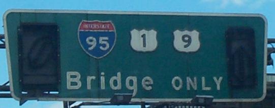
I-95 and US 1/9/46
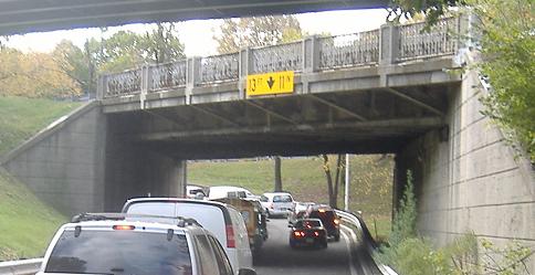
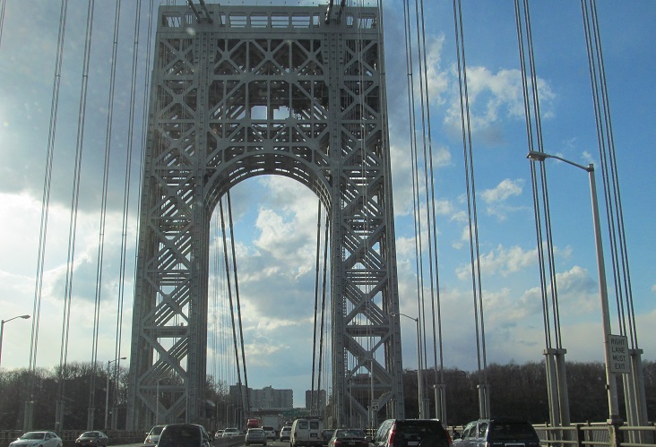
1930 bridge architecture over the Exit 72 ramp from the left side of the I-95 Local Lanes. On that bridge is the merge of I-95 NB with NJ 4 EB, and on the third level above that (rare in NJ) is US 1/9/46 NB/EB coming down from the Palisades. Originally, the lower roadway was part of a center exit from NJ 4 EB/entrance to 4 WB, a two-way Bergen County road. 4 EB continued up and over this bridge, and US 1/9/46 came down on a much older bridge that was original to the interchange. Because this bridge is so old, such that most of its peers have been replaced, and because it is part of something so unique, the first three-level interchange in the state, it is a New Jersey historic structure. It should still be replaced, but maybe it will be preserved somewhere, somehow.
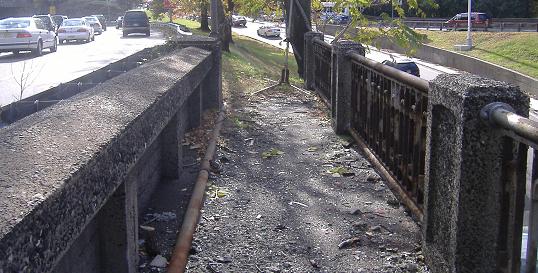
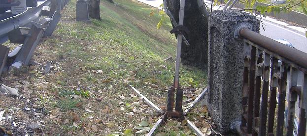
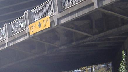
The southern side of the bridge (walking eastward) - sadly, the date and route number are obscured by guiderail. Guiderail that seems to be getting a lot of use. No wonder people don't use this sidewalk anymore.
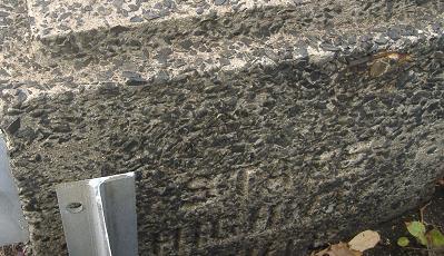
Trying my best, I finally dig a 4 out of the northwest parapet. Of course, I already knew that from the opening paragraph.
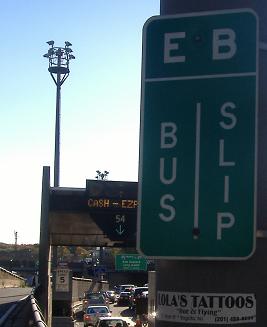
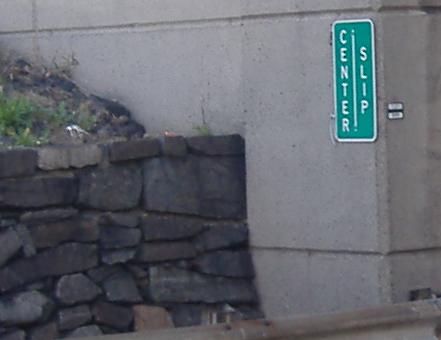
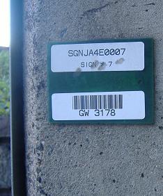
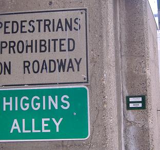
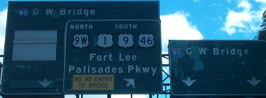
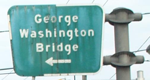
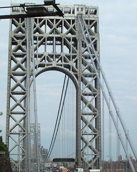
The Port Authority labels every little roadway that's part of the George Washington Bridge approach, and also barcodes every sign so if it comes down, they can order up a new one (the closeup is next to the Center Slip sign). The Center Slip leaves from the right side of the Upper Level roadway, and is the last exit in New Jersey from the I-95 Express Lanes. It joins with a left-side slip ramp from the Lower Level roadway to form the EB Bus Slip, which merges with the Center Ave. onramp at the GWB/Fort Lee Bus Station. That's right, there's a bus station with people milling about on an Interstate highway. Higgins Alley is fed by the other split of the Center Ave. onramp and also carries HOV lane traffic during the AM rush hour. Most of the time, it's either closed or is a staging area for oversize vehicles.
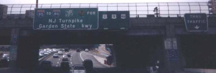
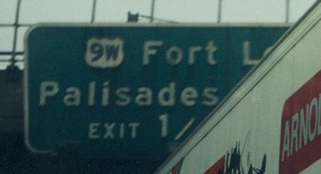
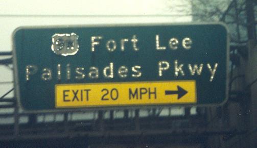
Some random old signs in the express (upper level) lanes, replaced in 2002 or so, courtesy HNTB. Wow, that's a lot of button copy on that Port Authority sign (the NJ 67 BGS is trapezoidal, so you know who made it) for what's nominally Exit 73.
SB courtesy Doug Kerr, from the vantage point of the express lanes/upper level. I miss those signs, but clearly their time was up.
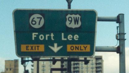
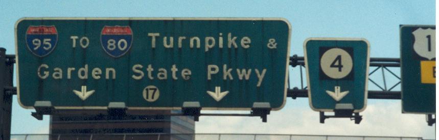
Now some SB signs of similar age and goneness from the local lanes/lower level, courtesy John Krakoff. What became so important about NJ 17 that wasn't when the original sign was made? Notice the ugly 1 shield (fortunately cut off) at the edge of the last photo.
Another/better view of John's second photo was taken by SPUI in 2001.
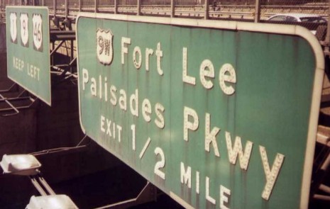
Old local-lane pull-through BGS, now gone, courtesy HNTB. Just like the NJ 67 shield above, tons o' button copy from the Port Auth.
This was on Bridge Plaza South EB at Martha Washington Way (a glorified onramp, more or less), and is now replaced by a modern non-trapezoid. Courtesy HNTB, this had brethren in NYC as well (and still has one on US 9).
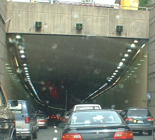
The NB local lanes tunnel under a piece of Fort Lee to get in position to take the lower level of the George Washington Bridge.
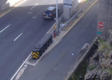
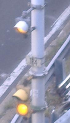
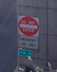
Looking down at the Local Lanes just before they enter that tunnel. This is an emergency access ramp that connects the Local Lanes to Hudson St. (CR 505). Obviously, internally it's ramp TR 4. Also obviously, that flasher assembly dates to 1960, because it still has the little white sign on it (compared to the newer green sign on the bridge pier for Exit 73, which leaves from the EB Bus Slip - remember what that is?).
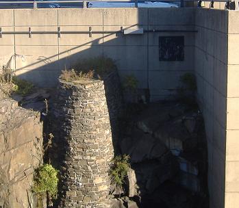
What I presume is one of the original support pillars constructed for the GWB approach, now part of the retaining wall keeping the Upper Level above the Lower Level. When it was a pillar, there was no Lower Level. This is, of course, my best guess.
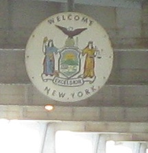
NY's state shield in the middle of the lower level of the GWB. Literally, this is the last picture you could take in NJ. It's also the end of US 46, which really should just have ended when it met US 1 and 9.
I wonder what this is. First photo courtesy HNTB.
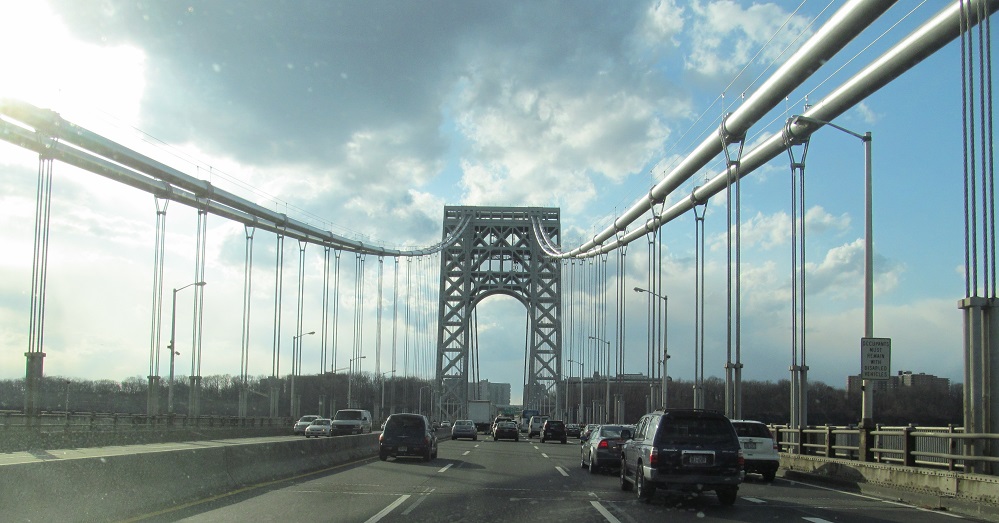
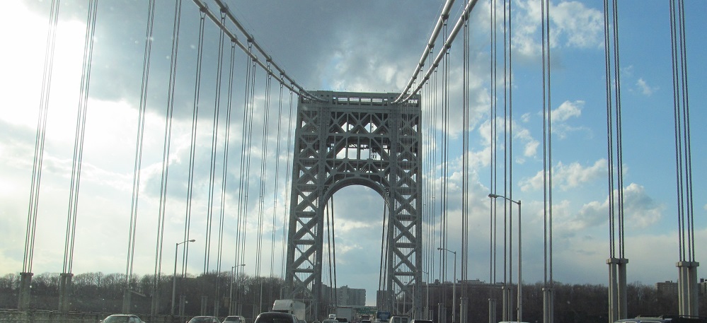
Heading west into New Jersey on the GWB upper level, and one from the Lower.
Continue south on free northern I-95
Continue south/west on US 1/9/46
Back to US 1-9 main page
Back to US 1 main page
Back to US 9 main page
Back to US 46 main page
Back to I-95/NJ Turnpike main page
Into New York on I-95/US 1/US 9
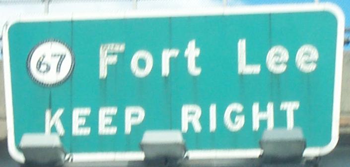
Onto NJ 67
Onto US 9W
To I-80
To the Garden State Parkway
To NJ 17
To NJ 4
Back to NJ Roads
Back to Roads