New Jersey Roads - Bergen CR 56 (former) - Fort Lee Rd.
Fort Lee Rd., former Bergen CR 56
As I say on the CR 56 page, maybe it was 12, not 56, but that doesn't matter here. Fort Lee Rd. starts in the heart of Hackensack, crossing the river on a much older bridge than the current 56 (the Midtown Bridge just to the north), then parallels Main St. and Degraw Ave. through Bogota and Teaneck. Well, more precisely, those roads parallel Fort Lee Road, since Fort Lee Rd. was there first. Now it gets cut off by the railroad tracks it once crossed, and dead-ends in Overpeck County Park by the I-95/I-80 interchange. East of Exit 70 on 95, Degraw Ave. becomes the eastern half of Fort Lee Rd., without the slightest hint of a stub (it's obscured by the interchange). The western half is a different story.

Still in Hackensack, a Bergen County LGS at CR 503 (River St.). If that's River St., ahead must be the bridge (the next and final intersection is Bridge St.).


East across the dying bridge to the first dead-end. You say you see a crossbucks and a gate in the background? It's just for pedestrians.


Just like on the real county route (well, the current one, anyway), Fort Lee Rd. gets an upside-down signal mast arm. It also gets a custom street sign holder that looks older than the street signs it holds.

EB at Teaneck Rd. (CR 39), with the old road in the background.


Old steel guiderail on the eastbound side, which now protects nothing except a few front lawns, gives way to even older cable guiderail, which protects nothing for a different reason - it has lost all of its tension over the years. Doesn't help when the spring comes unhooked, but then again, no one with any modern knowledge of guiderail would ever suggest a spring hooked into a concrete post would prevent running off the road.


The westbound cable guiderail is in similarly bad condition (on the abandoned part of the road, though, so it doesn't matter). The second photo shows a stretch of cable so short that it screws into two adjacent pieces without ever passing a post. (See if you can spot the two screw assemblies.) I'm sure that this didn't weaken the cable any, but it points to a bad job of engineering (or else a zealous use of spare parts).


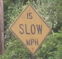
Onto the traveled part of the dead-end, the posts are painted, the springs are hung, and the one car that actually parks here won't roll down into the apartment complex. Still, as rusty as all of the pieces of the cable are (I'm looking in particular at the first photo), I wouldn't expect this to hold up to a 50-MPH crash like the original road may have seen coming across Overpeck Park.


Crossing into Overpeck Park, the township of Teaneck paved over the original cobblestones prior to the closure of Fort Lee Rd. - i.e. sometime before 1960. The messiest part of that job is clearly at the transition to concrete for the run through the uninhabited parkland.

Notice that Fort Lee Rd. has full-width concrete slabs. Most old roads have each side paved separately. As you can see, the crown has been worn down from traffic, and many of the slabs are cracked roughly in the middle third. These wide slabs may have helped the road be smoother or may have been easier to lay down, but had the road stayed open, they would have been replaced long ago, whereas more conventional concrete roads (even freeways) as old as the 1930's are still on their original pavement. Thanks to John Krakoff for pointing this out.

One more guiderail photo, just because it's so fascinating. Some of the posts have been pulled up, and somehow all of the cable ended up bunched here. There are several posts on either side of this, so it took some effort to get the slack into this area.


Past the improvised entrance to a small lot with a lot of debris (but how does anyone get out here to dump it?), to the end of the traversable road. It picks up again on the other side of a small but insistently flowing creek, and then is cut off by mighty I-95, whose signs are visible in the background of the last two photos. Needless to say, our merry band did not try to cross the creek, but the utility poles still march on until 95 tells them to stop. I guess it's not worth the expense to take them down?

Along the way, a detail of the small asphalt strip on either side of the concrete road. My guess is that this was done at a later point to widen the road from the original 20'-22' (the usual dimensions for such a road) to 24'-26', thus allowing drivers to get a little farther from the centerline and each other. Don't get too close to the edge though, for as you can see there's a guiderail post right there.


More views of the single slabs on the trek back west. John Krakoff blazes our trail.


Coming back up the road, there's a stone embankment keeping the concrete above the marsh. The second photo, leaning over as far as I can and facing east, shows the side of the concrete slab sitting on the stones. The third photo faces west. After many years of neglect, the underbrush has crept in to put this wall a few feet off of the paved edge of the road.

Back to the entrance and onward we go.
Current CR 56
Onto CR 503
To I-80
To NJ 4
Into Bergen County
Back to NJ Roads
Back to Roads