New Jersey Roads - Essex CR 609

Essex CR 609
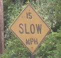
The sign above is from my personal collection.
Tour the abandoned NJ 24 interchange
Tour the proposed Eisenhower Parkway northward extension
This road should also be known as Triborough Road, according to NJ 24. Eisenhower is a neutered road: part expressway, part four-lane divided arterial, and connecting nothing useful. In full regalia, it would probably be a sea of brakelights now between I-280 and NJ 24, extending southward to NJ 124 and northward to Passaic Avenue just north of Bloomfield Avenue in West Caldwell, joining the four-lane-plus-center-turn-lane section there. However, environmental reviews and NIMBYism (even though almost no backyards would be taken) repeatedly squashes attempts to build the full highway. It's not dead yet, but for the foreseeable future, trucks will still be using JFK Parkway between 24 and South Orange Avenue, where Eisenhower currently ceases to be. For now, there are remnants of what may never be scattered throughout the old route, including a fully graded interchange at 24 and some clearing north of I-280. The right of way for the Parkway remains intact, still owned by the County - it will never be taken away for the same environmental reasons that are holding up the highway.

SB on Eisenhower Parkway at Dorsa Avenue, there was probably an NJ 24 shield here once. Maybe it was taken down when the southward extension to the already-completed interchange was put on indefinite hold. It's not completely invalid, since trucks to NJ 24 still use this route as I described above.


The original route of Beaufort Ave. came down the hill from Livingston and wound through what's now piles of asphalt and gravel belonging to a mechanical plant. What's remarkable is that the plant has left the original route of Beaufort Ave. as the clear road through the lot. Eisenhower Parkway swept through here at a lower elevation, knocking out the Beaufort Ave. hill and the curves south of the railroad crossing.


There's no proof, but there's a good chance this is the original curb (on the west/far side) and even pavement of Beaufort Ave. I wouldn't bet on the guiderail. Beaufort went around the west (left) side of the tavern to cross the railroad tracks, but thanks to access control the front door remains the way in, even if it's now the back door.

Looking back southward, project this hill as continuing up and then to the left and it will reach the current dead-end of Beaufort Ave. in Livingston (Spur CR 661, because the county couldn't get rid of the dangling end).

The traffic signal south of Eagle Rock Ave. has a DOT utility cover. But why would the (presumably NJ) DOT come this far south? Once you're off I-280, state jurisdiction ends. All I can think is that the state, which constructed the I-280 interchange, may have had a hand just a little more south of there as well. If the Eagle Rock Ave. intersection was built by the state, they may very well still own the signals, so when this signal was erected just to the south, the state would also take it over for coordination. Otherwise, NJDOT is not in the utilities business and there's no other local company or organization I know of abbreviated DOT, so I'd be flummoxed.

Now across I-280, this original sign (they don't make 'em this way anymore...) presages the end of the road, but it doesn't tell you what's there. You'll have to click on the big link.
 SB state-name shield.
Abandoned NJ 24 interchange
Proposed Eisenhower Parkway northward extension
To NJ 24
Onto I-280
Into Livingston
See more of Essex County
See more of my sign collection
Back to New Jersey Roads
Back to Roads