New Jersey Roads - CR 560
CR 560
CR 560 is the approach to the privately owned Dingman's Ferry toll bridge. Drive that bridge (eastbound) by clicking here.


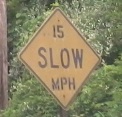
Click on the first photo to see what the old tonnage allowed was, and the second photo could be by Sussex County, but is non-standard enough to likely be by the operator of the bridge.

PA 739 SB at the other approach to the Dingman's Ferry bridge.
Don't forget to drive with me across the bridge to New Jersey, with the links at the top or bottom of this page.


Now facing westbound, driving out to the red light in the distance and finding the tollhouse. Guess which photo was taken at a different time?

CR 560 EB at Old Mine Road. Old Mine heads north to... US 206, correct, not SR 206. SR? NJ never had SR's... it had SHR's. Interesting. Anyway, Old Mine doesn't even head south anymore; it has been closed between here and somewhere around a dozen miles north of I-80, and is slowly returning to nature. If you head there quickly, it's still drivable.
S.R. S.R. *grumble mutter snort*
Well, if you call the whole thing NJ 54, I wouldn't complain...

Eastbound at S.R. US 206/CR 521, where CR 560 ends. It goes to Newton, not Newtown.

This sign sits on the gentle curve to the right (south) at the T intersection, but the Milford Bridge is to the left on US 206, and so there needs to be an arrow, and the sign should be placed farther back as well so that you're not already committed to the right turn.
Into Pennsylvania on PA 739
Onto Old Mine Road
Onto US 206 (not yet demoted)
Onto CR 521
Into Sussex County
Back to New Jersey Roads
Back to Roads