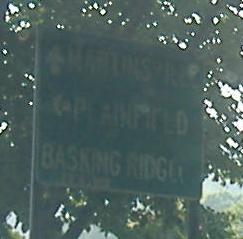
New Jersey Roads - CR 527 - N. of Bound Brook
CR 527 north of Bound Brook
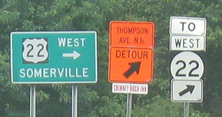
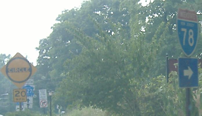
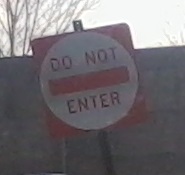
Detour signs for US 22 WB have been posted along US 22 EB that are definitely not US shields. CR 527 NB is used as the U-turn.
NB on Morning Glory Rd. and then SB on Washington Valley Rd., same intersection. The little text on the arrow in the first photo is SCDTES (Somerset County Department of Transportation and...), M6-1 (the FHWA designation for the arrow sign), 1-89 (month-day of erection).
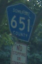
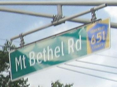
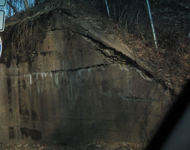
SB at Mt. Bethel Rd., which used to be one of the two Spur CR 527s to the north. Scroll down for traces of the other one. CR 638 is the tail end of Washington Valley Road, which comes out of CR 651 (Warrenville Road, was never Spur CR 527) to briefly become CR 527.
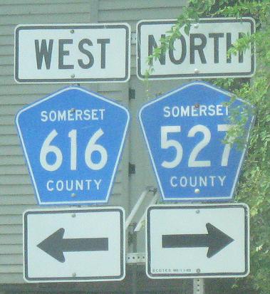
Clearview has invaded new Somerset County signage, although NJDOT still shuns it.
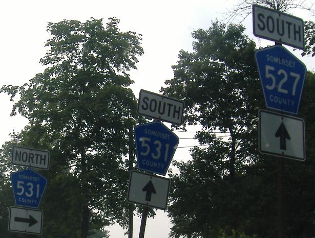
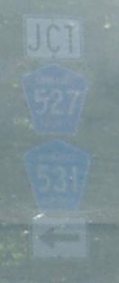
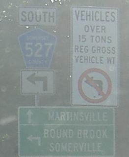
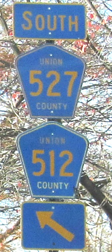
SB signs, all within two blocks of each other at or on the very short CR 527/CR 531 duplex. The last photo is within the shared traffic circle and should be SOUTH, not JCT, because you're already on both routes.
Another one on both routes, NB in the circle.
The old white-on-black street signs in Watchung have raised letters, and while I didn't get a great look, I would bet they're affixed with thick reflective tape.
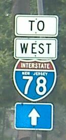
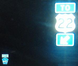
This shield is at the SB beginning of Glenside Avenue in Summit - and is the only shield pointing toward CR 527 since it was coming down Morris Ave. WB. So, CR 527 is not an easy road to follow, but once you figure it out, you're driving next to I-78 for several miles.

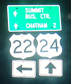
The help for the turn from Morris Ave. (there is a short connector leading to both Glenside Ave. and Baltusrol Rd.) comes in the form of a decades-old LWS. State Hi-way 24 is of course now NJ 124, not the NJ 24 freeway. Route 22 is US 22, which is accessible eventually from either Baltusrol or Glenside, if you know your turns. Of course, there was no I-78 back then. But, there was no Route 22, either. Beneath that metal 22 patch is... 29! Yes, NJSHR 29, the original number of the US 22 alignment that separated from NJ 28 in Somerville, before US 22 was ever put across it. Forget decades old, this sign is approaching a century. Now that I put this photo up, watch Union County suddenly decide it needs to upgrade signage. :(
I was right. I can't believe I was right. And THIS is the ugliness that replaced it.
Now Baltusrol Way is signed as CR 643, and US 22 is signed with a shield instead of State Hi-way. I can't believe it.
And they had the NERVE to get the NJ 24 shield wrong! Just shoot me. No, wait, shoot down these signs and bring back the old one.
Union County must have accidentally hired plumbers to design their signs. At least the shield points toward SB traffic (I took this at an odd angle), thus not contradicting the NB overhead.
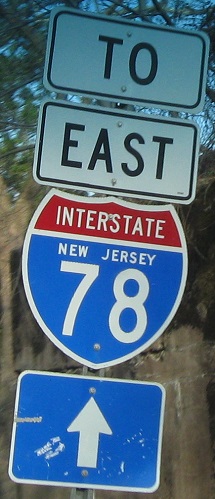
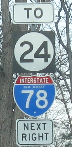
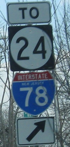
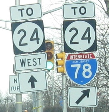
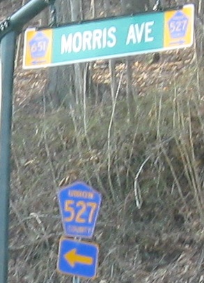
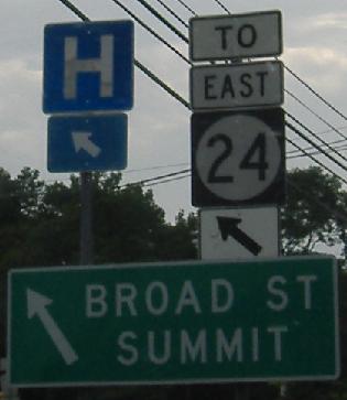
Now on Morris Ave., CR 527 NB skips past a former railroad abutment, joins Springfield Ave. (which used to be more of a Y intersection, but is now just a one-way side street), and hits NJ 24. Why would all of the advance signs say both NJ 24 and I-78 are to the right, when half of NJ 24 is straight ahead? What happened to the "East"? What happened to moving the "TO" down? What happened to blue banners for Interstate shields?
 One parking lot along one-way Morris Ave. says nuts to negative-contrast and flips the colors.
CR 527 SB leaves NJ 124 in Millburn at Broad St. CR 512 begins across NJ 24 and never goes SOUTH.

This is a jughandle from Broad St. WB, and it also collects traffic from NJ 24 EB Exit 9A. Other signs tell you that this jughandle goes TO CR 527. Well, since Morris Ave. to the south is one-way east between NJ 24 and NJ 124, even if it's legally CR 527, this is the touring route. So CR 527 makes a U-turn, bears right, and then makes a right onto Springfield Avenue. Yes, I said Morris before. The names keep changing - it's Morris in Millburn, then Springfield in Summit, but then Springfield breaks off at a place where it was recently made one-way eastbound, forcing traffic left onto... Morris! Those in the know, however, follow Middle Ave. straight ahead, and make a right a few blocks later to rejoin CR 527 SB.
On the north side of Millburn Ave. at Glenwood Dr., along CR 527 SB.
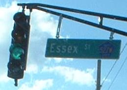
CR 527 and CR 577 bounce off of each other in Millburn, with 527 coming from the north on Old Short Hills Road and 577 leaving to the south on Main Street. They also occupy the one-way pair of Essex St. and Millburn Ave. Briefly, either Millburn or Essex County decided to call the one-way pair CR 527E/527W and 577E/577W - the W's belonging to the westbound Essex Street, such as the remnant in this photo, and also belonging to the SB CR's, which logically would be West of the NB sides. Anyway, that experiment died, so this is probably the last remnant of the lettered signage in the center of Millburn, on CR 527 NB/CR 577 SB. 527W would have been to the left (CR 527 SB), and 577W (CR 577 SB) to the right. As a side note, Millburn Ave. was two-way for a long time, obviously the main street through town, so all the shops front on it, leaving Essex St. with a few stores and a bunch of parking lots. If you're heading SB, you miss out on the real Millburn just a block away.
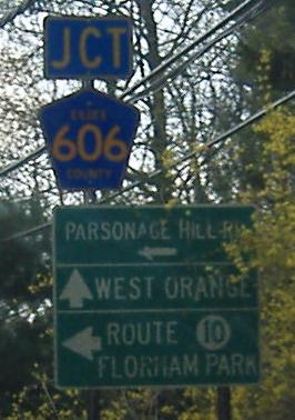
Old Short Hills Rd. (CR 527) SB and NB, respectively, at Parsonage Hill Rd. (CR 606).
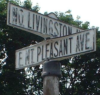
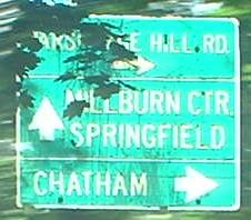
Old street signs still standing in the heart of Livingston, where CR 527 turns at CR 649 and then on the corner with NJ 10. Spur CR 527 used to follow 649 south to Hobart Gap Road, and then what is now CR 608 east/south to NJ 124.
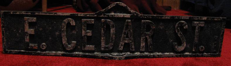
All the old street signs have been taken down - and sold, not scrapped, so a great credit to the town for that. I picked up this one - see more views of it and some other signs on the Livingston page linked below.
 Newer state-name shield, NB leaving Livingston.
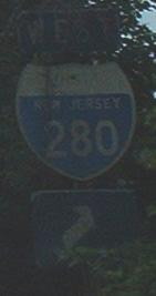
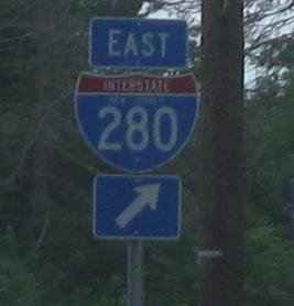
Livingston Ave. SB at I-280, where CR 527 enjoys its greatest importance as a four-lane limited-access expressway, with a speed limit of 45 MPH, two traffic signals with dual turn lanes for any non-permissive movement, a cloverleaf interchange... and once, this shield. Unfortunately, it's gone now, and this stretch barely lasts half a mile anyway, and the traffic light at Becker Farm Road is timed horribly...

On Eagle Rock Ave., for some reason the 6-series county route gets a directional banner, but the 5-series doesn't. This is a block-long multiplex, and CR 527 is heading south in this photo.
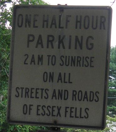
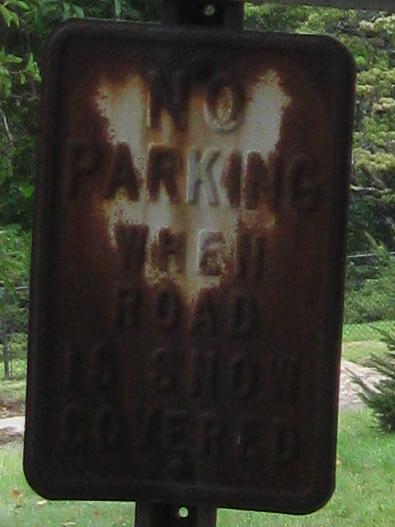
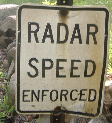
Entering Essex Fells on Roseland Ave. (CR 527, of course) NB. These three old signs that look completely mismatched actually share the same post - click on any of the photos to see the whole shebang.
Jump over Bound Brook and head south
Back to CR 527 main page
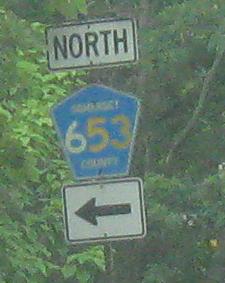
Somerset CR 613 and Somerset CR 651, former Spur CR 527
Essex CR 608, the other former Spur CR 527
Stray from Glenside Road on the abandoned Nikesite Road
Onto US 22
Onto CR 531
To I-78
Onto CR 651 (Morris Ave.)
Onto CR 512
To NJ 24
To NJ 10
Onto I-280
Onto CR 611
Into Essex County
Back to New Jersey Roads
Back to Roads