Massachusetts Roads - MA 3/28 - Memorial Dr., Land Blvd., Charles River Dam
MA 3/MA 28
Memorial Drive, Land Boulevard, Charles River Dam
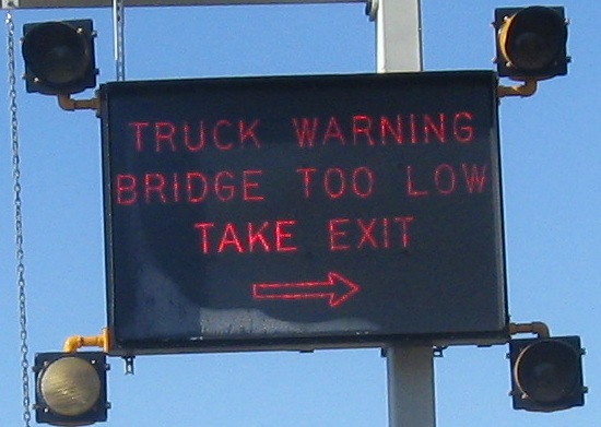
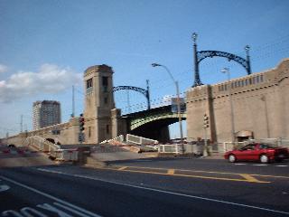
WB signage coming off of Land Blvd. at the eastern end of Mem Drive, at Longfellow Bridge. The LGS is MDC at its best - nonstandard but functional and fairly clear. The overhead signs are classic MDC, used to keep trucks from bringing down various overpasses on their roads (because MDC can't build proper overhead clearances).
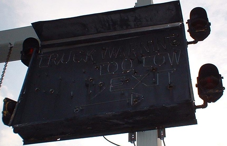
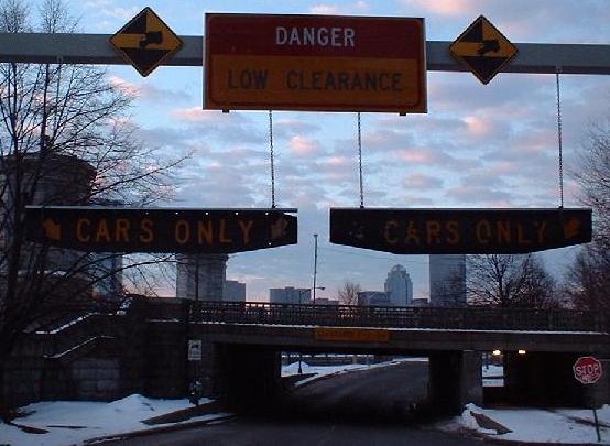
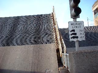
WB on Mem Drive just before the Mass. Ave. underpass. The sign lit up with neon if something overheight tried to get through, in addition to the same overheight warnings as can be seen a couple of pictures down. However, it was replaced with a far less cool neon sign, which you can see by clicking on the photo.
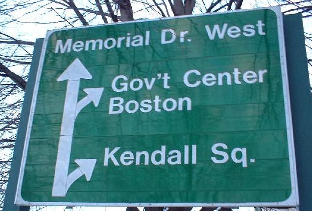
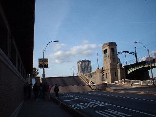
Both of these apply to the same roadway... and both are correct! It's just that the sign on the right is more exact, but it's highly non-compliant with the MUTCD - therefore, you know it was made by the MDC. This is the piece of Mem Drive that now connects to the Longfellow Bridge. The WB side, with all the cars, is original Mem Drive back when there used to be a rotary here, before the Red Line subway came out of the ground in the late '50's/early '60's and crossed the Longfellow. Now, since traffic isn't allowed to cross the subway tracks, Mem Drive scoots out along the water.
The WB Mem Drive/NB MA 3 offramp to Mass Ave NB/MA 2A WB (yeah, that's a mouthful), and a perspective of the new-for-2004 signals that finally allow a left turn - 2A WB to 3 NB (so, MassHighway/DCR-ex-MDC, when do we get the other left turns?). The ramps have been curved to encourage right turns instead of the illegal lefts that people still make, and the omnipresent NO TURN ON RED signs are blatantly ignored by drivers who remember the old pattern and won't stand for the change. Oh, and what exactly is that DO NOT ENTER sign in the foreground pointing to? You're coming down a one-way ramp and are about to be forced into a merge - not like you have choices of other places to enter.
A view of the bridges that MA 3 SB and its partner cross. The original bridge was on the left, and then its partner was built probably when the Longfellow Bridge (MA 3 NB) rotary was taken down (see above). Then, the original bridge was replaced, so the older bridge is now on the right, but it's in a newer location. At this point, the roadway is neither Land Blvd. nor Mem Drive. What is it?
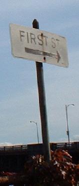
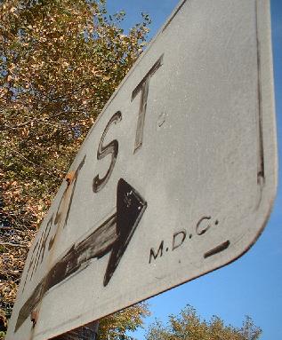
Why, it's First Street! Yes, the original bridge carried First, and if you were to walk in a straight line eastward you would follow the sidewalk of First Street right through eastern Cambridge. There are a couple of problems with this sign on the EB side (SB 3), though. For one, it's been turned 90 degrees, so only people trying to cross between the WB and EB roadways at the eastern edge of the bridges would be able to see it. Secondly, if you click on it for a closeup, you'll see that it's been painted, and is highly noncompliant (white on green is the current standard). And finally... it's wrong. Yes, traffic to First St. must now bear right onto Land Blvd., make a left at the next light, and then a right onto First, but this movement is forced. Maybe a long time ago it wasn't, back when the sign was made, but maybe this is just MDC boobery.
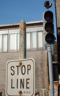
Oh, it gets better. This STOP LINE sign is on the eastbound side, and would be useful if either the traffic light, say, worked, or if the bridge, I don't know, ever opened. Yes, MDC makes me upset.
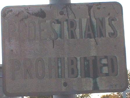
The MDC got this one right. Back in the '50's or '60's when the EB bridge opened, this sign would have been white on green. Peds are supposed to use the WB bridge, despite the arrow on the First St. sign telling them otherwise, but you can squeeze past EB traffic.
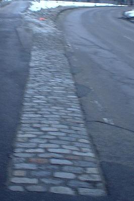
The stone gore where First St. and Land Blvd. WB merge. These are still visible in a few places, even on freeways, and there are even new ones being put in at Mass. Ave.!
Cambridge Parkway was MA 3 SB and the EB river roadway until Land Boulevard was dualized from being WB/NB only; it makes the river view a bit quieter for residents, and puts more traffic on one street for businesses. It's more picturesque now, and still goes through, though one can no longer turn left and go WB from the eastern end.
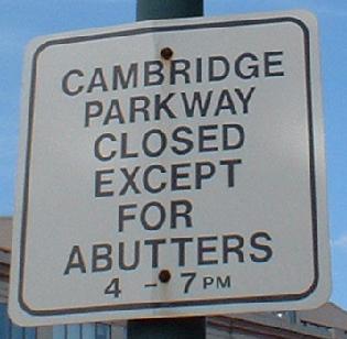
Tee hee hee, "butt"! This is just to keep through traffic out during rush hour.
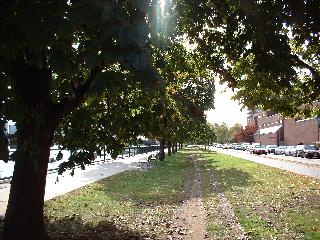
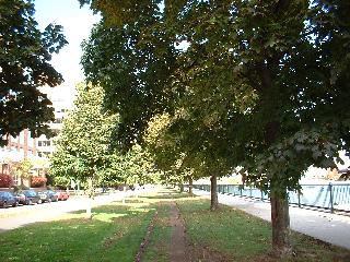
Much of the former pavement has been converted to a dirt trail beneath a canopy of trees.
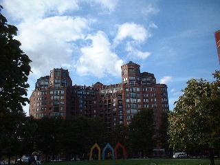
When you're rich, you can prevent things from blocking your river view. This giant building is on Land Blvd., and the park in the foreground is on Cambridge Parkway.
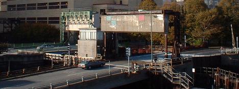
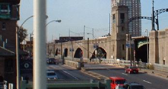
Now onto the Charles River Dam, which really isn't a dam anymore. The new dam is east of here, and the Science Museum is located on this one, directly over the Charles River.
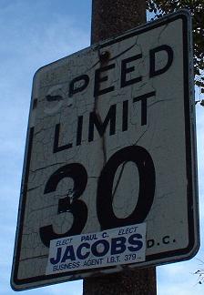
MDC signage, both old and oddly fonted. Oh, and if you can make it up to 30 MPH without hitting traffic, it's probably too dark out to read the sign.
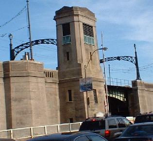
On the building that includes the tower where someone to this very day raises and lowers the drawbridge in the center of the dam.
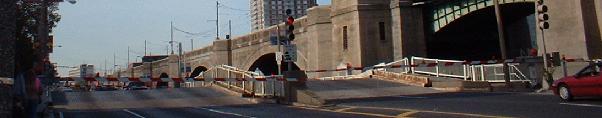


I got lucky and happened upon the drawbridge opening. These photos show the bridge first opening, then closing - notice that the NB side is somewhat quicker to come back down than the SB side. That means traffic gets to move sooner, which is a good thing because there's not a lot of queue space between the drawbridge and the Leverett Circle. Incidentally, this scene happened during rush hour, so traffic turning from Charles St. (aka Storrow Drive to the less knowledgable/MDC) to follow 28 NB was stacked up solid for something like a half hour delay. Also notice the open steel grate on this bridge.
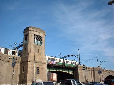
As you could see in the previous pictures, the Green Line subway is elevated on an old bridge parallel to the dam. This was built in 1910 to extend the Green Line from Park Street, out over Boston, to the Lechmere Station - plans to bring it farther north stalled, and the Orange Line was rerouted into Somerville instead. The bridge hasn't been touched up in quite some time, though, even though the rest of the elevated Green Line down to North Station is being torn up since North is now underground.
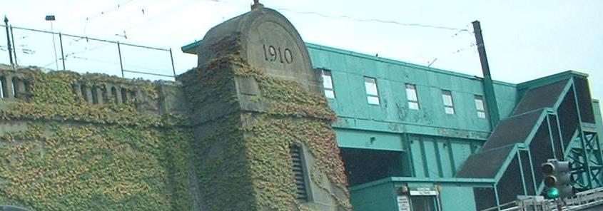
The Lechmere station and a column with the built-on date. At the time of this photograph in autumn 2004, the Green Line was out between North Station and Lechmere; the old elevated North Station had been taken down and the new underground one (integrated with the Orange Line) opened, and work was underway to connect the underground track from there with this Charles River viaduct. If you ask me, this was prime time to replace the viaduct as well.
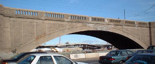
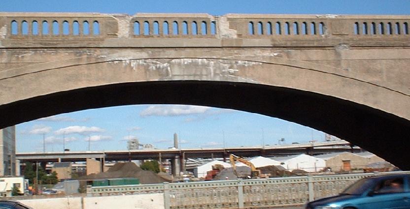

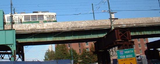
You can see concrete falling off the bridge in these pictures. Not very pretty.

Redone and much prettier, years later from the other side of the bridge, Nashua St. WB.
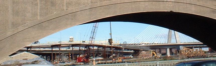
Looking through the Green Line at the ongoing (as of November 2002) construction at the Bunker Hill Bridge and the Leverett Circle Connector.
Where the Green Line crosses the channel used by Charles River traffic.
Just south of the old concrete bridge, now there are I-beams, but everything still needs maintenance pretty badly.
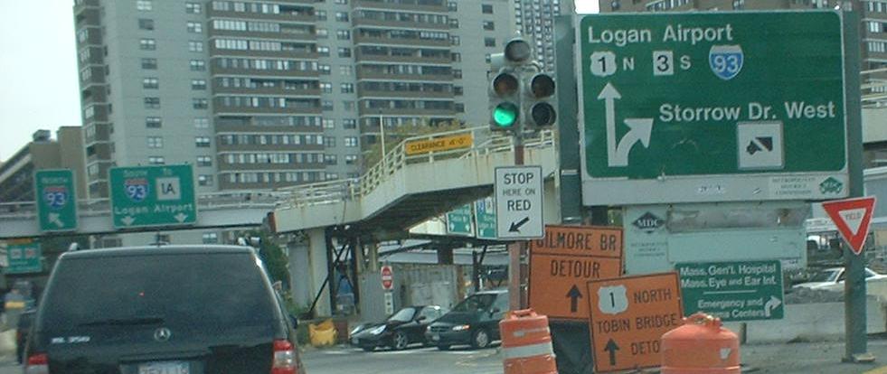
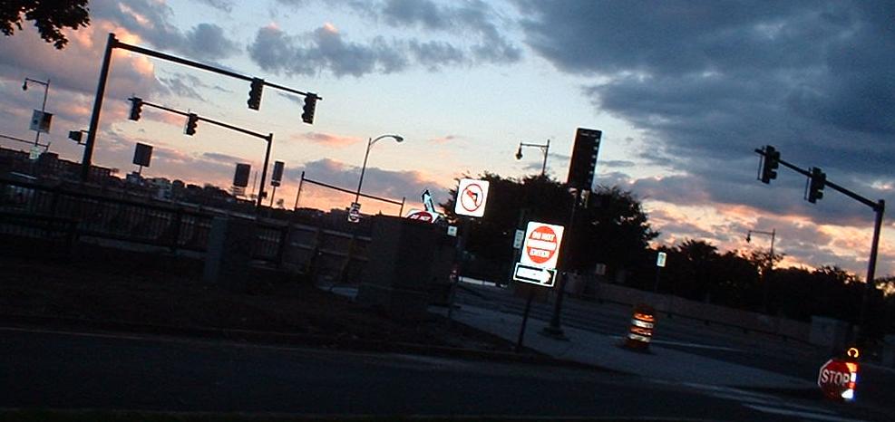
South side of the dam at... nope, not Storrow Drive. Charles St. (EB) and Embankment Drive (WB). MA 28 SB continues on Embankment, while MA 3 SB goes straight ahead onto I-93 SB. I wonder if this interchange will ever be properly signed - notice the paucity of MA 3 and US 1 signage.
Onto MA 3/MA 28: Leverett Circle, Embankment Rd./Charles St., Longfellow Br.
Continue north on MA 28
Onto MA 3/I-93/US 1 (Central Artery)
Back to MA 3 main page
Back to MA 28 main page
Westward on Memorial Drive to MA 2/US 3
Onto MA 2A
To MA 1A
Into Boston
Into Cambridge
See more of Middlesex County
Back to Massachusetts Roads
Back to Roads