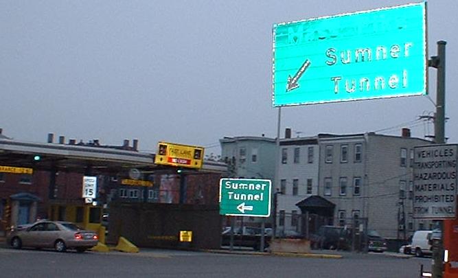
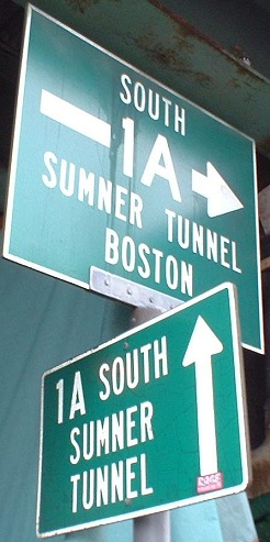
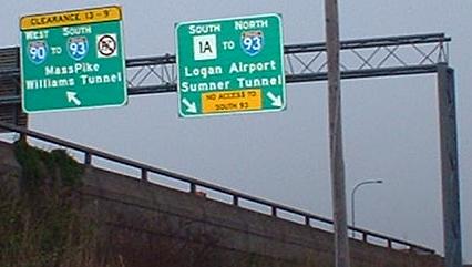
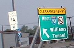
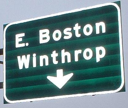
Approaching the original tunnel, the Sumner, now SB only. The first sign is quite old, and since 1A is already divided, it's only referring to the fact that traffic has to divide to get through the tollbooths. You can see that scenario in the second picture, where local traffic can exit directly onto Porter Street (hey, I wonder if the original tunnel approach came straight out of the city...) (the answer's yes, by the way). So, MA 1A isn't quite a freeway through the tunnels (there's even a slight undivided section right here), but it's a whole lot more legitimate than I-78 through the Holland Tunnel into New York.
The first sign coming out of the Callahan Tunnel NB. Click before it to watch a video through the tunnel.
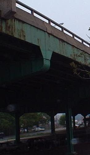
One of only two streets to cross underneath MA 1A in the heart of East Boston is Chelsea Street, here at George R. Visconti Road (aka the one-way surface street parallel to 1A SB). If 1A is ever tunnelled back as far as the airport, reconnecting East Boston to itself (which happened to US 1 through Charlestown several years ago), Porter Street would go back to being two-way atop the tunnel (same footprint as the elevated highway, aka the Green Monster of East Boston), and Visconti would disappear.
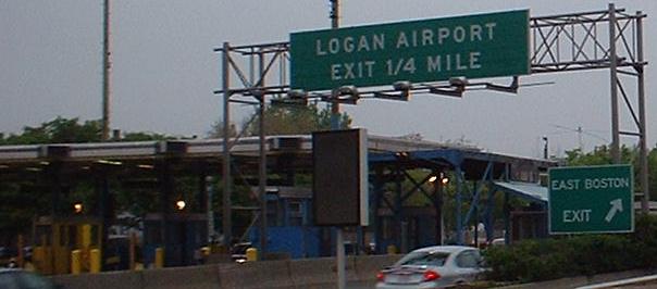
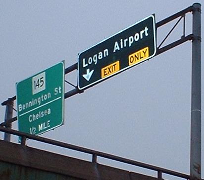
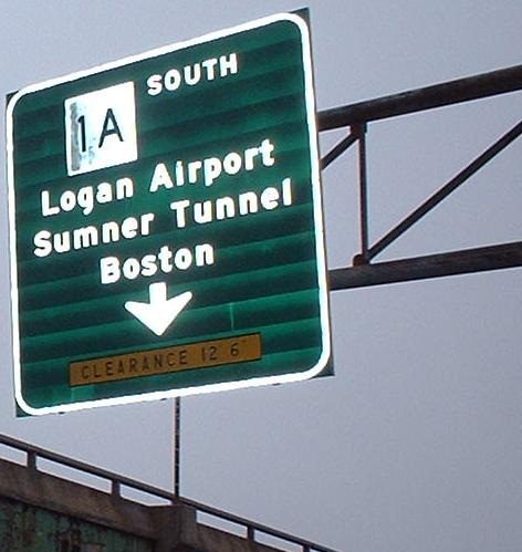
NB above East Boston, showing off signs both old and new at the entrance to Logan Airport. In the early dawn light, it's hard to make out the light brown color of the airport signage, which I've only ever seen in other airports (but the signage never looks like regular highway signage, so I don't know if the color is officially assigned to airports or not).
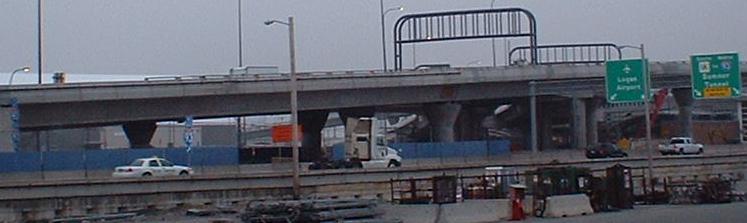
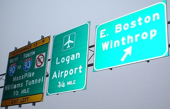
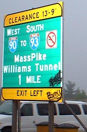
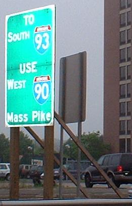
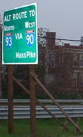
SB at the Logan exit, which is several hundred feet north of the NB exit (forming an extended and complicated 3-Y). Alternate routes to I-93 and I-90 are signed down the airport road, which I'm sure stems from construction of 90 through airport property, but just might remain there for the truly clueless motorists who missed the numerous advance signs for I-90.
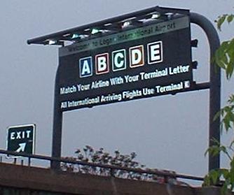
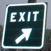
Perhaps this proliferation of exit signage will disappear as people get used to the new exit (especially the sign in the third photo), but for now, you really have to be illiterate to miss the exit.
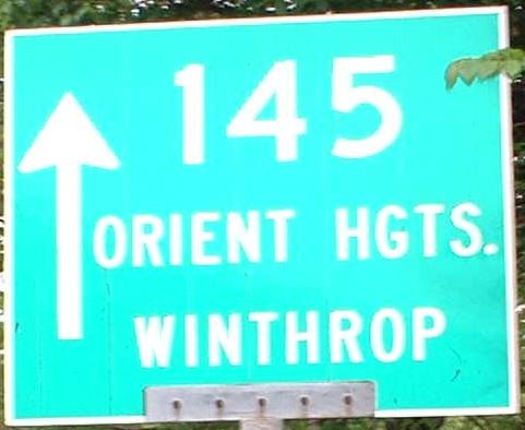
On MA 1A NB, and then on the surface road (Frankfort St.) that takes both 1A traffic and airport service road (Frankfort Street) traffic to MA 145. The NB pull-through MA 1A BGS that lost its reflective powers is now gone.
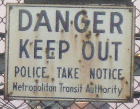
Look to the right when exiting to Frankfort St. and you'll hopefully catch this original (to the freeway) sign on the fence over the MBTA railroad. The sign, of course, dates back to the days of Charlie and his dumb wife who handed him a sandwich instead of a nickel.
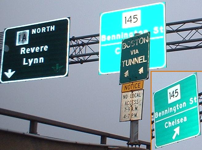
The SB onramp from Bennington Street, which just ceased being MA 145.
The same exit from the SB side, though you wouldn't know it. Since MA 145 heads northward from this intersection, there's no reason to sign it from MA 1A (there are better ways to get there, such as taking the other end of MA 145, which curls around the coastline as basically a half-loop). Actual signage of Bennington Street would be nice though.
An old sign assembly perched atop the beginning of the freeway (William F. McClellan Highway, though I believe that name stretches northward onto the semi-expressway/semi-Jersey Freeway).
Even more I-90 signage. While these are all temporary (wooden supports in the median), I expect the 1-mile sign to be replaced with something metal, but the other ones may bite the dust after all is done.
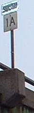
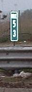
Since MA 1A just began at I-93 at the south end of the Sumner and Callahan Tunnels, this milepost (and others like it) is proof that numbering continues between the southern and northern sections of the route, ghosted along US 1. Chris Commans tells me that the mileposts were in fact adjusted when 1 was switched onto I-93 instead of running through Boston, but that would have been unnecessary if MassHighway had just extended MA 1A along the old US 1 route. Since the southern section turns into US 1A in Rhode Island, I'd support making that US 1A in Massachusetts as well (continuity is nice), and then starting mileposts where they belong up here. Then again, routes are moved around every 10-15 years or so, so who knows what 1A might turn into?
This sign is the same on the other side, but for REVERE; this sign faces SB at the East Boston border (see, EB is part of Boston). The blue shield in the middle says "ense petit placidam svb libertate qvietem" - exercise for my Latin readers!