Massachusetts Roads - MA 16 WB
Just after parting from MA 1A southbound, this sign isn't screwed in, so that I was able to rotate it 180 degrees to once again face traffic and be useful. I only wish the first sign hadn't been screwed in, so that I could remove it and force MassHighway to put up a better one.
 At South Ferry St.
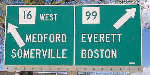
Green shields in the Revere Beach Parkway circle (all three legs are named that, but just one leg goes up to the MA 99 rotary) just after crossing northward over MA 16.
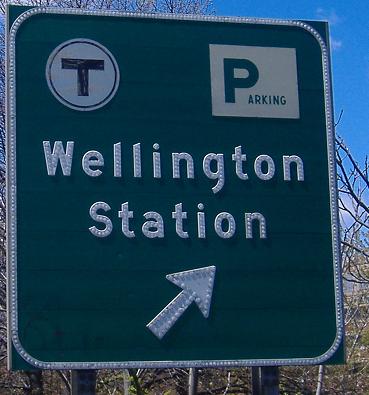
At the Orange Line T station, button copy that matches the EB signs and those inside the station (on the main MA 16 page).
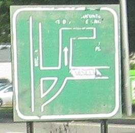
This sign at Locust St. (the road heading right) was probably put up by Medford for Hormel Stadium (the dead-end bearing right), because state signs would last longer and wouldn't have inscrutably tiny text.
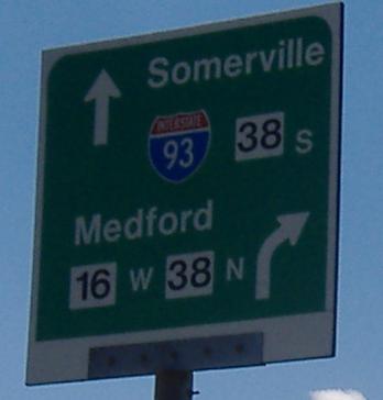
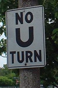
Tiny shields and wrong font, so it must be MDC (aka DCR) signage.
MassHighway can't do much better sometimes. Interstate shields do not change colors in any situation.
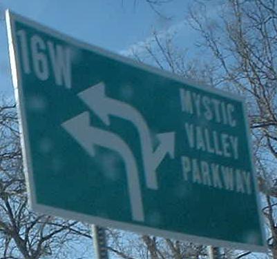
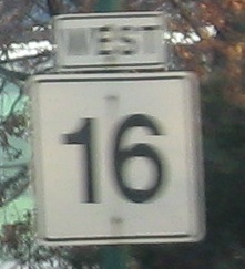
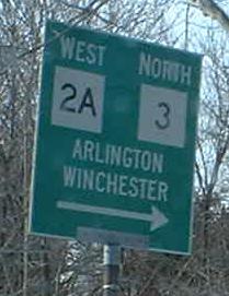
Signage from the circle where MA 16 and the Mystic River Parkway diverge (their western junction). The first is on the Parkway/MA 16 WB, and the second is on the Parkway EB/inside the rotary.
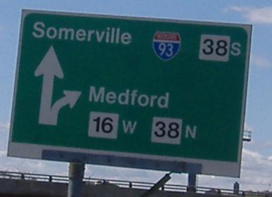
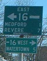
Approaching the US 3 multiplex (link at bottom), at Mass. Ave./MA 2A in Somerville. MA 3 doesn't begin for a few miles yet.
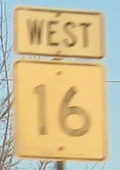
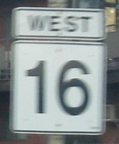
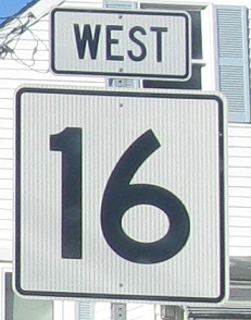
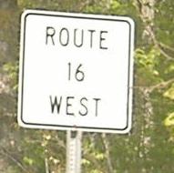
Since there's no NJ 16, Massachusetts took pity and made these shields in Watertown. There's a total of three, with one of them on the eastbound side.
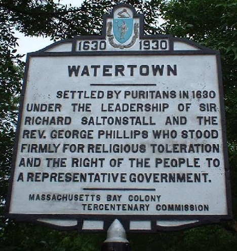
1930 commemorative sign on the WB side of the road just across the Charles River in Watertown. There's an identical one on US 20.
Signage overhead and old, respectively, at Highland St. and the Newton Trial Court just after Watertown St. (MA 16) has ended at Washington St. Washington comes from I-90 Exit 17 and will carry 16 through Wellesley.
Old Newton signage on the left (median) and right side of the road just before the rotary.
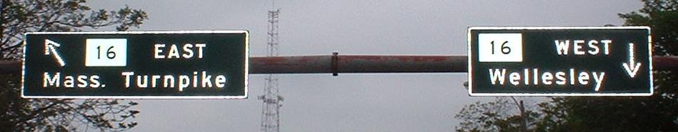
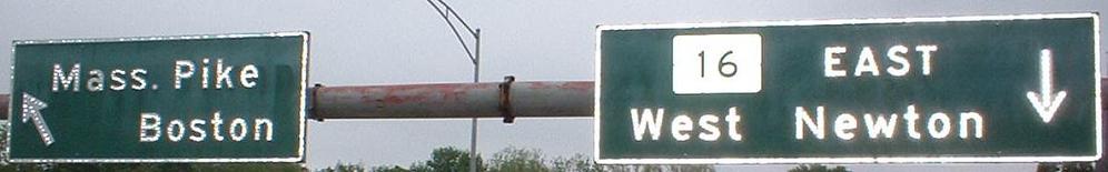
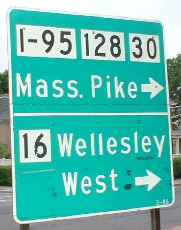
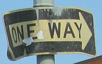
Signage above I-90 Exit 16 in the MA 16 rotary. The first two are where the WB side splits into dedicated WB lanes and U-turn/Mass Pike lanes; obviously the LGS with all the squares is oblivious to the fact that all traffic must turn left anyway (the Mass. Pike West can only be reached at Exit 15, along with I-95 and MA 30). Of course, "West" should be "WEST", and I have never seen an Interstate in a state route shield before, especially with an "I-". The one-way sign is/was where WB offramp traffic meets the rotary, and faces no one in particular.
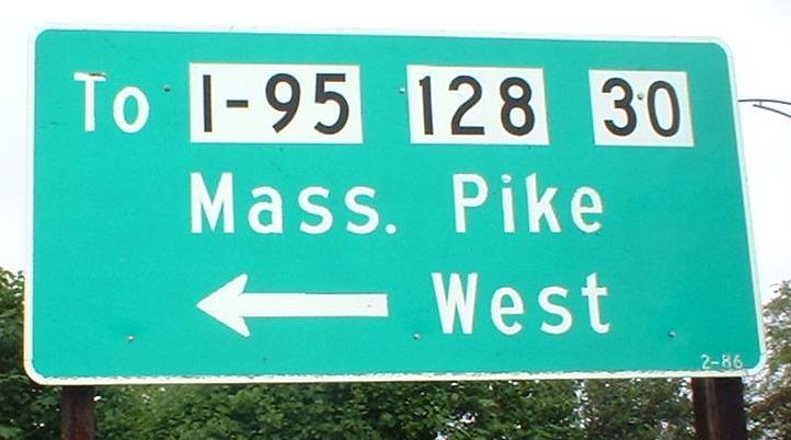
The thick, wide font just past MA 30 mimics the LGS's found at that intersection. Go to the 30 page (link at bottom) for more from there - I promise you will not be disappointed.
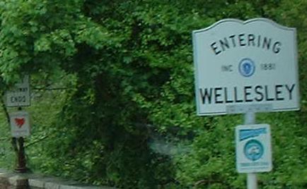
Boxy blue-on-white signage for the I-95 NB loop ramp is clearly not state-installed, even though state maintenance doesn't end till the second sign, at the Charles River and the Wellesley border. "State highway ends" is a little scarier than "state maintenance ends," but every state seems to prefer the former.
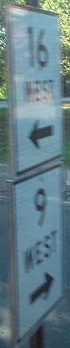
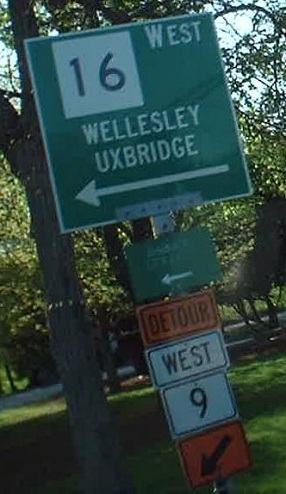
The left and right side of the MA 16 WB ramp to MA 9 WB. Since the half-century old MA 9 underpass is being reconstructed, that means we get fun construction signage, including these cuuuute shields! The faded LGS is for Babson College.
Mistakes in south-central Mass. I leave them as an exercise to the reader.
The counterpart to the white sign on the EB page, at least visible after exiting the campground but still atrocious. I believe they are both gone now.
Over to the EB side
East onto MA 16/US 3 (and MA 2)
Back to MA 16 main page
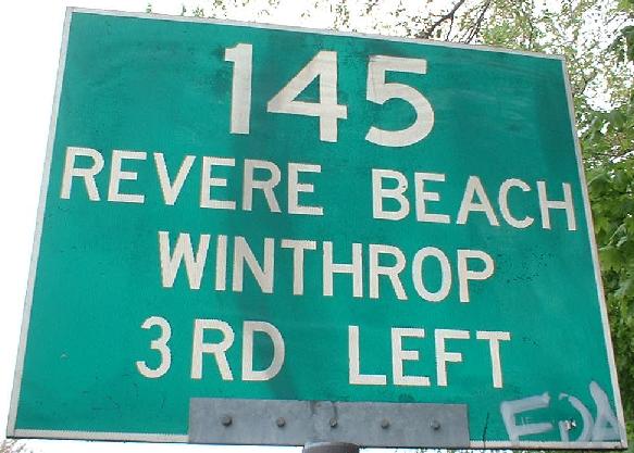
Onto MA 145
Onto MA 99
Onto I-93
Onto MA 38
Onto US 3
Onto MA 2A
Onto I-90, the Mass. Turnpike
To MA 30
Onto I-95 (and MA 128)
Onto MA 9
Back to Massachusetts Roads
Back to Roads