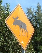
Alaska Roads - AK 98

Remember your history? AK 98 is named after the Klondike gold rush of 1898. Even though the gold was found in the Yukon Territory, not Alaska, many travelers disembarked in Skagway (the location of the above sign, which is the only AK 98 shield in existence I believe, facing traffic coming from the ferry docks). There were two paths from there, and the more popular one, the Trail of '98, became known as Dead Horse Path because no one knew how to take care of their animals. Most people didn't find much of anything, but those who did came back and made Skagway a rollicking town, with bars, brothels, and... well, no and. Bars and brothels. Money is fun.

This is the first and only guide sign on AK 98. Coming from the ferry docks, you head NB, pass this sign, and turn left. You then pass the shield atop this page, and turn right. That's it. Coming into town, it's just presumed you'll find the docks on your own. Once AK 98 crosses into Canada, it becomes BC 2, and then YT 2. Skagway locals (all twelve of them or so) call it Klondike 2, despite Alaska's efforts to convince them otherwise.
This is the William Moore bridge, the only suspension bridge in Alaska. It is also the only single-span suspension bridge in the world. Think about it.... It thus has two distinctions: the most unlikely location for a world-record bridge, and the most overbuilt bridge in the world.

Those are reflectors above the road, and they're there all the way up the mountains to British Columbia. In winter, snow can get 12 feet deep, and plows need those reflectors to be high enough so that they can see the sides of the road. I wonder how much snow a plow can clear each pass? Another interesting note is that the Alaska customs is several miles from the border, and British Columbia customs is even farther the other way. They are both located in the first geographically feasible place on their respective sides of the border, of course.
Back to Alaska Roads
Back to Roads