Ontario Roads - QEW
Queen Elizabeth Way (secret Highway 451)


Got something old and blue, got something new and... is weird the fourth one? That stately QEW font is apparently the norm, or at least the old norm, so says Chris Bessert. Photos courtesy Doug Kerr.

The QEW runs from the Peace Bridge (to Buffalo, NY), northwestward around Lake Ontario, curving back to the northeast and putting up with a long Highway 403 multiplex. It then continues along the coast into Toronto as far as Exit 135 for Highway 427. Past there, the QEW was given to the city of Toronto and is now known as the Gardiner Expressway east to the end at Don Valley Parkway. The above photo was taken by Averill Hecht east of Hamilton, eastbound in 1976. Not much has changed, except most of the QEW has six lanes now instead of four, and the old speed limit sign way on the right (which is MAXIMUM 60, as in 60 MPH, before the metric switch) has been replaced. So, actually, a lot has changed.

Another thing to point out, perfectly illustrated past the end of Highway 405, is that the QEW is not signed east-west like other highways. It's signed Toronto-Niagara, which works fine in conversation (Niagara-bound versus eastbound, you can live with) but does not translate easily to this page (I was traveling NB - no, not northbound, in fact it's more southward than anything - then I came back TB...). I'm inclined to consider the highway east-west, and there's a good argument for north-south, but the highway just isn't complicated enough for special directions. Clearly, the fact that it's named after Her Royal Highness the Queen Mother Queen Elizabeth (or some such moniker) has given the highway an inflated sense of importance such that it cannot deign to be signed by plebeian directions. Or else the freeway is so old that it predates the concepts of east and west. For the rest of this page, Toronto is west and Niagara (Falls) is east, and you'll like it.

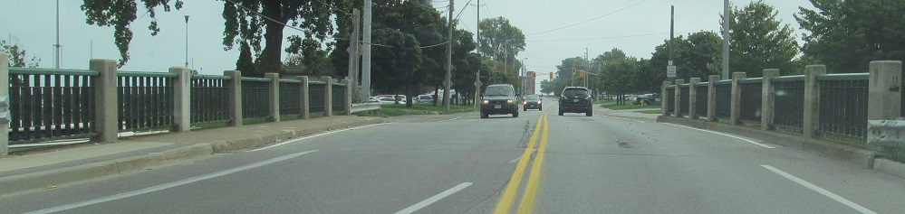
NB, I mean Toronto-bound, under Dixie Rd. in Mississauga, Peel RR 4.


Traveling eastward across the Burlington Bay Skyway to the north of Hamilton. To the left is Beach Blvd., spanning Hamilton Harbour across the older Burlington Lift Bridge. Burlington is the next city to the northwest.

To the engineers of the Skyway, this sort of junction makes perfect mathematical sense and you're perfectly safe driving across the bridge. Just try to keep your eyes on the road and trust us...


WB and EB sides of a new pedestrian crossing just east of the Burlington Street mini-freeway. The EB side shows the considerable tilt in the unique arch.


When I came through here in January 2010, it was snowing and the QEW was still being widened at the Highway 406 interchange. The road works have since been completed (or, if you're American and prefer conservation of letters, the "road work has") and three lanes are now open through here in both directions. The inverted D-1 trapezoids are likely related to a detour for QEW delays or closures during construction. The two black and yellow arrows are also Ontario standard. It can be confusing for people who assume when they see a sign that all of the arrows shown are all of the lanes that exist, and for those of us who grew up in a country with a concept of "Exit Only," it can also be confusing that seeing black arrows above the exit just means that it's those lanes exiting, even if it's one lane and not an exit-only situation.


EB across 12 Mile Creek on the Henley Bridge.


Henley Bridge WB. The ornate monuments are engraved on the sides, giving you some roadside reading if stuck in incessant traffic. Any chance of me making fun of such a concept went out the window when my only clue as to the name of the bridge came from the last photograph, showing it engraved in the side.

By September 2010, the Highway 406 interchange was all set, but this one just to the east at Martindale Rd. was very much under construction.


Heading eastward up the Garden City Skyway to cross the Welland Canal. Every other road has two choices: a tunnel underneath (since the canal is built up, the road doesn't have to go very deep) or a drawbridge at canal level. Because this is the QEW, it rides high above the towering cargo ships, although originally it crossed a drawbridge like any other road. That other road was Niagara Regional Road 81, Queenston St., and the remnants of the QEW feeding into it are quite visible as Dunkirk Rd. to the west and the continuation of RR 81 as York Rd. to the east. Highway 55 (now RR 55) ended/ends at RR 81 for that exact reason - it had been the QEW once - and the connection to the Skyway incarnation of the QEW was accomplished via trailblazers to the next interchange to the east.

The end of Highway 405, not Ontario's shortest freeway but definitely its least interesting (or else I'd have a page for it), merges only into the QEW Toronto-bound. It's plain to see that the 405 half of the assembly needs a lot of help. If you also spied that the QEW shield should be blue on yellow like the ones you saw above, give yourself two points and a free kick.


Niagara-bound at the shortest of the 400-series freeways, which ends in the heart of Niagara Falls, second photo courtesy Doug Kerr (and should not be blue). In fact, Highway 420 was once part of the QEW until it was extended southward. Click on over to that page via the big link below and you'll see the evidence. The first photo should have a QEW shield to be on par with the other highways, and the last photo should have green arrows underneath the QEW because it's the through route. Incidentally, "The Falls" is unnecessary - "Niagara Falls" and "U.S.A." as two separate destinations would give complete information.


EB from Exit 7 (Bowen Rd., RR 21) to the Canadian customs. The QEW really doesn't end until the border, and since Meter is undefined (the unit of measurement is always lower case), I suppose you can't argue the sign's accuracy.

The first WB exit has a pair of pull-through signs so those stupid Americans won't get lost in Fort Erie. Hey, I have an idea - maybe if you sign the QEW east-west, it'll be harder to get lost?

EB onto the Peace Bridge, right at the American border (marked by flags towering above this photo's perspective. To see all the glory of this bridge, click through below to the NY side.
Highway 403 and 403/QEW
Onto Highway 420, former QEW
Over to Beach Blvd. (Lakeshore Road) and more QEW photos
Into New York on the Peace Bridge
Into Toronto on the Gardiner Expressway
Onto Highway 406
Onto Niagara RR 20
Onto Central Ave., Niagara RR 124
Back to Ontario Roads
Back to Roads